File:Mapa Sao Paulo Ferrovias.svg
Jump to navigation
Jump to search

Size of this PNG preview of this SVG file: 800 × 500 pixels. Other resolutions: 320 × 200 pixels | 640 × 400 pixels | 1,024 × 640 pixels | 1,280 × 800 pixels | 2,560 × 1,601 pixels | 1,017 × 636 pixels.
Original file (SVG file, nominally 1,017 × 636 pixels, file size: 43 KB)
Captions
Captions
Add a one-line explanation of what this file represents
| Description |
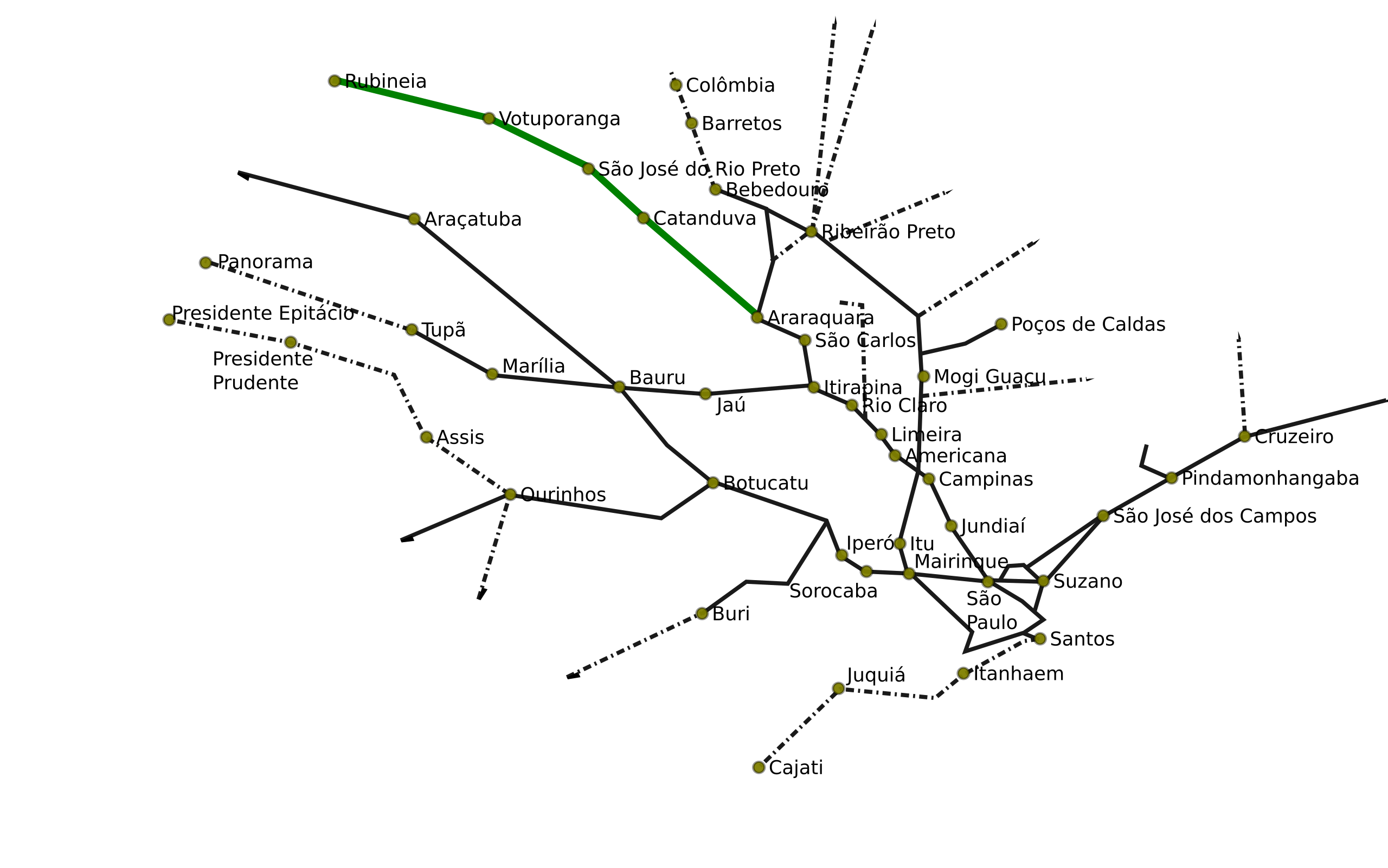
Português: Mapa de Ferrovias do Estado de São Paulo
English: Map of the railways of the brazilian State of São Paulo |
|||
| Date | (UTC) | |||
| Source | ||||
| Author |
|
|||
| Other versions |
Derivative works of this file: Mapa Cajati Santos.png
|
|||
| SVG development |
|


I, the copyright holder of this work, hereby publish it under the following licenses:
This file is licensed under the Creative Commons Attribution 2.5 Generic license.
- You are free:
- to share – to copy, distribute and transmit the work
- to remix – to adapt the work
- Under the following conditions:
- attribution – You must give appropriate credit, provide a link to the license, and indicate if changes were made. You may do so in any reasonable manner, but not in any way that suggests the licensor endorses you or your use.

|
Permission is granted to copy, distribute and/or modify this document under the terms of the GNU Free Documentation License, Version 1.2 or any later version published by the Free Software Foundation; with no Invariant Sections, no Front-Cover Texts, and no Back-Cover Texts. A copy of the license is included in the section entitled GNU Free Documentation License. |
| This file is licensed under the Creative Commons Attribution-Share Alike 3.0 Unported license. | ||
| ||
| This licensing tag was added to this file as part of the GFDL licensing update. |
You may select the license of your choice.
Original upload log[edit]
This image is a derivative work of the following images:
- File:SaoPaulo_MesoMicroMunicip.svg licensed with Cc-by-2.5, GFDL
- 2006-08-30T20:50:02Z Raphael.lorenzeto 1020x638 (1123987 Bytes) trocando por versão com geocódigos
- 2006-06-27T16:05:41Z Giro720 1024x691 (1097141 Bytes) Revertido para versão mais nova
- 2006-06-27T16:04:32Z Giro720 1006x684 (1442727 Bytes) Revertido para versão mais nova
- 2006-06-11T20:55:57Z Raphael.lorenzeto 1024x691 (1097141 Bytes) '
- 2006-05-02T02:12:11Z Raphael.lorenzeto 1006x684 (1442727 Bytes) {{User:Raphael.lorenzeto/DerivativeMaps}} {{Information| |Description=Map of São Paulo state |Source=own work |Date=April, 20 2006 |Author=Raphael Lorenzeto de Abreu |Permission={{self2|GFDL|cc-by-2.5}} |other_versions= }} [
Uploaded with derivativeFX
File history
Click on a date/time to view the file as it appeared at that time.
| Date/Time | Thumbnail | Dimensions | User | Comment | |
|---|---|---|---|---|---|
| current | 17:02, 1 July 2010 | | 1,017 × 636 (43 KB) | DieBucheBot (talk | contribs) | Trying to fix SVG using scour |
| 03:19, 1 June 2009 |  | 1,017 × 636 (70 KB) | Sekelsenmat (talk | contribs) | {{Information |Description=Mapa de Ferrovias do Estado de São Paulo |Source=*File:SaoPaulo_MesoMicroMunicip.svg |Date=2009-06-01 04:19 (UTC) |Author=*File:SaoPaulo_MesoMicroMunicip.svg: Raphael Lorenzeto de Abreu *derivative work: ~~~ |Permis |
You cannot overwrite this file.
File usage on Commons
The following 13 pages use this file:
- User:JoKalliauer
- User:JoKalliauer/Pictures
- File:Mapa Cajati Santos.png
- File:Mapa Ferrovia Araraquara.png
- File:Mapa Ramal Piracicaba.png
- File:Mapa SPFerrovias Bauru.png
- File:Mapa Sao Paulo Bitolas.png
- File:Mapa Sao Paulo Boa Vista Guaiana.png
- File:Mapa Sao Paulo Jundiai Santos.png
- File:Mapa Sao Paulo Mairinque Santos.png
- File:Mapa Sao Paulo Sorocabana.png
- File:Mapa Tronco Companhia Paulista.png
- File:Mapa Tronco Oeste Companhia Paulista.png