File:Maritime Claims of Ecuador and Peru.svg
Jump to navigation
Jump to search

Size of this PNG preview of this SVG file: 614 × 599 pixels. Other resolutions: 246 × 240 pixels | 492 × 480 pixels | 787 × 768 pixels | 1,049 × 1,024 pixels | 2,099 × 2,048 pixels | 1,864 × 1,819 pixels.
Original file (SVG file, nominally 1,864 × 1,819 pixels, file size: 373 KB)
Captions
Captions
Add a one-line explanation of what this file represents
Summary[edit]
Licensing[edit]
I, the copyright holder of this work, hereby publish it under the following licenses:

|
Permission is granted to copy, distribute and/or modify this document under the terms of the GNU Free Documentation License, Version 1.2 or any later version published by the Free Software Foundation; with no Invariant Sections, no Front-Cover Texts, and no Back-Cover Texts. A copy of the license is included in the section entitled GNU Free Documentation License. |
This file is licensed under the Creative Commons Attribution-Share Alike 3.0 Unported license.
- You are free:
- to share – to copy, distribute and transmit the work
- to remix – to adapt the work
- Under the following conditions:
- attribution – You must give appropriate credit, provide a link to the license, and indicate if changes were made. You may do so in any reasonable manner, but not in any way that suggests the licensor endorses you or your use.
- share alike – If you remix, transform, or build upon the material, you must distribute your contributions under the same or compatible license as the original.
You may select the license of your choice.
File history
Click on a date/time to view the file as it appeared at that time.
| Date/Time | Thumbnail | Dimensions | User | Comment | |
|---|---|---|---|---|---|
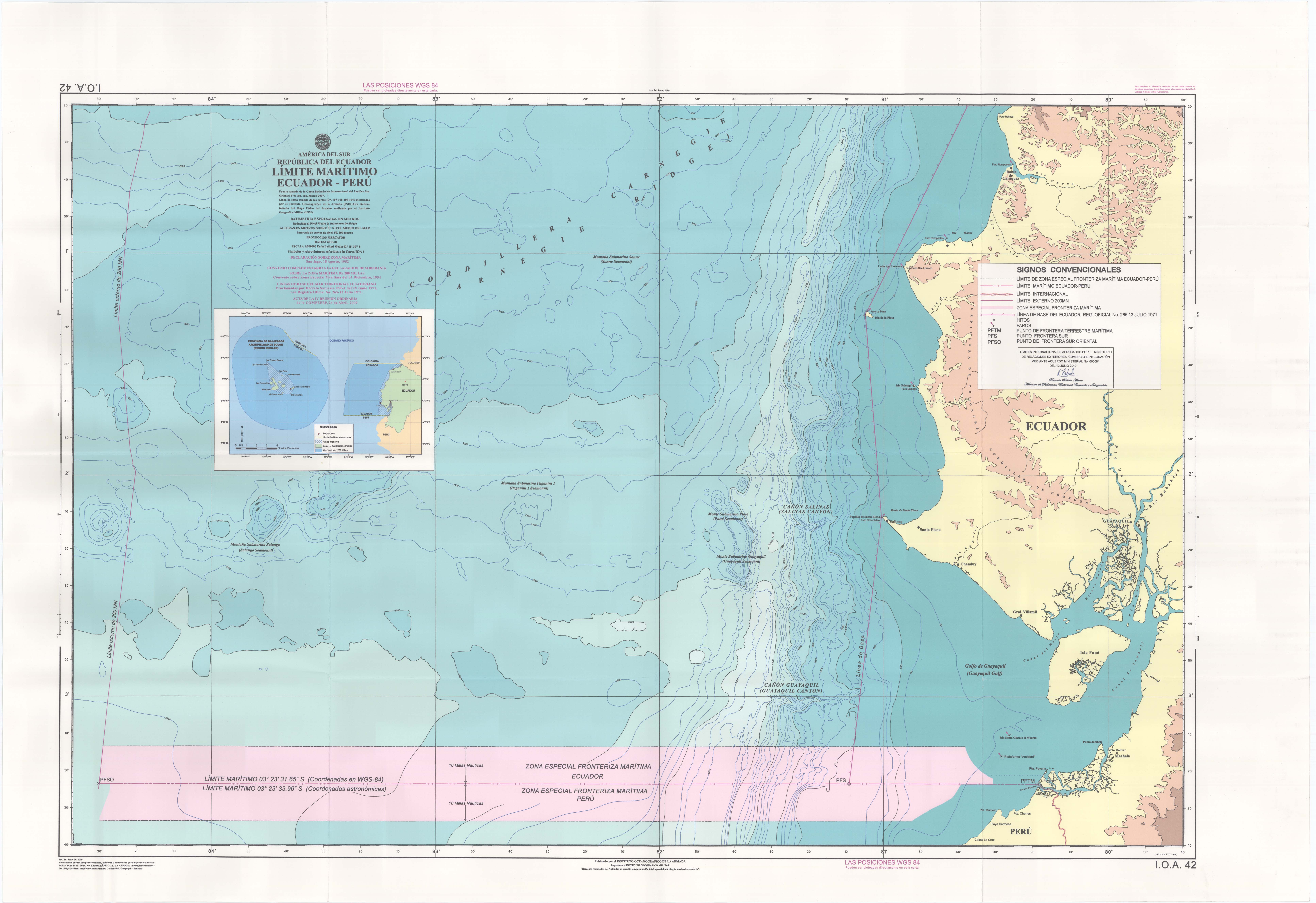
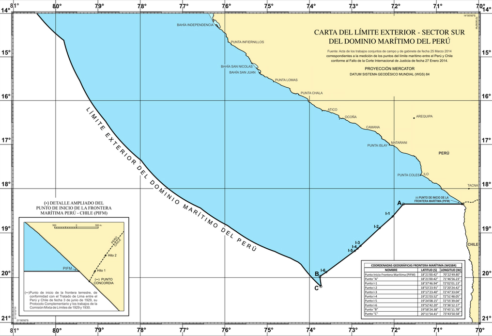
| current | 12:10, 11 April 2014 | | 1,864 × 1,819 (373 KB) | Milenioscuro (talk | contribs) | {{Information |Description ={{en|1=Map of the maritime claims of Ecuador, Peru, and surrounding countries, including internal/archipelagic waters, territorial waters, and exclusive economic zones (EEZ).}}}} {{es|1=Mapa de las reclamaciones... |
You cannot overwrite this file.
File usage on Commons
There are no pages that use this file.
File usage on other wikis
The following other wikis use this file:
- Usage on en.wikipedia.org
- Usage on tr.wikipedia.org
Metadata
Categories:
- CC-BY-SA-3.0
- SVG maps of Peru
- SVG maps of Ecuador
- Maps of territorial waters of Peru
- Maps of territorial waters of Ecuador
- Maps of maritime boundary between Ecuador and Peru
- Maps of maritime boundary between Peru and Chile
- 2014 maps of South America
- 21st-century maps of Ecuador
- 21st-century maps of Peru
- Maps of territorial waters of Colombia
- Maps of territorial waters of Costa Rica
- Maps of territorial waters of Panama
- Costa Rica-Ecuador border