File:Massif du Giffre.jpg
Jump to navigation
Jump to search
Size of this preview: 800 × 400 pixels. Other resolutions: 320 × 160 pixels | 640 × 320 pixels | 1,024 × 512 pixels | 1,280 × 640 pixels | 2,688 × 1,344 pixels.
Original file (2,688 × 1,344 pixels, file size: 959 KB, MIME type: image/jpeg)
Captions
Captions
Add a one-line explanation of what this file represents
Summary[edit]
| Description |
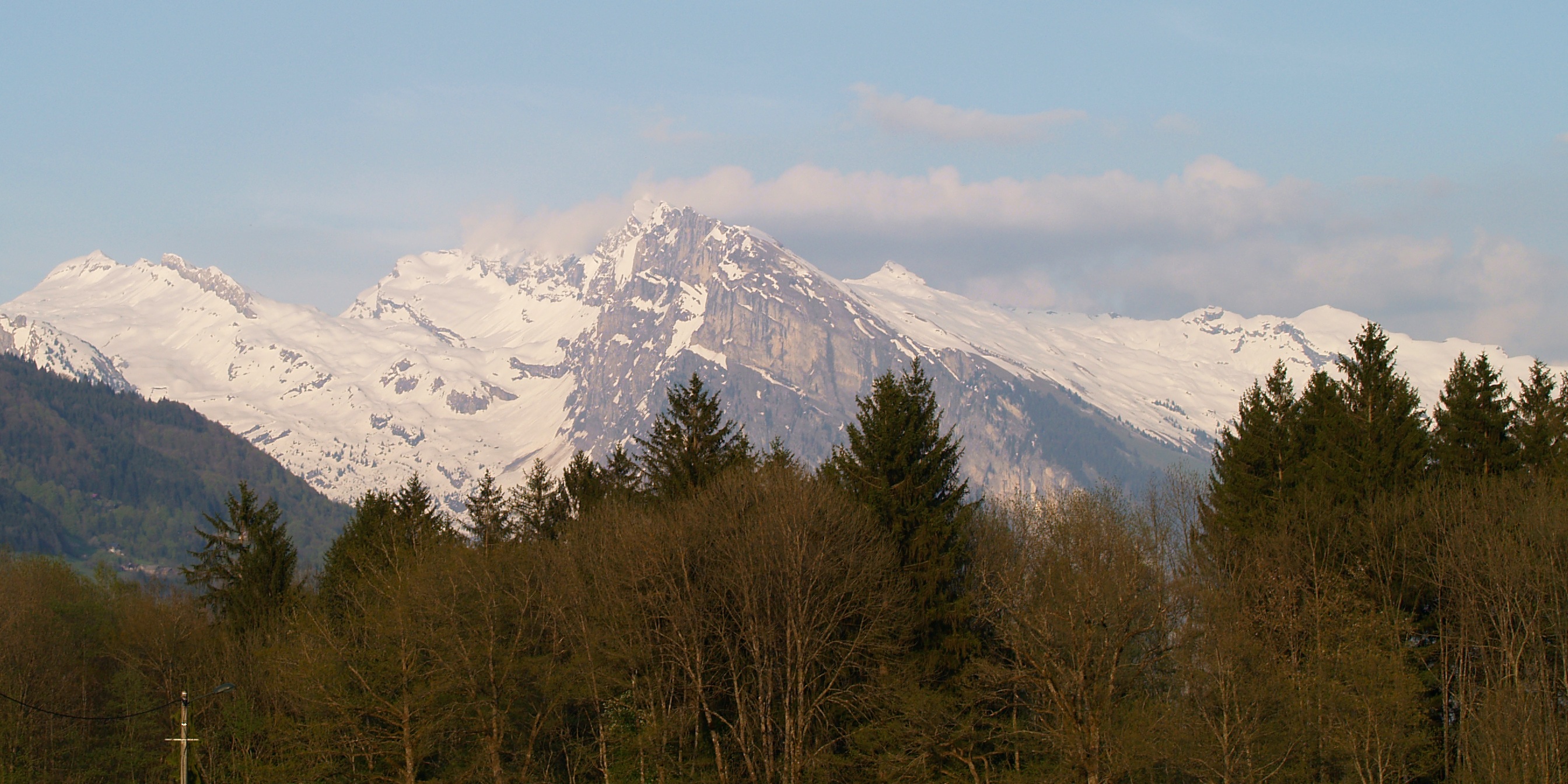
English: Massif du Giffre (Haute Savoie), viewed from the Avenue des Thezieres in front of the municipal campsite at Taninges.
Français : Massif du Giffre (Haute Savoie) - de gauche a droite:
Pointe Rousse des Chambres et le Rochers de la Couarra, massif du Criou (avec au premier plan, l'Aouille), derrière (dans les nuages) les Avoudrues, Pointe de Ressachat. |
| Date | |
| Source | Own work |
| Author | Tijs Michels |
| Permission (Reusing this file) |
cc-by-sa-3.0 (see below) |
| Camera location | | View this and other nearby images on: OpenStreetMap |
|---|
Licensing[edit]
I, the copyright holder of this work, hereby publish it under the following licenses:
This file is licensed under the Creative Commons Attribution-Share Alike 3.0 Unported license.
- You are free:
- to share – to copy, distribute and transmit the work
- to remix – to adapt the work
- Under the following conditions:
- attribution – You must give appropriate credit, provide a link to the license, and indicate if changes were made. You may do so in any reasonable manner, but not in any way that suggests the licensor endorses you or your use.
- share alike – If you remix, transform, or build upon the material, you must distribute your contributions under the same or compatible license as the original.

|
Permission is granted to copy, distribute and/or modify this document under the terms of the GNU Free Documentation License, Version 1.2 or any later version published by the Free Software Foundation; with no Invariant Sections, no Front-Cover Texts, and no Back-Cover Texts. A copy of the license is included in the section entitled GNU Free Documentation License. |
You may select the license of your choice.
File history
Click on a date/time to view the file as it appeared at that time.
| Date/Time | Thumbnail | Dimensions | User | Comment | |
|---|---|---|---|---|---|
| current | 21:37, 3 August 2008 | | 2,688 × 1,344 (959 KB) | Tmichels (talk | contribs) | {{Information |Description={{en|1=Massif du Haut-Giffre (Haute Savoie), viewed from the Avenue des Thezieres in front of the municipal campsite at Taninges - from left to right (North to |
You cannot overwrite this file.
File usage on Commons
The following 2 pages use this file:
File usage on other wikis
The following other wikis use this file:
- Usage on arz.wikipedia.org
- Usage on fr.wikipedia.org
- Usage on pl.wikipedia.org
- Usage on www.wikidata.org