File:Mechi districts.png
Jump to navigation
Jump to search

Size of this preview: 776 × 600 pixels. Other resolutions: 311 × 240 pixels | 621 × 480 pixels | 994 × 768 pixels | 1,056 × 816 pixels.
Original file (1,056 × 816 pixels, file size: 34 KB, MIME type: image/png)
Captions
Captions
Add a one-line explanation of what this file represents
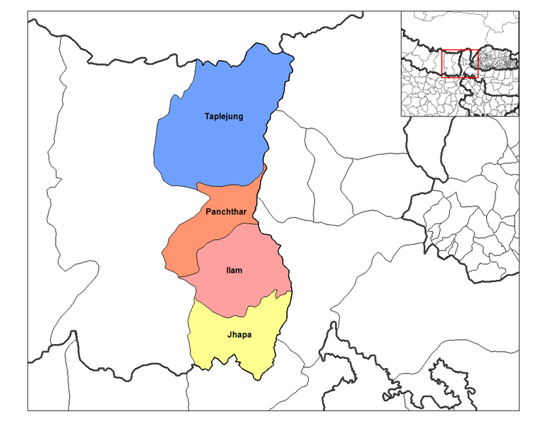
| Description | Map of the districts of Mechi Zone (wp-EN) in Nepal. Created by Rarelibra 19:32, 18 September 2006 (UTC) for public domain use, using MapInfo Professional v8.5 and various mapping resources. | ||
| Date | 18 September 2006 (original upload date) | ||
| Source | Transferred from en.wikipedia to Commons. | ||
| Author | The original uploader was Rarelibra at English Wikipedia. | ||
| Permission (Reusing this file) |
|
Original upload log[edit]
The original description page was here. All following user names refer to en.wikipedia.
- 2006-09-18 19:32 Rarelibra 1056×816×8 (35157 bytes) Map of the districts of Mechi zone in Nepal. Created by ~~~~ for public domain use, using MapInfo Professional v8.5 and various mapping resources.
File history
Click on a date/time to view the file as it appeared at that time.
| Date/Time | Thumbnail | Dimensions | User | Comment | |
|---|---|---|---|---|---|
| current | 17:12, 9 April 2007 | | 1,056 × 816 (34 KB) | Hégésippe Cormier (talk | contribs) | {{Information |Description=Map of the districts of '''Mechi Zone''' (wp-EN) in Nepal. Created by Rarelibra 19:32, 18 September 2006 (UTC) for public domain use, using MapInfo Professional v8.5 and |
You cannot overwrite this file.
File usage on Commons
The following 2 pages use this file:
File usage on other wikis
The following other wikis use this file:
- Usage on ar.wikipedia.org
- Usage on bg.wikipedia.org
- Usage on bh.wikipedia.org
- Usage on bn.wikipedia.org
- Usage on de.wikipedia.org
- Usage on dty.wikipedia.org
- Usage on el.wikipedia.org
- Usage on en.wikipedia.org
- Usage on es.wikipedia.org
- Usage on fi.wikipedia.org
- Usage on gu.wikipedia.org
- Usage on hif.wikipedia.org
- Usage on it.wikipedia.org
- Usage on ja.wikipedia.org
- Usage on ko.wikipedia.org
- Usage on mai.wikipedia.org
- Usage on ne.wikipedia.org
- Usage on new.wikipedia.org
- Usage on nl.wikipedia.org
- Usage on nn.wikipedia.org
- Usage on no.wikipedia.org
- Usage on pl.wikipedia.org
- Usage on pnb.wikipedia.org
- Usage on ru.wikipedia.org
- Usage on sa.wikipedia.org
- Usage on simple.wikipedia.org
- Usage on sk.wikipedia.org
- Usage on ta.wikipedia.org
- Usage on ur.wikipedia.org
View more global usage of this file.