File:Melor 02 nov 2003 0220Z.jpg
Jump to navigation
Jump to search
Size of this preview: 800 × 600 pixels. Other resolutions: 320 × 240 pixels | 640 × 480 pixels | 1,024 × 768 pixels | 1,280 × 960 pixels | 2,560 × 1,920 pixels | 4,800 × 3,600 pixels.
Original file (4,800 × 3,600 pixels, file size: 2.45 MB, MIME type: image/jpeg)
Captions
Captions
Add a one-line explanation of what this file represents
Summary[edit]
| Description |
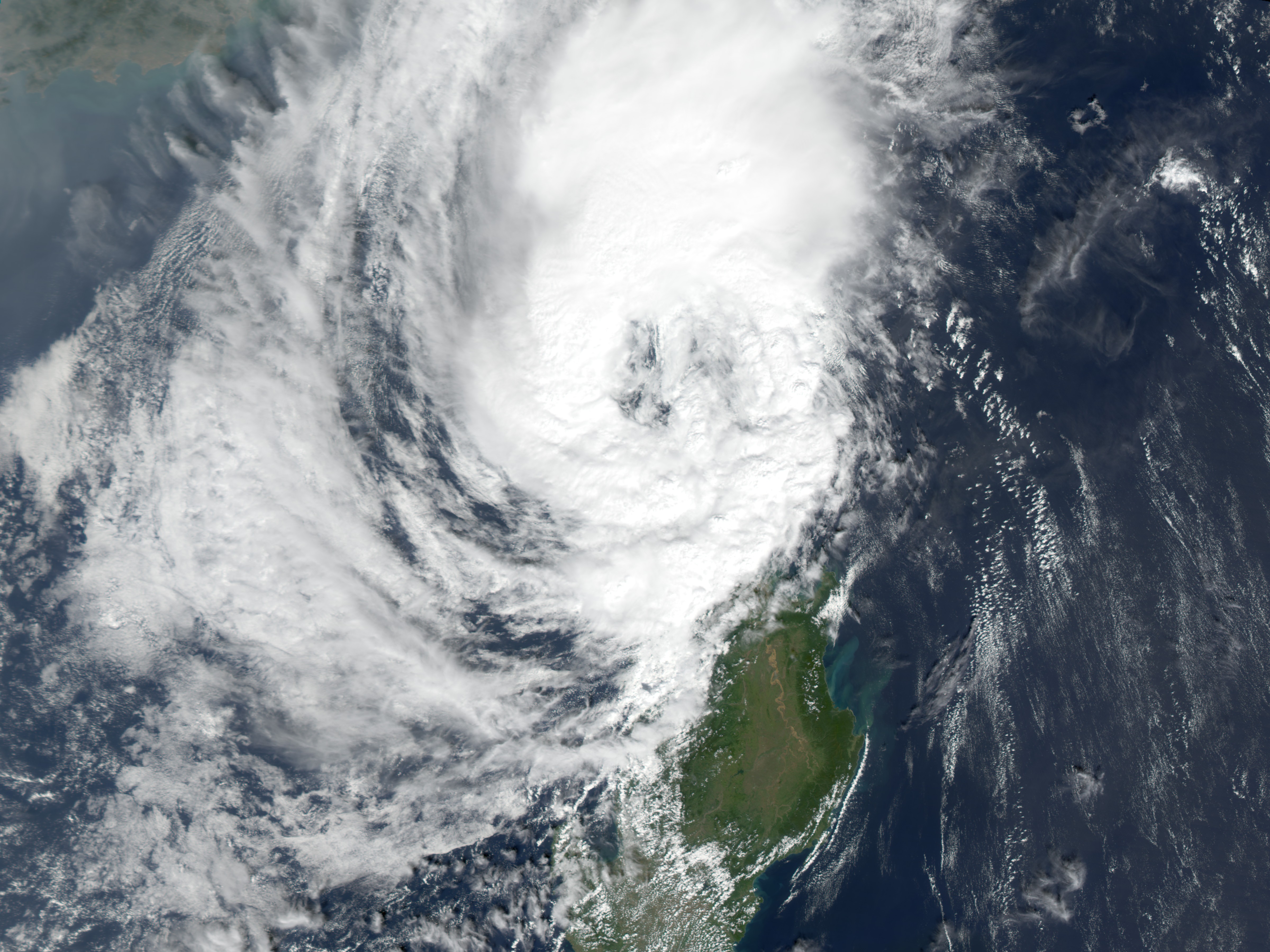
Typhoon Melor swept through the northern Philippines on November 1, 2003, bringing 85 mile-per-hour winds and up to six inches of rain to the northeastern shores of Luzon. The Moderate Resolution Imaging Spectroradiometer (MODIS) on the Terra satellite captured this image of the storm leaving the island on November 2, 2003. Flooding can clearly be seen in its wake. The Cargayan River, swollen and muddy with the storm’s run-off, is shown in the inset. According to news reports, at least four people died in the floods. The high resolution image provided above is at MODIS’ maximum spatial resolution of 250 meters per pixel. |
|||||
| Date | ||||||
| Source | http://earthobservatory.nasa.gov/NaturalHazards/natural_hazards_v2.php3?img_id=11831 | |||||
| Author | Image courtesy Jesse Allen, based on data from the MODIS Rapid Response Team at NASA GSFC | |||||
| Permission (Reusing this file) |
|

File history
Click on a date/time to view the file as it appeared at that time.
| Date/Time | Thumbnail | Dimensions | User | Comment | |
|---|---|---|---|---|---|
| current | 15:11, 27 November 2006 | | 4,800 × 3,600 (2.45 MB) | Good kitty (talk | contribs) | == Summary == {{Information |Description=Typhoon Melor swept through the northern Philippines on November 1, 2003, bringing 85 mile-per-hour winds and up to six inches of rain to the northeastern shores of Luzon. The Moderate Resolution Imaging Spectrorad |
You cannot overwrite this file.
File usage on Commons
There are no pages that use this file.