File:Most humorous sign in OZ.jpg
Jump to navigation
Jump to search
Size of this preview: 519 × 600 pixels. Other resolutions: 208 × 240 pixels | 415 × 480 pixels | 665 × 768 pixels | 886 × 1,024 pixels | 1,536 × 1,775 pixels.
Original file (1,536 × 1,775 pixels, file size: 640 KB, MIME type: image/jpeg)
Captions
Captions
Add a one-line explanation of what this file represents
Summary
[edit]
| Description |
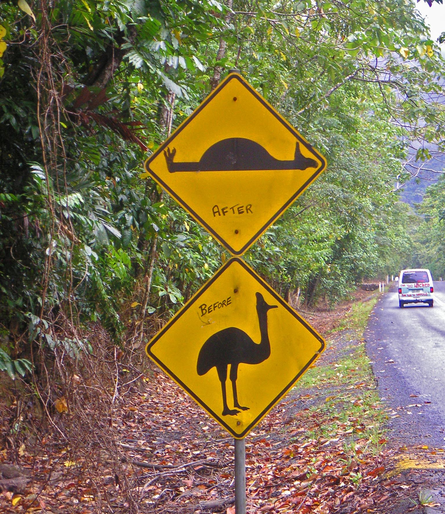
Most humorous sign in OZ A lot of signs in oz have had small alterations. Such as the 100 or more Dip and Crest signs in Cape York cleverly changed to variations like Dope and Brest. However, this is the funniest one. Indicating to the drivers just what could happen to an endangered Cassowary. (The top sign was a speed bump sign) |
| Date | |
| Source | Most humorous sign in OZ |
| Author | Neil from I am traveling around asia at the moment, Mongolia |
| Camera location | | View this and other nearby images on: OpenStreetMap |
|---|
Licensing
[edit]
This file is licensed under the Creative Commons Attribution 2.0 Generic license.
- You are free:
- to share – to copy, distribute and transmit the work
- to remix – to adapt the work
- Under the following conditions:
- attribution – You must give appropriate credit, provide a link to the license, and indicate if changes were made. You may do so in any reasonable manner, but not in any way that suggests the licensor endorses you or your use.
| This image was originally posted to Flickr by NeilsPhotography at https://www.flickr.com/photos/21976354@N07/2349769668. It was reviewed on 21 July 2010 by FlickreviewR and was confirmed to be licensed under the terms of the cc-by-2.0. |
File history
Click on a date/time to view the file as it appeared at that time.
| Date/Time | Thumbnail | Dimensions | User | Comment | |
|---|---|---|---|---|---|
| current | 09:30, 21 July 2010 | | 1,536 × 1,775 (640 KB) | Electron (talk | contribs) | {{Information |Description=Most humorous sign in OZ A lot of signs in oz have had small alterations. Such as the 100 or more Dip and Crest signs in Cape York cleverly changed to variations like Dope and Brest. However, this is the funniest |
You cannot overwrite this file.
File usage on Commons
There are no pages that use this file.