File:MountToneyMap.jpg
Jump to navigation
Jump to search
Size of this preview: 750 × 600 pixels. Other resolutions: 300 × 240 pixels | 600 × 480 pixels | 1,000 × 800 pixels.
Original file (1,000 × 800 pixels, file size: 154 KB, MIME type: image/jpeg)
Captions
Captions
Add a one-line explanation of what this file represents
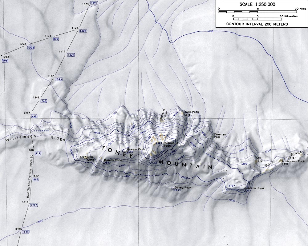
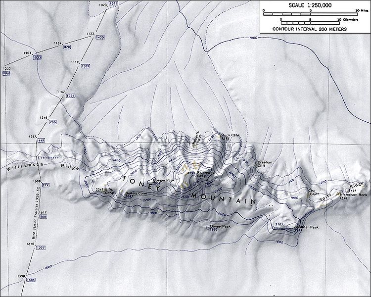
Topographic map of Toney Mountain (1:250,000 scale) from USGS Toney Mountain. Source: http://usarc.usgs.gov/antarctic_atlas/ USGS Atlas of Antarctic Research
This image is in the public domain in the United States because it only contains materials that originally came from the United States Geological Survey, an agency of the United States Department of the Interior. For more information, see the official USGS copyright policy.
|
File history
Click on a date/time to view the file as it appeared at that time.
| Date/Time | Thumbnail | Dimensions | User | Comment | |
|---|---|---|---|---|---|
| current | 13:48, 17 January 2005 | | 1,000 × 800 (154 KB) | GarciaB~commonswiki (talk | contribs) | Topographic map of Toney Mountain (1:250,000 scale) |
You cannot overwrite this file.
File usage on Commons
There are no pages that use this file.
File usage on other wikis
The following other wikis use this file:
- Usage on ceb.wikipedia.org
- Usage on de.wikipedia.org
- Usage on en.wikipedia.org
- Usage on es.wikipedia.org
- Usage on fr.wikipedia.org
- Usage on nn.wikipedia.org
- Usage on sv.wikipedia.org
- Usage on uk.wikipedia.org
- Usage on www.wikidata.org
- Usage on zh.wikipedia.org