File:National-atlas-pennsylvania.png
Jump to navigation
Jump to search
No higher resolution available.
National-atlas-pennsylvania.png (762 × 590 pixels, file size: 140 KB, MIME type: image/png)
Captions
Captions
Add a one-line explanation of what this file represents
Summary[edit]
| Description |
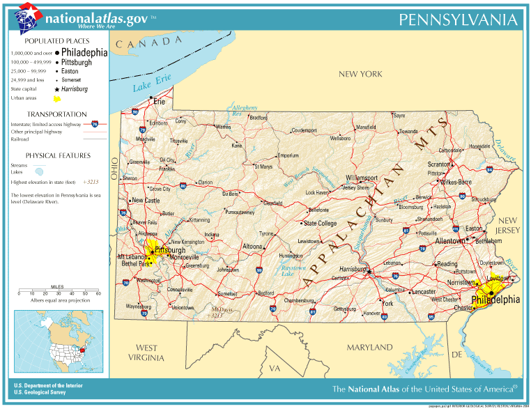
English: Map of Pennsylvania. |
| Date | |
| Source | National Atlas |
| Author |
Licensing[edit]
This map was obtained from an edition of the National Atlas of the United States. Like almost all works of the U.S. federal government, works from the National Atlas are in the public domain in the United States.
Online access: NationalAtlas.gov | 1970 print edition: Library of Congress, Perry-Castañeda Library
|
File history
Click on a date/time to view the file as it appeared at that time.
| Date/Time | Thumbnail | Dimensions | User | Comment | |
|---|---|---|---|---|---|
| current | 19:10, 14 October 2005 | | 762 × 590 (140 KB) | Warden (talk | contribs) | Reverted to earlier revision |
| 18:19, 11 September 2005 |  | 762 × 590 (140 KB) | Shauni (talk | contribs) | {{PD-USGov-Atlas}} Category:Maps of Pennsylvania |
You cannot overwrite this file.
File usage on Commons
There are no pages that use this file.
File usage on other wikis
The following other wikis use this file:
- Usage on ast.wikipedia.org
- Usage on bn.wikipedia.org
- Usage on ca.wikipedia.org
- Usage on da.wikipedia.org
- Usage on en.wikipedia.org
- Usage on es.wikipedia.org
- Usage on io.wikipedia.org
- Usage on ja.wikipedia.org
- Usage on mk.wikipedia.org
- Usage on mr.wikipedia.org
- Usage on new.wikipedia.org
- Usage on nl.wikipedia.org
- Usage on ru.wikipedia.org