File:Netherlands Limburg location map.svg
Jump to navigation
Jump to search

Size of this PNG preview of this SVG file: 282 × 600 pixels. Other resolutions: 113 × 240 pixels | 225 × 480 pixels | 361 × 768 pixels | 481 × 1,024 pixels | 962 × 2,048 pixels | 470 × 1,000 pixels.
Original file (SVG file, nominally 470 × 1,000 pixels, file size: 78 KB)
Captions
Captions
Add a one-line explanation of what this file represents
Summary[edit]
| Description |
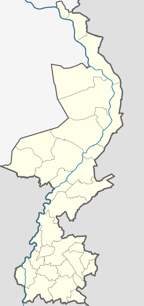
English: Location map of province Limburg in the Netherlands
Equirectangular projection, N/S stretching 160 %. Geographic limits of the map:
Deutsch: Positionskarte von der Provinz Limburg in den Niederlanden
Quadratische Plattkarte, N-S-Streckung 160 %. Geographische Begrenzung der Karte:
|
| Date | |
| Source | Own work |
| Author | Erik Frohne |
| Other versions | OSM - provincie Limburg.PNG |
| SVG development |
Licensing[edit]
I, the copyright holder of this work, hereby publish it under the following licenses:

|
Permission is granted to copy, distribute and/or modify this document under the terms of the GNU Free Documentation License, Version 1.2 or any later version published by the Free Software Foundation; with no Invariant Sections, no Front-Cover Texts, and no Back-Cover Texts. A copy of the license is included in the section entitled GNU Free Documentation License. |
This file is licensed under the Creative Commons Attribution-Share Alike 3.0 Unported license.
- You are free:
- to share – to copy, distribute and transmit the work
- to remix – to adapt the work
- Under the following conditions:
- attribution – You must give appropriate credit, provide a link to the license, and indicate if changes were made. You may do so in any reasonable manner, but not in any way that suggests the licensor endorses you or your use.
- share alike – If you remix, transform, or build upon the material, you must distribute your contributions under the same or compatible license as the original.
You may select the license of your choice.
File history
Click on a date/time to view the file as it appeared at that time.
| Date/Time | Thumbnail | Dimensions | User | Comment | |
|---|---|---|---|---|---|
| current | 11:51, 30 December 2018 | | 470 × 1,000 (78 KB) | NordNordWest (talk | contribs) | upd 2019 |
| 17:07, 2 May 2016 |  | 470 × 1,000 (78 KB) | NordNordWest (talk | contribs) | upd | |
| 20:15, 13 June 2015 |  | 470 × 1,000 (81 KB) | קרלוס הגדול (talk | contribs) | lighter borders between provinces | |
| 18:37, 29 December 2013 |  | 470 × 1,000 (78 KB) | NordNordWest (talk | contribs) | update 2013 | |
| 11:25, 20 March 2009 |  | 470 × 1,000 (146 KB) | Erik Frohne (talk | contribs) | {{Information |Description={{en|1=Location map of province Limburg in the Netherlands Equirectangular projection, N/S stretching 160 %. Geographic limits of the map: * N: 51.782° N * S: 50.744° N * W: 5.56° E * E: 6.34° E}} {{de|1=Positionskarte von |
You cannot overwrite this file.
File usage on Commons
There are no pages that use this file.
File usage on other wikis
The following other wikis use this file:
- Usage on ba.wikipedia.org
- Usage on bg.wikipedia.org
- Usage on cs.wikipedia.org
- Usage on de.wikipedia.org
- Fernsehturm Roermond
- Sportpark Kaalheide
- Parkstad Limburg Stadion
- Vorlage:Positionskarte Niederlande Limburg
- De Koel
- Gaiazoo
- Wikipedia:Kartenwerkstatt/Positionskarten/Europa
- Fortuna-Sittard-Stadion
- Stadion De Geusselt
- Hermann von Neuenahr der Jüngere
- Sender Eys
- Designer Outlet Roermond
- Sender Hulsberg
- Schleidener Zoll
- Vaalsbroeker Mühle
- Usage on de.wikivoyage.org
- Usage on eo.wikipedia.org
- Usage on es.wikipedia.org
- Usage on frr.wikipedia.org
- Usage on fr.wikipedia.org
View more global usage of this file.