File:Ontario 55 map.svg
Jump to navigation
Jump to search

Size of this PNG preview of this SVG file: 600 × 600 pixels. Other resolutions: 240 × 240 pixels | 480 × 480 pixels | 768 × 768 pixels | 1,024 × 1,024 pixels | 2,048 × 2,048 pixels | 750 × 750 pixels.
Original file (SVG file, nominally 750 × 750 pixels, file size: 223 KB)
Captions
Captions
Add a one-line explanation of what this file represents
Summary[edit]
| Description |
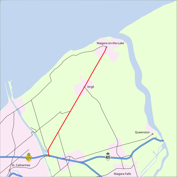
English: A map of Ontario Highway 55 (in red) in northeastern Niagara Region. |
| Date | (UTC) |
| Source | Own work |
| Author | Floydian τ ¢ |
Licensing[edit]
This file is licensed under the Creative Commons Attribution-Share Alike 3.0 Unported license.
- You are free:
- to share – to copy, distribute and transmit the work
- to remix – to adapt the work
- Under the following conditions:
- attribution – You must give appropriate credit, provide a link to the license, and indicate if changes were made. You may do so in any reasonable manner, but not in any way that suggests the licensor endorses you or your use.
- share alike – If you remix, transform, or build upon the material, you must distribute your contributions under the same or compatible license as the original.
Original upload log[edit]
Transferred from en.wikipedia to Commons by Rschen7754 using CommonsHelper.
The original description page was here. All following user names refer to en.wikipedia.
- 2013-11-07 06:27 Floydian 750×750× (228702 bytes) {{Information |Description = A map of [[Ontario Highway 55]] (in red) in northeastern Niagara Region. |Source = {{own}} |Date = ~~~~~ |Author = ~~~ |Permission = {{cc-by-sa-3.0}} |other_versions = }} {{Keep local}}
File history
Click on a date/time to view the file as it appeared at that time.
| Date/Time | Thumbnail | Dimensions | User | Comment | |
|---|---|---|---|---|---|
| current | 07:52, 8 November 2013 | | 750 × 750 (223 KB) | File Upload Bot (Magnus Manske) (talk | contribs) | Transfered from en.wikipedia by User:rschen7754 using CommonsHelper |
You cannot overwrite this file.
File usage on Commons
The following page uses this file:
File usage on other wikis
The following other wikis use this file:
- Usage on www.wikidata.org