File:Orlandskart.jpg
Jump to navigation
Jump to search

Size of this preview: 598 × 599 pixels. Other resolutions: 240 × 240 pixels | 479 × 480 pixels | 767 × 768 pixels | 1,154 × 1,156 pixels.
Original file (1,154 × 1,156 pixels, file size: 179 KB, MIME type: image/jpeg)
Captions
Captions
Add a one-line explanation of what this file represents
Summary[edit]
| Description |
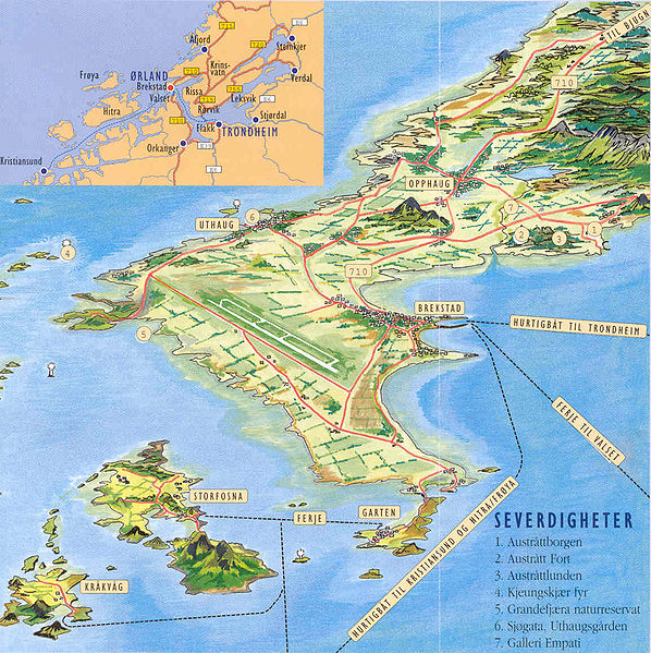
Perspektivkart over Ørland kommune i Sør-Trøndelag. Lagt ut av kommunens informasjonssjef. |
|||||||||
| Date | 20 July 2005 (original upload date) | |||||||||
| Source | Originally from no.wikipedia; description page is/was here. | |||||||||
| Creator |
Original uploader was Orland at no.wikipedia |
|||||||||
| Permission (Reusing this file) |
CC-BY-2.5; Released under the GNU Free Documentation License. | |||||||||
| Geotemporal data | ||||||||||
| Bounding box |
|
|||||||||
| Georeferencing | ||||||||||
Licensing[edit]
This file is licensed under the Creative Commons Attribution 2.5 Generic license.
- You are free:
- to share – to copy, distribute and transmit the work
- to remix – to adapt the work
- Under the following conditions:
- attribution – You must give appropriate credit, provide a link to the license, and indicate if changes were made. You may do so in any reasonable manner, but not in any way that suggests the licensor endorses you or your use.

|
Permission is granted to copy, distribute and/or modify this document under the terms of the GNU Free Documentation License, Version 1.2 or any later version published by the Free Software Foundation; with no Invariant Sections, no Front-Cover Texts, and no Back-Cover Texts. A copy of the license is included in the section entitled GNU Free Documentation License. |
| This file is licensed under the Creative Commons Attribution-Share Alike 3.0 Unported license. | ||
| ||
| This licensing tag was added to this file as part of the GFDL licensing update. |
Original upload log[edit]
(All user names refer to no.wikipedia)
- 2005-07-20 09:52 Orland 1154×1156×8 (183785 bytes) Perspektivkart over Ørland kommune i Sør-Trøndelag{{betinget_bilde1}}
File history
Click on a date/time to view the file as it appeared at that time.
| Date/Time | Thumbnail | Dimensions | User | Comment | |
|---|---|---|---|---|---|
| current | 21:47, 17 October 2007 | | 1,154 × 1,156 (179 KB) | File Upload Bot (Magnus Manske) (talk | contribs) | {{BotMoveToCommons|no.wikipedia}} {{Information |Description=Perspektivkart over Ørland kommune i Sør-Trøndelag. Lagt ut av kommunens informasjonssjef. |Source=Originally from [http://no.wikipedia.org no.wikipedia]; description page is/was [http://no. |
You cannot overwrite this file.
File usage on Commons
There are no pages that use this file.
File usage on other wikis
The following other wikis use this file:
- Usage on bjn.wikipedia.org
- Usage on en.wikipedia.org
- Usage on es.wikipedia.org
- Usage on fa.wikipedia.org
- Usage on fr.wikipedia.org
- Usage on no.wikipedia.org
- Usage on pl.wikipedia.org
- Usage on ru.wikipedia.org