File:Overview of West Lancaster.jpg
Jump to navigation
Jump to search

Size of this preview: 800 × 596 pixels. Other resolutions: 320 × 239 pixels | 640 × 477 pixels | 1,024 × 763 pixels | 1,280 × 954 pixels | 2,576 × 1,920 pixels.
Original file (2,576 × 1,920 pixels, file size: 2.02 MB, MIME type: image/jpeg)
Captions
Captions
Add a one-line explanation of what this file represents
| Description |
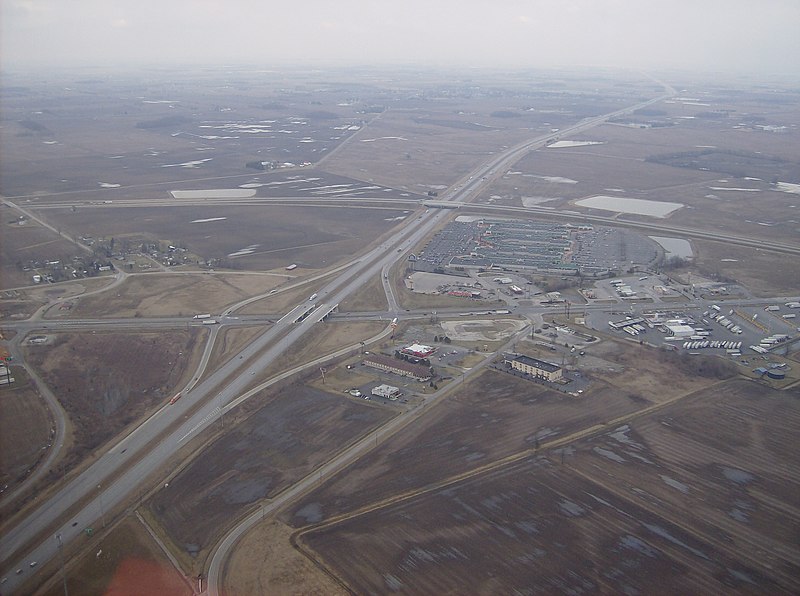
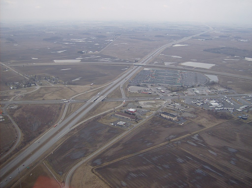
English: Aerial view of West Lancaster, a community in southern Jefferson Township, Fayette County, Ohio, United States. The village of Octa lies primarily just off the bottom edge of the picture, although its village limits extend along the road that appears from the picture's bottom edge. Picture taken from a Diamond Eclipse light airplane at an altitude of 2,500 feet MSL at an bearing of approximately 5º. The interchange is Interstate 71 over State Route 435, and the divided highway's overpass in the background is U.S. Route 35 passing over the interstate. |
||
| Date | Taken on 6 March 2008 | ||
| Source | Own work | ||
| Author | Nyttend | ||
| Permission (Reusing this file) |
|
| Annotations | This image is annotated: View the annotations at Commons |
File history
Click on a date/time to view the file as it appeared at that time.
| Date/Time | Thumbnail | Dimensions | User | Comment | |
|---|---|---|---|---|---|
| current | 03:42, 26 May 2008 | | 2,576 × 1,920 (2.02 MB) | Nyttend (talk | contribs) | {{Information |Description=Aerial view of {{w|West Lancaster, Ohio|West Lancaster}}, a community in southern {{w|Jefferson Township, Fayette County, Ohio|Jefferson Township}}, {{w|Fayette County, Ohio|Fayette County}}, {{w|Ohio}}, {{w|United States}}. Pi |
You cannot overwrite this file.
File usage on Commons
The following 2 pages use this file:
File usage on other wikis
The following other wikis use this file:
- Usage on ar.wikipedia.org
- Usage on arz.wikipedia.org
- Usage on ca.wikipedia.org
- Usage on en.wikipedia.org
- Usage on es.wikipedia.org
- Usage on eu.wikipedia.org
- Usage on fr.wikipedia.org
- Usage on ht.wikipedia.org
- Usage on it.wikipedia.org
- Usage on ja.wikipedia.org
- Usage on lld.wikipedia.org
- Usage on pl.wikipedia.org
- Usage on pt.wikipedia.org
- Usage on sh.wikipedia.org
- Usage on sr.wikipedia.org
- Usage on uk.wikipedia.org
- Usage on vi.wikipedia.org
- Usage on www.wikidata.org
- Usage on zh-min-nan.wikipedia.org
- Usage on zh.wikipedia.org
Metadata
Categories:
- Aerial photographs of Ohio
- Divided highways in the United States
- Diamond interchanges
- Interchanges in Ohio
- Aerial photographs of interchanges in the United States
- Interstate 71 in Ohio
- Jefferson Township, Fayette County, Ohio
- Octa, Ohio
- Shopping malls in Ohio
- Bridges on U.S. Route 35
- U.S. Route 35 in Ohio
- Ohio State Route 435
- 2008 in Ohio