File:Paige 1912 EnchantedRock.jpg
Jump to navigation
Jump to search

Size of this preview: 800 × 553 pixels. Other resolutions: 320 × 221 pixels | 640 × 442 pixels | 1,024 × 707 pixels | 1,280 × 884 pixels | 2,560 × 1,768 pixels | 4,501 × 3,109 pixels.
Original file (4,501 × 3,109 pixels, file size: 4.84 MB, MIME type: image/jpeg)
Captions
Captions
Add a one-line explanation of what this file represents
Summary[edit]
| Description |
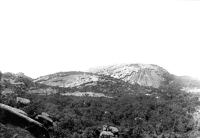
English: Enchanted Rock in southwestern part of Llano quadrangle, looking 45 degrees W. from most easterly peak in-group, shows exfoliation of the granite parallel to the surface. Llano County, Texas. 1912. Plate 10 in U.S. Geological Survey. Folio 183. 1912. |
| Date | |
| Source | U.S. Geological Survey Photographic Library, http://libraryphoto.cr.usgs.gov/ |
| Author | Sidney Paige |
| Camera location | | View this and other nearby images on: OpenStreetMap |
|---|
Licensing[edit]
This image is in the public domain in the United States because it only contains materials that originally came from the United States Geological Survey, an agency of the United States Department of the Interior. For more information, see the official USGS copyright policy.
|
File history
Click on a date/time to view the file as it appeared at that time.
| Date/Time | Thumbnail | Dimensions | User | Comment | |
|---|---|---|---|---|---|
| current | 18:38, 20 December 2008 | | 4,501 × 3,109 (4.84 MB) | Leaflet (talk | contribs) | {{Information |Description={{en|1=Enchanted Rock in southwestern part of Llano quadrangle, looking 45 degrees W. from most easterly peak in-group, shows exfoliation of the granite parallel to the surface. Llano County, Texas. 1912. Plate 10 in U.S. Geolog |
You cannot overwrite this file.
File usage on Commons
The following page uses this file:
File usage on other wikis
The following other wikis use this file:
- Usage on de.wikipedia.org
- Usage on nl.wikipedia.org