File:Pamir topographic map-fr.svg
Jump to navigation
Jump to search

Size of this PNG preview of this SVG file: 800 × 513 pixels. Other resolutions: 320 × 205 pixels | 640 × 410 pixels | 1,024 × 656 pixels | 1,280 × 820 pixels | 2,560 × 1,641 pixels | 3,543 × 2,271 pixels.
Original file (SVG file, nominally 3,543 × 2,271 pixels, file size: 4.41 MB)
Captions
Captions
Add a one-line explanation of what this file represents
Summary[edit]
| Camera location | | View this and other nearby images on: OpenStreetMap |
|---|
| Description |
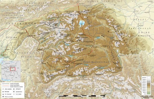
Deutsch: Topographische Karte zum Pamir, in Französische
English: Topographic map in French language of Pamir Mountains
Español: Mapa topográfico en francès de la Cordillera del Pamir
Italiano: Carta topografica del Pamir (en francese)
日本語: パミール高原の地図
Português: Carta topográfica e da administração do Pamir em francês
|
||
| Date | (UTC) | ||
| Source |
Création personnelle ;
|
||
| Author | © Bourrichon (talk) - fr:Bourrichon | ||
| Permission (Reusing this file) |
|
||
| Other versions |
Add-your-version : Template:Other versions/Pamir Template:Other versions/Pamir |
![[1]](http://www.pamirs.org/images/maps/pamir-gr.jpg)

|
This SVG file contains embedded text that can be translated into your language, using any capable SVG editor, text editor or the SVG Translate tool. For more information see: About translating SVG files. |
This W3C-unspecified vector image was created with Inkscape .
Licensing[edit]
I, the copyright holder of this work, hereby publish it under the following licenses:

|
Permission is granted to copy, distribute and/or modify this document under the terms of the GNU Free Documentation License, Version 1.2 or any later version published by the Free Software Foundation; with no Invariant Sections, no Front-Cover Texts, and no Back-Cover Texts. A copy of the license is included in the section entitled GNU Free Documentation License. |
This file is licensed under the Creative Commons Attribution-Share Alike 3.0 Unported, 2.5 Generic, 2.0 Generic and 1.0 Generic license.
- You are free:
- to share – to copy, distribute and transmit the work
- to remix – to adapt the work
- Under the following conditions:
- attribution – You must give appropriate credit, provide a link to the license, and indicate if changes were made. You may do so in any reasonable manner, but not in any way that suggests the licensor endorses you or your use.
- share alike – If you remix, transform, or build upon the material, you must distribute your contributions under the same or compatible license as the original.
You may select the license of your choice.
| Annotations | This image is annotated: View the annotations at Commons |
File history
Click on a date/time to view the file as it appeared at that time.
| Date/Time | Thumbnail | Dimensions | User | Comment | |
|---|---|---|---|---|---|
| current | 16:39, 28 April 2012 | | 3,543 × 2,271 (4.41 MB) | Bourrichon (talk | contribs) | Reverted to version as of 00:03, 23 April 2012 |
| 16:36, 28 April 2012 |  | 3,543 × 2,271 (4.18 MB) | Bourrichon (talk | contribs) | allègement → simple svg | |
| 00:03, 23 April 2012 |  | 3,543 × 2,271 (4.41 MB) | Bourrichon (talk | contribs) | mini bug | |
| 23:51, 22 April 2012 |  | 3,543 × 2,271 (4.4 MB) | Bourrichon (talk | contribs) | ||
| 17:02, 21 April 2012 |  | 3,543 × 2,271 (4.32 MB) | Bourrichon (talk | contribs) | Glacier Fedchenko | |
| 16:28, 21 April 2012 |  | 3,543 × 2,271 (4.32 MB) | Bourrichon (talk | contribs) | ||
| 15:23, 20 April 2012 |  | 3,543 × 2,271 (4.32 MB) | Bourrichon (talk | contribs) | +mines/querry ; + airport/aerodrome | |
| 14:39, 20 April 2012 |  | 3,543 × 2,271 (4.28 MB) | Bourrichon (talk | contribs) | ||
| 14:34, 20 April 2012 |  | 3,543 × 2,271 (4.12 MB) | Bourrichon (talk | contribs) | -bug typo | |
| 14:25, 20 April 2012 |  | 3,543 × 2,271 (3.85 MB) | Bourrichon (talk | contribs) | == {{int:filedesc}} == {{coord|38.5|N|72.5|E|region:TJ_type:mountain_dim:500000|format=dms|display=title}} {{Information |Description= {{fr|Carte topographique en français du massif du fr:Pamir, au fr:Tadjikistan.}} {{de|Topographische Ka... |
You cannot overwrite this file.
File usage on Commons
The following 3 pages use this file:
File usage on other wikis
The following other wikis use this file:
- Usage on arz.wikipedia.org
- Usage on ba.wikipedia.org
- Usage on be.wikipedia.org
- Usage on bg.wikipedia.org
- Usage on ceb.wikipedia.org
- Usage on de.wikipedia.org
- Usage on es.wikipedia.org
- Usage on et.wikipedia.org
- Usage on fr.wikipedia.org
- Pamir
- Utilisateur:Gemini1980
- Wikipédia:Sélection/Afghanistan
- Wikipédia:Sélection/Kirghizistan
- Wikipédia:Sélection/Tadjikistan
- Wikipédia:Sélection/Montagne
- Discussion Wikipédia:Wikiconcours/mars 2012/Équipes/Équipe 5
- Chaînon Kashgar
- Chaînon de l'Académie des Sciences
- Chaînon Trans-Alaï
- Chaînon Yazgoulem
- Chaînon Pierre Ier
- Chaînon Shakhdara
- Chaînon Sarikol
- Chaînon Muskol
- Chaînon Rushan
- Chaînon Darvaz
- Chaînon Shugnan
- Chaînon Alitshur méridional
- Wikipédia:Lumière sur/Septembre 2012
- Wikipédia:Lumière sur/Pamir
- Portail:Asie/Lumière sur…/Articles de qualité
View more global usage of this file.