File:Puddle near the Teign - geograph.org.uk - 993126.jpg
Jump to navigation
Jump to search

Size of this preview: 450 × 600 pixels. Other resolutions: 180 × 240 pixels | 480 × 640 pixels.
Original file (480 × 640 pixels, file size: 122 KB, MIME type: image/jpeg)
Captions
Captions
Add a one-line explanation of what this file represents
Summary[edit]
| Description |
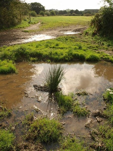
English: Puddle near the Teign On the left, Kingsteignton Footpath 11 (here used by the eastern arm of the Templar Way) follows the right bank of the Teign (out of sight). On the right is a field boundary running away from the river across the water meadows on the flood plain. This and the puddle are at a point where a track runs down to ford the nearby river. |
| Date | |
| Source | From geograph.org.uk |
| Author | Derek Harper |
| Attribution (required by the license) | Derek Harper / Puddle near the Teign / |
| Camera location | | View this and other nearby images on: OpenStreetMap |
|---|
_heading:202.00&language=en)
| Object location | | View this and other nearby images on: OpenStreetMap |
|---|
_heading:202.00&language=en)
Licensing[edit]

|
This image was taken from the Geograph project collection. See this photograph's page on the Geograph website for the photographer's contact details. The copyright on this image is owned by Derek Harper and is licensed for reuse under the Creative Commons Attribution-ShareAlike 2.0 license.
|
This file is licensed under the Creative Commons Attribution-Share Alike 2.0 Generic license.
Attribution: Derek Harper
- You are free:
- to share – to copy, distribute and transmit the work
- to remix – to adapt the work
- Under the following conditions:
- attribution – You must give appropriate credit, provide a link to the license, and indicate if changes were made. You may do so in any reasonable manner, but not in any way that suggests the licensor endorses you or your use.
- share alike – If you remix, transform, or build upon the material, you must distribute your contributions under the same or compatible license as the original.
File history
Click on a date/time to view the file as it appeared at that time.
| Date/Time | Thumbnail | Dimensions | User | Comment | |
|---|---|---|---|---|---|
| current | 04:53, 23 February 2011 | | 480 × 640 (122 KB) | GeographBot (talk | contribs) | == {{int:filedesc}} == {{Information |description={{en|1=Puddle near the Teign On the left, Kingsteignton Footpath 11 (here used by the eastern arm of the Templar Way) follows the right bank of the Teign (out of sight). On the right is a field boundary ru |
You cannot overwrite this file.
File usage on Commons
There are no pages that use this file.