File:QuebecSatelliteNASA.jpg
Jump to navigation
Jump to search
No higher resolution available.
QuebecSatelliteNASA.jpg (800 × 481 pixels, file size: 183 KB, MIME type: image/jpeg)
Captions
Captions
Add a one-line explanation of what this file represents
Summary[edit]
| Description |
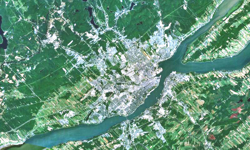
English: Quebec city on the north shore of St. Lawrence river, Lévis on the south shore and Orleans Island in the river.
Français : La ville de Québec sur la rive nord du fleuve Saint-Laurent, Lévis sur la rive-sud et l'île d'Orléans dans le fleuve. |
| Date | 8 December 2005 (first upload on Commons) |
| Source | File:Quebec city-satellite image.jpg |
| Author | NASA |
| Other versions |
|

Licensing[edit]
| This image is in the public domain because it is a screenshot from NASA’s globe software World Wind using a public domain layer, such as Blue Marble, MODIS, Landsat, SRTM, USGS or GLOBE.
|
 |
File history
Click on a date/time to view the file as it appeared at that time.
| Date/Time | Thumbnail | Dimensions | User | Comment | |
|---|---|---|---|---|---|
| current | 04:52, 5 September 2007 | | 800 × 481 (183 KB) | Gilbertus (talk | contribs) | {{Information |Description=English: Quebec city on the north shore of St. Lawrence river, Lévis on the south shore and Orleans Island in the river. Français : La ville de Québec sur la rive nord du fleuve Saint-Laurent, Lévis sur la rive-sud et l'île |
You cannot overwrite this file.
File usage on Commons
There are no pages that use this file.
File usage on other wikis
The following other wikis use this file:
- Usage on ar.wikipedia.org
- Usage on en.wikipedia.org
- Usage on es.wikipedia.org
- Usage on fr.wikipedia.org
- Usage on pl.wikipedia.org
- Usage on www.wikidata.org