File:Rixton Clay Pits Nature Reserve - geograph.org.uk - 2742.jpg
Jump to navigation
Jump to search
No higher resolution available.
Rixton_Clay_Pits_Nature_Reserve_-_geograph.org.uk_-_2742.jpg (640 × 480 pixels, file size: 76 KB, MIME type: image/jpeg)
Captions
Captions
Add a one-line explanation of what this file represents
Summary[edit]
| Description |
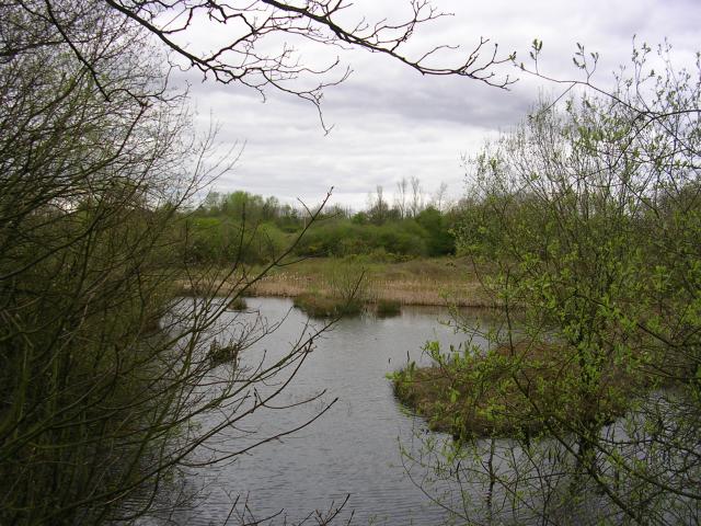
English: Rixton Clay Pits Nature Reserve. An interesting nature reserve and SSSI, owned and managed by Warrington Borough Council. Formed from the clay pits of a disused brickworks excavated in the glacial boulder clay of the area. When the works closed in the 1960's the excavations began to fill with water forming a number of variously sized ponds. Great Crested Newt colonise many of these ponds and the site is well known for the variety of wildlife found there. Many species of Dragonfly, Damselfly and fungi are represented. Photo taken from SJ 685 903 |
| Date | |
| Source | From geograph.org.uk |
| Author | Keith Williamson |
| Attribution (required by the license) | Keith Williamson / Rixton Clay Pits Nature Reserve / |
| Object location | | View this and other nearby images on: OpenStreetMap |
|---|
_&language=en)
Licensing[edit]

|
This image was taken from the Geograph project collection. See this photograph's page on the Geograph website for the photographer's contact details. The copyright on this image is owned by Keith Williamson and is licensed for reuse under the Creative Commons Attribution-ShareAlike 2.0 license.
|
This file is licensed under the Creative Commons Attribution-Share Alike 2.0 Generic license.
Attribution: Keith Williamson
- You are free:
- to share – to copy, distribute and transmit the work
- to remix – to adapt the work
- Under the following conditions:
- attribution – You must give appropriate credit, provide a link to the license, and indicate if changes were made. You may do so in any reasonable manner, but not in any way that suggests the licensor endorses you or your use.
- share alike – If you remix, transform, or build upon the material, you must distribute your contributions under the same or compatible license as the original.
- Remove redundant categories and try to put this image in the most specific category/categories
- Remove this template
- The location categories are based on information from this geonames tool and this OpenStreetMap tool combined with a database. You can also have a look at this tool from mysociety.
- The topic category from Geograph was Lakes and Rivers (find similar images and Rivers at Geograph)
File history
Click on a date/time to view the file as it appeared at that time.
| Date/Time | Thumbnail | Dimensions | User | Comment | |
|---|---|---|---|---|---|
| current | 03:19, 30 January 2010 | | 640 × 480 (76 KB) | GeographBot (talk | contribs) | == {{int:filedesc}} == {{Information |description={{en|1=Rixton Clay Pits Nature Reserve. An interesting nature reserve and SSSI, owned and managed by Warrington Borough Council. Formed from the clay pits of a disused brickworks excavated in the glacial b |
You cannot overwrite this file.
File usage on Commons
There are no pages that use this file.