File:Roadway, eye-bars, and north tower. - Three Sisters Bridges, Sixth Street Bridge, Spanning Allegheny River at Sixth Street, Pittsburgh, Allegheny County, PA HAER PA,2-PITBU,78A-3.tif
Jump to navigation
Jump to search

Size of this JPG preview of this TIF file: 800 × 577 pixels. Other resolutions: 320 × 231 pixels | 640 × 462 pixels | 1,024 × 739 pixels | 1,280 × 923 pixels | 2,560 × 1,847 pixels | 5,000 × 3,607 pixels.
Original file (5,000 × 3,607 pixels, file size: 17.2 MB, MIME type: image/tiff)
Captions
Captions
Add a one-line explanation of what this file represents
Summary[edit]
| Roadway, eye-bars, and north tower. - Three Sisters Bridges, Sixth Street Bridge, Spanning Allegheny River at Sixth Street, Pittsburgh, Allegheny County, PA | ||||
|---|---|---|---|---|
| Photographer |
Lowe, Jet, creator |
|||
| Title |
Roadway, eye-bars, and north tower. - Three Sisters Bridges, Sixth Street Bridge, Spanning Allegheny River at Sixth Street, Pittsburgh, Allegheny County, PA |
|||
| Description |
Covell, Vernon R; Nutter, A D; Roush, Stanley L; Wilkerson, T J; American Bridge Company; Foundation Company; Allegheny County Department of Public Works; Brown, Norman F; Richardson, George S; Arnold, Bion J; Clemente, Roberto; DeLony, Eric N, project manager; Pennsylvania Department of Transportation, sponsor; Pennsylvania Historical and Museum Commission, sponsor; Lowe, Jet, photographer; Berg, David C, photographer; Gordon, Susan H, delineator; Hanley, James P, delineator; Maleeva, Julia, delineator; Zsembery, Rachel J, delineator |
|||
| Depicted place | Pennsylvania; Allegheny County; Pittsburgh | |||
| Date | 1999 | |||
| Dimensions | 5 x 7 in. | |||
| Current location |
Library of Congress Prints and Photographs Division Washington, D.C. 20540 USA http://hdl.loc.gov/loc.pnp/pp.print |
|||
| Accession number |
HAER PA,2-PITBU,78A-3 |
|||
| Credit line |
|
|||
| Notes |
|
|||
| References |
|
|||
| Source | https://www.loc.gov/pictures/item/pa3659.photos.361484p | |||
| Permission (Reusing this file) |
|
|||

File history
Click on a date/time to view the file as it appeared at that time.
| Date/Time | Thumbnail | Dimensions | User | Comment | |
|---|---|---|---|---|---|
| current | 05:07, 1 August 2014 | 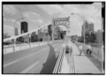 | 5,000 × 3,607 (17.2 MB) | Fæ (talk | contribs) | GWToolset: Creating mediafile for Fæ. HABS 31 July 2014 (3000:3200) |
You cannot overwrite this file.
File usage on Commons
The following page uses this file: