File:S-Bahn-Stammstrecke Wien.png
Jump to navigation
Jump to search
Size of this preview: 800 × 501 pixels. Other resolutions: 320 × 201 pixels | 640 × 401 pixels | 1,024 × 642 pixels | 1,280 × 802 pixels | 2,560 × 1,604 pixels | 5,055 × 3,168 pixels.
Original file (5,055 × 3,168 pixels, file size: 4.81 MB, MIME type: image/png)
Captions
Captions
Add a one-line explanation of what this file represents
Summary[edit]
| Description |
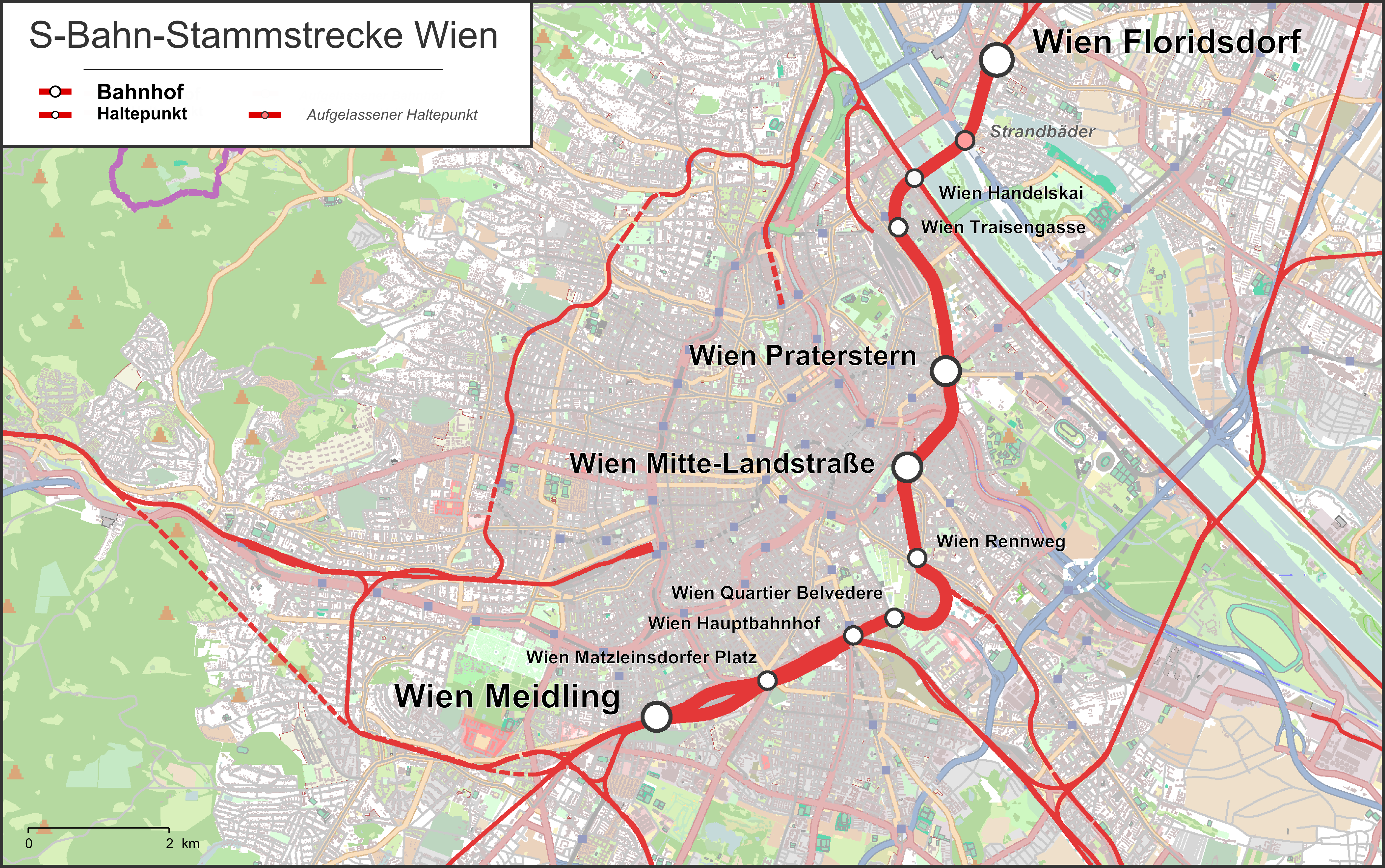
English: Map of the trunk line of the Vienna S-Bahn
Deutsch: Karte der S-Bahn-Stammstrecke in Wien |
| Date | |
| Source |
Own work Map was created using: |
| Author | |
| Permission (Reusing this file) |
Map data (c) OpenStreetMap (and) contributors, CC-BY-SA |
Licensing[edit]
This file is licensed under the Creative Commons Attribution-Share Alike 2.0 Generic license.
- You are free:
- to share – to copy, distribute and transmit the work
- to remix – to adapt the work
- Under the following conditions:
- attribution – You must give appropriate credit, provide a link to the license, and indicate if changes were made. You may do so in any reasonable manner, but not in any way that suggests the licensor endorses you or your use.
- share alike – If you remix, transform, or build upon the material, you must distribute your contributions under the same or compatible license as the original.
File history
Click on a date/time to view the file as it appeared at that time.
| Date/Time | Thumbnail | Dimensions | User | Comment | |
|---|---|---|---|---|---|
| current | 10:16, 11 November 2018 | | 5,055 × 3,168 (4.81 MB) | Pechristener (talk | contribs) | Haltestelle 'Radetzkyplatz' wurde schon Jahrzehnte vor der Einrichtung der Stammstrecke genannten Schnellbahnstrecke (Teileröffnung 1959, Volleröffnung 1962) nicht mehr angefahren. Hat auch nie 'Wien Radetzkyplatz' geheissen. ==> entfernt |
| 21:01, 9 February 2014 |  | 5,055 × 3,168 (4.84 MB) | Pechristener (talk | contribs) | Lage der aufgelassenen Haltestelle Wien Strandbäder richtig gestellt. | |
| 22:46, 8 February 2014 |  | 5,055 × 3,168 (4.84 MB) | Pechristener (talk | contribs) | == {{int:filedesc}} == {{Information |Description ={{en|1=Map of the trunk line of the Vienna S-Bahn}} {{de|1=Karte der S-Bahn-Stammstrecke in Wien }} |Source ={{own}} Map was created using: *[http://www.... |
You cannot overwrite this file.
File usage on Commons
The following 6 pages use this file:
- User:Chumwa/OgreBot/Potential transport maps/2018 November 11-20
- User:Chumwa/OgreBot/Public transport information/2018 November 11-20
- User:Chumwa/OgreBot/Transport Maps/2018 November 11-20
- User:Chumwa/OgreBot/Travel and communication maps/2018 November 11-20
- User:Pechristener
- Category:Main Route (Vienna)
File usage on other wikis
The following other wikis use this file:
- Usage on de.wikipedia.org
- Usage on en.wikipedia.org
- Usage on it.wikipedia.org
- Usage on www.wikidata.org