File:SR 123 area history.svg
Jump to navigation
Jump to search

Size of this PNG preview of this SVG file: 800 × 444 pixels. Other resolutions: 320 × 178 pixels | 640 × 356 pixels | 1,024 × 569 pixels | 1,280 × 711 pixels | 2,560 × 1,422 pixels | 1,152 × 640 pixels.
Original file (SVG file, nominally 1,152 × 640 pixels, file size: 29 KB)
Captions
Captions
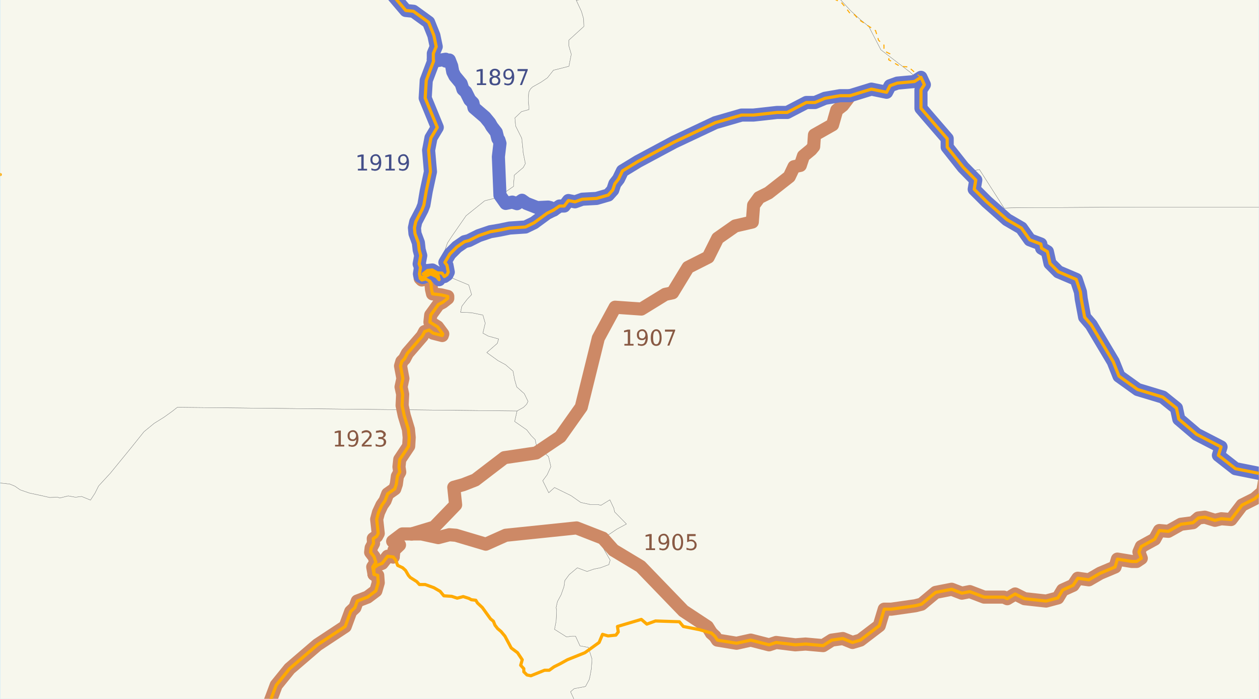
This is a map of the highways on the east side of Mount Rainier in Washington.
Summary[edit]
| Description | This is a map of the highways on the east side of Mount Rainier in Washington. The road on the north, now SR 410, was added to the state highway system in 1897 and moved south in 1919; the road on the south, now US 12 and SR 123, was added in 1905 and shifted west in 1907 and 1923. Current US 12 east of SR 123 was re-added in 1931. Email me if you would like a copy of the GIS data I created for the highways. |
| Date | 22 March 2008 (original upload date) |
| Source | No machine-readable source provided. Own work assumed (based on copyright claims). |
| Author | No machine-readable author provided. NE2 assumed (based on copyright claims). |
Licensing[edit]
| I, the copyright holder of this work, release this work into the public domain. This applies worldwide. In some countries this may not be legally possible; if so: I grant anyone the right to use this work for any purpose, without any conditions, unless such conditions are required by law. |
File history
Click on a date/time to view the file as it appeared at that time.
| Date/Time | Thumbnail | Dimensions | User | Comment | |
|---|---|---|---|---|---|
| current | 04:42, 22 March 2008 | | 1,152 × 640 (29 KB) | NE2 (talk | contribs) | == Summary == This is a map of the highways on the east side of Mount Rainier in Washington. The road on the north, now SR 410, was added to the state highway system in 1897 and moved south in 1919; the road on the south, now US 12 and SR 123, was added i |
You cannot overwrite this file.
File usage on Commons
The following page uses this file:
File usage on other wikis
The following other wikis use this file:
- Usage on en.wikipedia.org