File:Saint-CrépinFault.jpg
Jump to navigation
Jump to search

Size of this preview: 800 × 600 pixels. Other resolutions: 320 × 240 pixels | 640 × 480 pixels | 1,024 × 768 pixels | 1,280 × 960 pixels | 2,560 × 1,920 pixels | 3,648 × 2,736 pixels.
Original file (3,648 × 2,736 pixels, file size: 772 KB, MIME type: image/jpeg)
Captions
Captions
Add a one-line explanation of what this file represents
Summary[edit]
| Description |
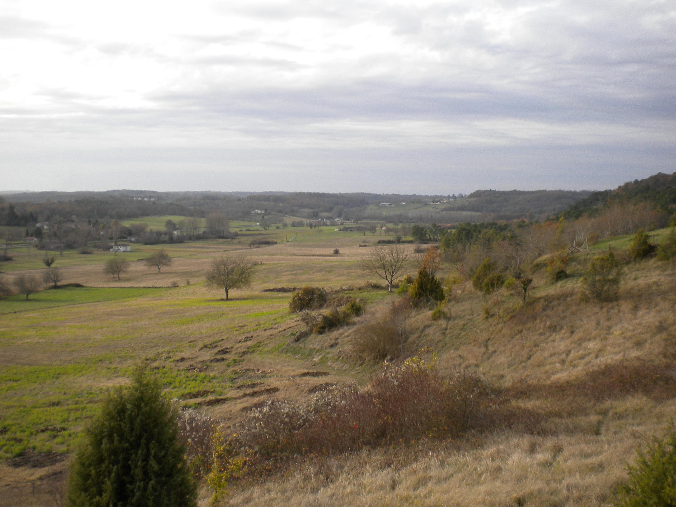
English: Valley southwest of Saint-Crépin-de-Richemont (Dordogne, France). Photo taken from the hamlet of Grange Haute from the ESE. The valley houses the trace of the Mareuil Fault - the fault runs next to the D 939 visible at the left. Along the fault the compartment on the left has been upthrusted by about 100 meters.
Deutsch: Tal südwestlich von Saint-Crépin-de-Richemont, aufgenommen aus ostsüdöstlicher Richtung vom Weiler Grange Haute. Durch das Tal läuft die Mareuil-Störung, direkt neben der links sichtbaren D 939. Die Störung ist eine Aufschiebung, entlang derer die linke Talseite um rund 100 Meter angehoben wurde.
Français : Vallon au sud-ouest de Saint-Crépin-de-Richemont (Dordogne, France). La photo était prise près de l'hameau de Grange Haute. Ce vallon est la trace de l'accident de Mareuil, une faille reverse, qui a remonté le compartiment à gauche par environs 100 mètres. La faille court tout proche de la D 939 visible à gauche. |
| Date | |
| Source | Own work |
| Author | Rudolf Pohl |
Licensing[edit]
I, the copyright holder of this work, hereby publish it under the following licenses:
This file is licensed under the Creative Commons Attribution-Share Alike 3.0 Unported license.
- You are free:
- to share – to copy, distribute and transmit the work
- to remix – to adapt the work
- Under the following conditions:
- attribution – You must give appropriate credit, provide a link to the license, and indicate if changes were made. You may do so in any reasonable manner, but not in any way that suggests the licensor endorses you or your use.
- share alike – If you remix, transform, or build upon the material, you must distribute your contributions under the same or compatible license as the original.

|
Permission is granted to copy, distribute and/or modify this document under the terms of the GNU Free Documentation License, Version 1.2 or any later version published by the Free Software Foundation; with no Invariant Sections, no Front-Cover Texts, and no Back-Cover Texts. A copy of the license is included in the section entitled GNU Free Documentation License. |
You may select the license of your choice.
File history
Click on a date/time to view the file as it appeared at that time.
| Date/Time | Thumbnail | Dimensions | User | Comment | |
|---|---|---|---|---|---|
| current | 14:36, 18 June 2010 | | 3,648 × 2,736 (772 KB) | Rudolf Pohl (talk | contribs) | {{Information |Description={{en|1=Valley southwest of Saint-Crépin-de-Richemont (Dordogne, France). Photo taken from the hamlet of Grange-Haute from the ESE. The valley houses the trace of the Mareuil Fault - the fault runs next to the D 939 visible at t |
You cannot overwrite this file.
File usage on Commons
There are no pages that use this file.
File usage on other wikis
The following other wikis use this file:
- Usage on de.wikipedia.org
- Usage on pl.wikipedia.org