File:Sakasagawa Dam survey.jpg
Jump to navigation
Jump to search
No higher resolution available.
Sakasagawa_Dam_survey.jpg (520 × 395 pixels, file size: 52 KB, MIME type: image/jpeg)
Captions
Captions
Add a one-line explanation of what this file represents
Summary[edit]
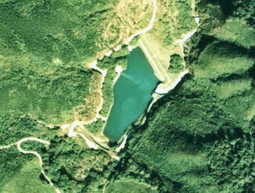
Aerial Photo of Sakasagawa Dam (1976), Nikkō city, Tochigi prefecture, Japan.
日本語: 逆川ダムの航空写真。1976年度撮影。
Licensing[edit]

|
The copyright holder of this file, the Ministry of Land, Infrastructure, Transport and Tourism of Japan, allows anyone to use it for any purpose, provided that the copyright holder is properly attributed. Redistribution, derivative work, commercial use, and all other use is permitted. |
Attribution:
Copyright © National Land Image Information (Color Aerial Photographs), Ministry of Land, Infrastructure, Transport and Tourism
|
 |
This image is copyrighted by the Ministry of Land, Infrastructure, Transport and Tourism of Japan. For terms of use, see the stipulation to use of National Land Information (in Japanese) and message from MLIT (in Japanese and English). When you display this image on an article, include the following phrase in the description: "Made based on National Land Image Information (Color Aerial Photographs), Ministry of Land, Infrastructure, Transport and Tourism".
|
File history
Click on a date/time to view the file as it appeared at that time.
| Date/Time | Thumbnail | Dimensions | User | Comment | |
|---|---|---|---|---|---|
| current | 09:14, 25 October 2007 | | 520 × 395 (52 KB) | Qurren (talk | contribs) | Aerial Photo of Sakasagawa Dam (1976), Nikkō city, Tochigi prefecture, Japan. {{ja|逆川ダムの航空写真。1976年度撮影。}} Category:Dams in Tochigi prefecture Category:Nikko, Tochigi == Licensing == {{AerialPhot |
You cannot overwrite this file.
File usage on Commons
There are no pages that use this file.
File usage on other wikis
The following other wikis use this file:
- Usage on en.wikipedia.org
- Usage on ja.wikipedia.org
- Usage on www.wikidata.org