File:Sanjak of Novibazar-sr.png
Jump to navigation
Jump to search

Size of this preview: 531 × 600 pixels. Other resolutions: 212 × 240 pixels | 425 × 480 pixels | 786 × 888 pixels.
Original file (786 × 888 pixels, file size: 61 KB, MIME type: image/png)
Captions
Captions
Add a one-line explanation of what this file represents
Summary[edit]
| Description |
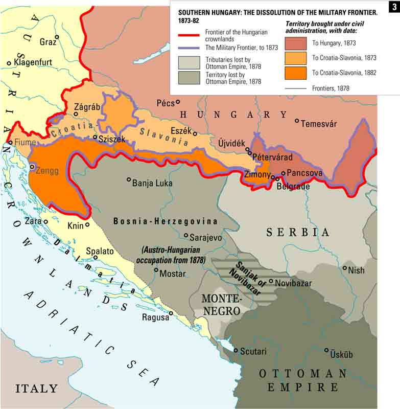
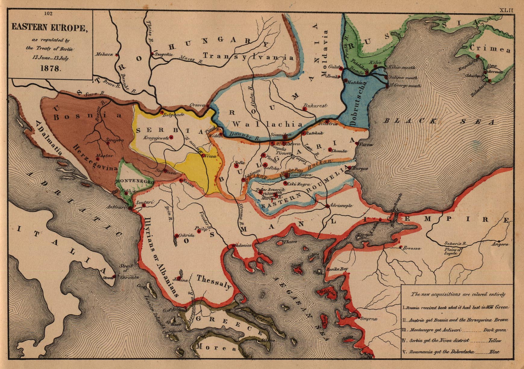
English: Map of the Sanjak of Novibazar, nominal territory of the Ottoman Empire under Austro-Hungarian occupation in 1878. Српски / srpski: Мапа Новопазарског санџака, номиналне територије Османског царства под Аустро-Угарском окупацијом 1878. године. |
| Date | |
| Source | Own work |
| Author | PANONIAN |
Licensing[edit]
I, the copyright holder of this work, hereby publish it under the following license:
| This file is made available under the Creative Commons CC0 1.0 Universal Public Domain Dedication. | |
| The person who associated a work with this deed has dedicated the work to the public domain by waiving all of their rights to the work worldwide under copyright law, including all related and neighboring rights, to the extent allowed by law. You can copy, modify, distribute and perform the work, even for commercial purposes, all without asking permission.
|
References[edit]
- http://terkepek.adatbank.transindex.ro/kepek/netre/258.gif
- http://www.historyonmaps.com/ColourSamples/cbig/DissolutionMilitayFrontier.jpg
- http://www.lib.utexas.edu/maps/historical/eastern_europe1878.jpg
- http://images.nationmaster.com/images/motw/historical/balkans_1912.jpg
- http://maps.grida.no/library/files/storage/balkans-history-_003.png
- The Times History of Europe, Times Books, London, 2002.
- Istorijski atlas, Geokarta, Beograd, 1999.
- Školski istorijski atlas, Zavod za izdavanje udžbenika SR Srbije, Beograd, 1970.
- Povijesni atlas, Učila - Zagreb, Zagreb, 1971.
- Denis Šehić - Demir Šehić, Istorijski atlas sveta, Beograd, 2007.
File history
Click on a date/time to view the file as it appeared at that time.
| Date/Time | Thumbnail | Dimensions | User | Comment | |
|---|---|---|---|---|---|
| current | 09:29, 17 April 2014 | | 786 × 888 (61 KB) | PANONIAN (talk | contribs) | {{Information |Description ={{en|1=Map of the Sanjak of Novibazar, nominal territory of the Ottoman Empire under Austro-Hungarian occupation in 1878.}} |Source ={{own}} |Author =PANONIAN |Date =2014 |Permi... |
You cannot overwrite this file.
File usage on Commons
There are no pages that use this file.
File usage on other wikis
The following other wikis use this file:
- Usage on mk.wikipedia.org
- Usage on sr.wikipedia.org
Categories:
- Sanjak of Novi Pazar
- Maps of the history of Sandžak
- Maps of the Ottoman period in the history of Serbia
- Maps of the history of Montenegro under Ottoman and Venetian rule
- Maps of the history of Kosovo under Ottoman Empire
- Maps of sanjaks of the Ottoman Empire
- Maps of the Ottoman Empire in the 19th century
- Political maps of Austria-Hungary
- Serbian-language maps