File:Satellite view of northwestern Europe.jpg
Jump to navigation
Jump to search
Size of this preview: 771 × 600 pixels. Other resolutions: 309 × 240 pixels | 617 × 480 pixels | 988 × 768 pixels | 1,280 × 996 pixels | 2,560 × 1,991 pixels | 7,200 × 5,600 pixels.
Original file (7,200 × 5,600 pixels, file size: 5.4 MB, MIME type: image/jpeg)
Captions
Captions
Add a one-line explanation of what this file represents
Summary[edit]
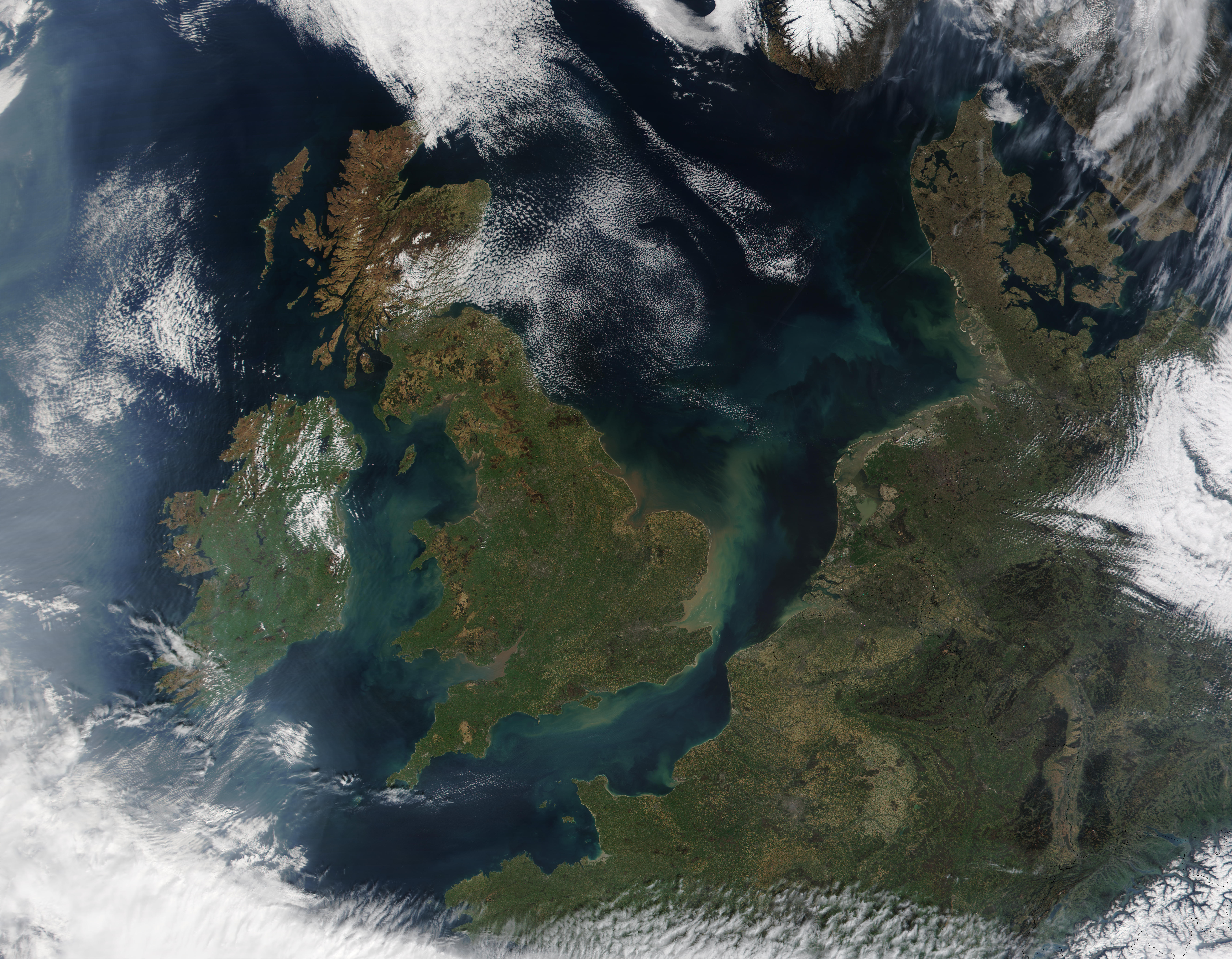
| Description | Satellite image of North-Western Europe in April 2002. |
| Date | |
| Source | NASA Visible Earth |
| Author | Jacques Descloitres, MODIS Land Rapid Response Team, NASA/GSFC |
| Other versions | cropped to Great Britain |
Licensing[edit]
| This file is in the public domain in the United States because it was solely created by NASA. NASA copyright policy states that "NASA material is not protected by copyright unless noted". (See Template:PD-USGov, NASA copyright policy page or JPL Image Use Policy.) | ||
 |
Warnings:
|
File history
Click on a date/time to view the file as it appeared at that time.
| Date/Time | Thumbnail | Dimensions | User | Comment | |
|---|---|---|---|---|---|
| current | 13:30, 5 September 2012 | | 7,200 × 5,600 (5.4 MB) | EurekaLott (talk | contribs) | higher resolution |
| 08:54, 12 February 2006 |  | 1,800 × 1,400 (590 KB) | Ranveig (talk | contribs) | Satellite image of North-Western Europe in April 2002. From NASA's Visible Earth http://visibleearth.nasa.gov/cgi-bin/viewrecord?15551 See also cropped version Image:Satellite image of Great Britain and Northern Ireland in April 2002.jpg {{PD-USG |
You cannot overwrite this file.
File usage on Commons
The following 2 pages use this file:
- File:UK A2002096 1110 1km.jpg (file redirect)
- File:United Kingdom satellite image.png
File usage on other wikis
The following other wikis use this file:
- Usage on nn.wikipedia.org