File:Schlesien1890.jpg
Jump to navigation
Jump to search
Size of this preview: 800 × 553 pixels. Other resolutions: 320 × 221 pixels | 640 × 442 pixels | 1,024 × 707 pixels | 1,280 × 884 pixels | 2,560 × 1,768 pixels | 4,691 × 3,240 pixels.
Original file (4,691 × 3,240 pixels, file size: 7.04 MB, MIME type: image/jpeg)
Captions
Captions
Add a one-line explanation of what this file represents
Summary[edit]
| Description |
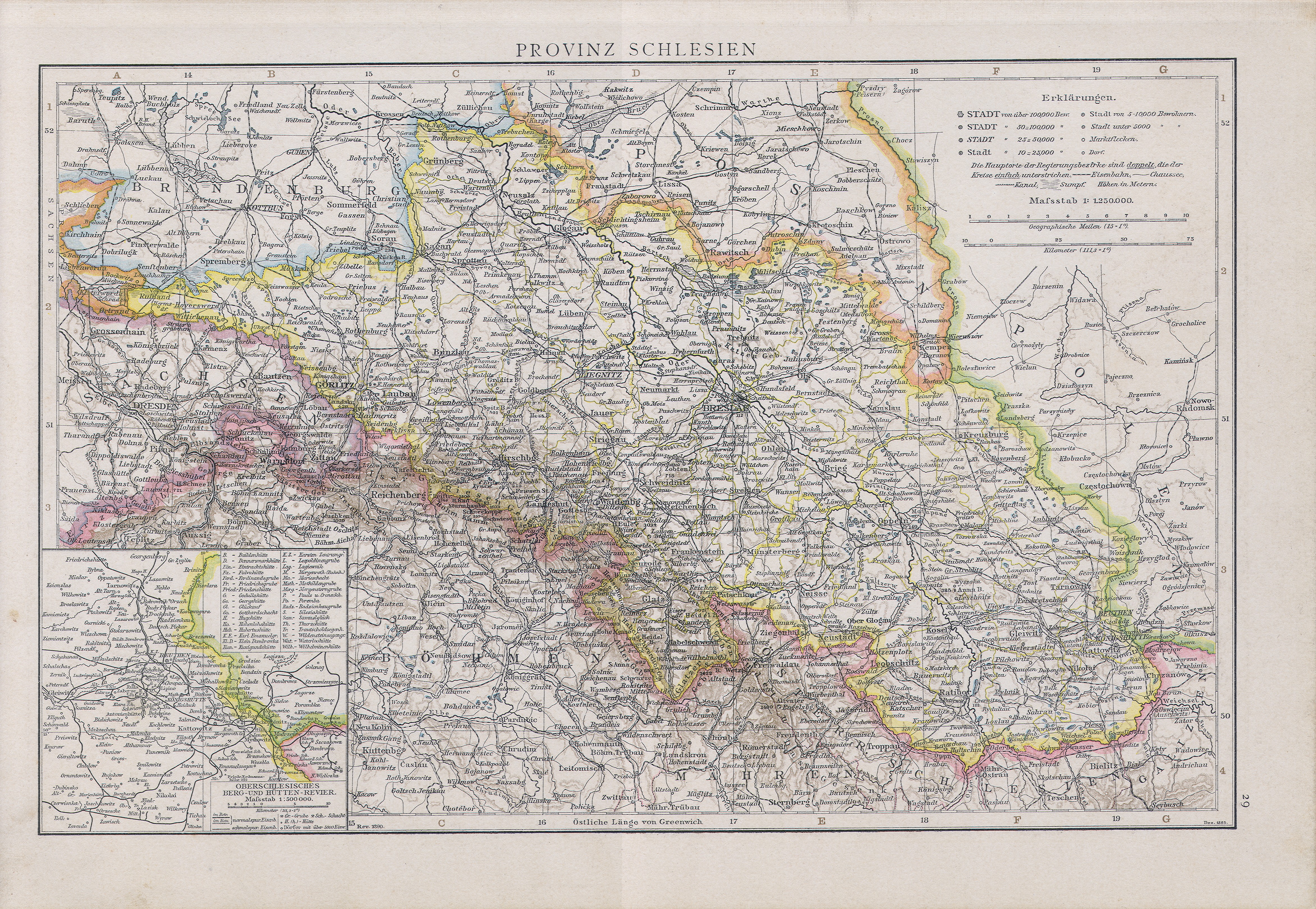
English: Map of Silesia, 1890
Slovenčina: Mapa Sliezska, 1890
Deutsch: Karte von Schlesien nebst oberschlesischem Industriegebiet, 1890 |
|||||||||||||||||||||||
| Date | ||||||||||||||||||||||||
| Source | Richard Andrees allgemeiner Handatlas : in hundertzwanzig Kartenseiten; nebst alphabetischem Namenverzeichnis. 2., verm. und verbesserte Aufl. Bielefeld/Leipzig: Velhagen & Klasing 1890 | |||||||||||||||||||||||
| Author |
|
|||||||||||||||||||||||

Licensing[edit]
|
This work is in the public domain in its country of origin and other countries and areas where the copyright term is the author's life plus 100 years or fewer. | |
| This file has been identified as being free of known restrictions under copyright law, including all related and neighboring rights. | |
File history
Click on a date/time to view the file as it appeared at that time.
| Date/Time | Thumbnail | Dimensions | User | Comment | |
|---|---|---|---|---|---|
| current | 08:05, 9 July 2008 | | 4,691 × 3,240 (7.04 MB) | Matriosa (talk | contribs) | {{Information |Description={{en|1=Map of Silesia, 1890}} {{sk|1=Mapa Sliezska, 1890}} |Source=Allgemeiner handatlas. 1890 |Author=Andree |Date=1890 |Permission= |other_versions= }} {{ImageUpload|full}} Category:Old Maps of Silesia |
You cannot overwrite this file.
File usage on Commons
There are no pages that use this file.
File usage on other wikis
The following other wikis use this file:
- Usage on be.wikipedia.org
- Usage on cs.wikipedia.org
- Usage on de.wikipedia.org
- Usage on incubator.wikimedia.org
- Usage on ru.wikipedia.org