File:Sl-map.png
Jump to navigation
Jump to search
No higher resolution available.
Sl-map.png (330 × 355 pixels, file size: 11 KB, MIME type: image/png)
Captions
Captions
Add a one-line explanation of what this file represents
Summary[edit]
| Description |
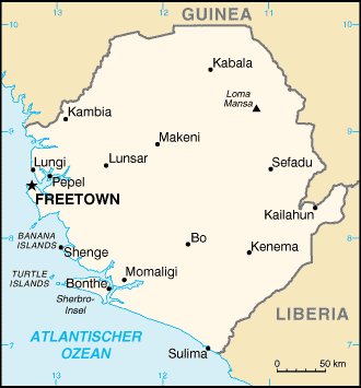
Deutsch: Karte von Sierra Leone |
| Date | 16 June 2003 (original upload date) |
| Source | Transferred from de.wikipedia to Commons., original source was "aus der englischen Wikipedia" ("from the english wikipedia"). later version was translated to german |
| Author | The original uploader was Stefan Kühn at German Wikipedia. |
| Permission (Reusing this file) |
PD-USGOV, de:CIA World Factbook |
Licensing[edit]
This work is in the public domain in the United States because it is a work prepared by an officer or employee of the United States Government as part of that person’s official duties under the terms of Title 17, Chapter 1, Section 105 of the US Code.
Note: This only applies to original works of the Federal Government and not to the work of any individual U.S. state, territory, commonwealth, county, municipality, or any other subdivision. This template also does not apply to postage stamp designs published by the United States Postal Service since 1978. (See § 313.6(C)(1) of Compendium of U.S. Copyright Office Practices). It also does not apply to certain US coins; see The US Mint Terms of Use.
|
 | |
| This file has been identified as being free of known restrictions under copyright law, including all related and neighboring rights. | ||
Original upload log[edit]
The original description page was here. All following user names refer to de.wikipedia.
- 2004-10-25 13:10 Tzzzpfff 330×355× (10881 bytes) übersetzt
- 2003-06-16 20:14 Stefan Kühn 330×355× (8790 bytes) Karte von Sierra Leone - aus der englischen Wikipedia
File history
Click on a date/time to view the file as it appeared at that time.
| Date/Time | Thumbnail | Dimensions | User | Comment | |
|---|---|---|---|---|---|
| current | 23:00, 3 July 2011 | | 330 × 355 (11 KB) | Akkakk (talk | contribs) | {{Information |Description={{de|Karte von Sierra Leone de:CIA World Factbook}} |Source=Transferred from [http://de.wikipedia.org de.wikipedia], original source was "aus der englischen Wikipedia" ("from the english wikipedia") |Date={{Date|2003|06|16} |
You cannot overwrite this file.
File usage on Commons
There are no pages that use this file.
File usage on other wikis
The following other wikis use this file:
- Usage on bs.wikipedia.org
- Usage on de.wikipedia.org
- 18. Januar
- Executive Outcomes
- Liste von Orten in Sierra Leone
- Benutzer:Radamanth/Sierra Leone
- Outamba-Kilimi-Nationalpark
- Bürgerkrieg in Sierra Leone
- Tiwai
- Tacugama
- Mamunta-Mayoso Wildlife Sanctuary
- Gola-Regenwald-Nationalpark
- Benutzer:Uwe Dedering/Länderliste
- Kangari-Hills-Waldschutzgebiet
- Tingi-Hills-Waldreservat
- Kambui-Hills-Waldschutzgebiet
- Usage on io.wikipedia.org
- Usage on tr.wikipedia.org