File:South Africa electoral wards 2009 blank.svg
Jump to navigation
Jump to search

Size of this PNG preview of this SVG file: 684 × 599 pixels. Other resolutions: 274 × 240 pixels | 548 × 480 pixels | 876 × 768 pixels | 1,168 × 1,024 pixels | 2,337 × 2,048 pixels | 809 × 709 pixels.
Original file (SVG file, nominally 809 × 709 pixels, file size: 3.3 MB)
Captions
Captions
Add a one-line explanation of what this file represents
W3C-validity not checked.
Summary[edit]
| Description |
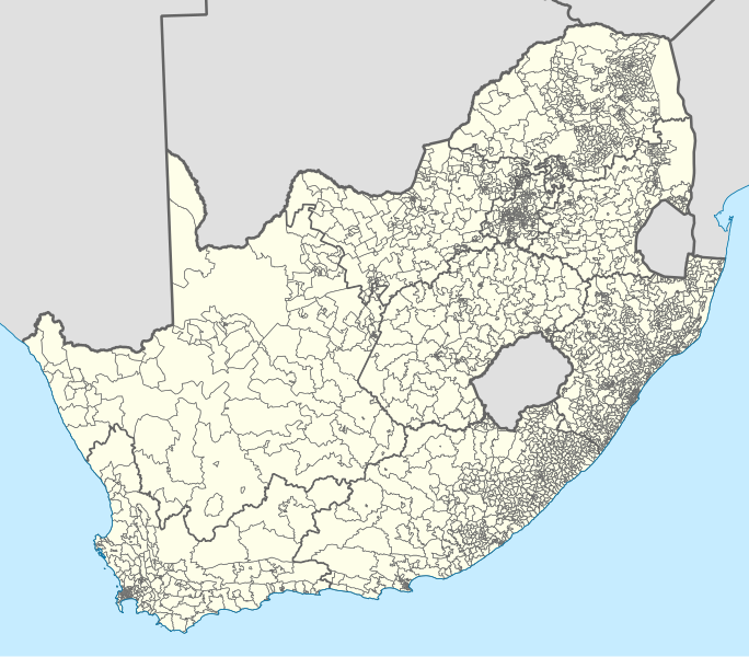
English: Map showing the borders of the electoral wards of South Africa used in the 2009 general election. In municipalities that are not divided into wards, the whole municipal area is shown as a single ward. |
| Date | |
| Source | Own work, based on official ward boundary data from the Municipal Demarcation Board. |
| Author | Htonl |
| Other versions | File:South Africa electoral wards 2006 blank.svg, File:South Africa electoral wards 2011 blank.svg |
Licensing[edit]
| I, the copyright holder of this work, release this work into the public domain. This applies worldwide. In some countries this may not be legally possible; if so: I grant anyone the right to use this work for any purpose, without any conditions, unless such conditions are required by law. |
File history
Click on a date/time to view the file as it appeared at that time.
| Date/Time | Thumbnail | Dimensions | User | Comment | |
|---|---|---|---|---|---|
| current | 18:24, 24 April 2011 | | 809 × 709 (3.3 MB) | Htonl (talk | contribs) | *actually* make the SVG code valid |
| 18:11, 24 April 2011 |  | 809 × 709 (3.28 MB) | Htonl (talk | contribs) | make SVG code valid | |
| 17:42, 24 April 2011 |  | 809 × 709 (3.28 MB) | Htonl (talk | contribs) | == Summary == {{Information |Description={{en|1=Map showing the borders of the electoral wards of South Africa used in the 2006 general election. In municipalities that are not divided into wards, the whole municipal area |
You cannot overwrite this file.
File usage on Commons
There are no pages that use this file.