File:South America (orthographic projection).svg
Ir a la navegación
Ir a la búsqueda

Tamaño de esta previsualización PNG del archivo SVG: 541 × 541 píxeles. Otras resoluciones: 240 × 240 píxeles | 480 × 480 píxeles | 768 × 768 píxeles | 1024 × 1024 píxeles | 2048 × 2048 píxeles.
Archivo original (archivo SVG, nominalmente 541 × 541 píxeles, tamaño de archivo: 93 kB)
Leyendas
Leyendas
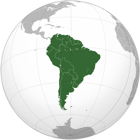
América del Sur o Sudamérica
| Descripción |
Português: South America (orthographic projection) |
||||
| Fecha | |||||
| Fuente |
Português: Imagem feita a partir de Brazil (orthographic projection).svg. |
||||
| Autor |
by Luan |
||||
| Permiso (Reutilización de este archivo) |
Yo, el titular de los derechos de autor de esta obra, la publico en los términos de la siguiente licencia: Este archivo se encuentra bajo la licencia Creative Commons Atribución 3.0 Unported.
|
||||
| Otras versiones |
Obras derivadas de ésta: |
||||
| SVG desarrollo | El código fuente de esta imagen SVG es válido. Este mapa fue creado con Inkscape. SVG watermarked with invisible embedded text. |

.svg)
.png)
Historial del archivo
Haz clic sobre una fecha y hora para ver el archivo tal como apareció en ese momento.
| Fecha y hora | Miniatura | Dimensiones | Usuario | Comentario | |
|---|---|---|---|---|---|
| actual | 20:24 12 sep 2012 | | 541 × 541 (93 kB) | Palosirkka (discusión | contribs.) | Scrubbed with http://codedread.com/scour/ |
| 20:08 3 jul 2009 |  | 541 × 541 (386 kB) | Luan (discusión | contribs.) | {{Information |Description= {{pt|Projeção ortográfica da América do Sul.}} |Source= {{pt|Imagem feita a partir de Brazil (orthographic projection).svg.}}{{Inkscape}}{{GFDL-GMT}} |Date= 2009-07-03 |Author= |
No puedes sobrescribir este archivo.
Usos del archivo
Hay más de 100 páginas que usan este archivo. La lista siguiente sólo muestra las primeras 100 páginas que usan este archivo. También puedes consultar la lista completa.
.svg)
- Atlas of South America
- Grey–green orthographic projections maps
- Sudamérica - América do Sul
- User:Heraldry/Projections
- User:Marquinhos
- User:Ssolbergj/orthographic
- User:Vsolymossy
- File:ALBA (orthographic projection).png
- File:Africa (orthographic projection).svg
- File:African Union (orthographic projection).svg
- File:Almoravid map.svg
- File:America do Sul (orthographic projection).jpg
- File:Americas (orthographic projection).svg
- File:Andean Community (orthographic projection).svg
- File:Antarctica (orthographic projection).svg
- File:Antillas (orthographic projection).svg
- File:Arctic (orthographic projection).svg
- File:Argentina (orthographic projection).png
- File:Argentina (orthographic projection).svg
- File:Aridoamerica (orthographic projection).svg
- File:Armenia (orthographic projection).svg
- File:Asia (orthographic projection).svg
- File:Association of Southeast Asian Nations (orthographic projection).svg
- File:Australia-New Guinea (orthographic projection).svg
- File:Australia (orthographic projection).svg
- File:Australia map with outlying islands.svg
- File:Brazil (orthographic projection).svg
- File:Canada (orthographic projection).svg
- File:Central America (orthographic projection).svg
- File:Central Asia (orthographic projection).svg
- File:Chile (orthographic projection).svg
- File:Colombia (orthographic projection).svg
- File:Democratic Republic of the Congo (orthographic projection).svg
- File:Dominion of Pakistan & Indian Controlled Kashmir (orthographic projection).svg
- File:Earth icon Fredrik.svg
- File:East Asia (orthographic projection).svg
- File:Ecuador (orthographic projection).svg
- File:Europe (orthographic projection).svg
- File:European Union (orthographic projection).svg
- File:Federal Republic of Central America (orthographic projection).svg
- File:First Brazilian Empire (orthographic projection).svg
- File:First Mexican Empire (orthographic projection).svg
- File:Georgia (orthographic projection).svg
- File:Global European Union.svg
- File:Great Colombia (orthographic projection).svg
- File:Greater Middle East (orthographic projection).svg
- File:Haiti (orthographic projection).svg
- File:India (orthographic projection).svg
- File:Indonesia (orthographic projection).svg
- File:Iran (orthographic projection).svg
- File:Iraq (orthographic projection).svg
- File:Jamaica (orthographic projection).svg
- File:Japan (orthographic projection).svg
- File:Kazakhstan (orthographic projection).svg
- File:Latin America (orthographic projection).svg
- File:Location South America.png
- File:Lusophone America (orthographic projection).svg
- File:MERCOSUR (orthographic projection).svg
- File:Madagascar (orthographic projection).svg
- File:Maghreb (orthographic projection).svg
- File:Malaysia (orthographic projection).svg
- File:Mesoamerica (orthographic projection) with borders.svg
- File:Mexico (orthographic projection).svg
- File:Mexico and Central America (orthographic projection).svg
- File:Middle East (orthographic projection).svg
- File:Mongolia (orthographic projection).svg
- File:New Spain (orthographic projection).svg
- File:New Zealand (orthographic projection).svg
- File:North Africa (orthographic projection).svg
- File:North America (orthographic projection).svg
- File:North American Agreement (orthographic projection).svg
- File:North Korea (orthographic projection).svg
- File:Orthographic Projection of South America.png
- File:Paraguay (orthographic projection).svg
- File:People's Republic of China (orthographic projection).svg
- File:Peru (orthographic projection).svg
- File:Peru–Bolivia Confederation (orthographic projection).svg
- File:Philippines (orthographic projection).svg
- File:Republic of Artsakh (orthographic projection).svg
- File:Rio Group (orthographic projection).svg
- File:Roman Empire (orthographic projection).svg
- File:Russian Federation (orthographic projection).svg
- File:Second Mexican Empire (orthographic projection).svg
- File:South Asia (orthographic projection) without national boundaries.svg
- File:South Korea (orthographic projection).svg
- File:Southern Europe (orthographic projection).svg
- File:The Philippines and ASEAN (orthographic projection).svg
- File:Third Reich (orthographic projection).svg
- File:Tunisia (orthographic projection).svg
- File:Turkey (orthographic projection).svg
- File:Union of South American Nations (orthographic projection).svg
- File:Union of Soviet Socialist Republics (orthographic projection).svg
- File:United Provinces of Central America (orthographic projection).svg
- File:Venezuela (orthographic projection).svg
- File:Viceroyalty of Peru (orthographic projection).svg
- File:Viceroyalty of the Río de la Plata (orthographic projection).svg
- Template:Grey-green orthographic projections maps
- Category:Economy of South America
- Category:Geography of South America
- Category:Politics of South America
.png)
.svg)
.svg)
.jpg)
.svg)
.svg)
.svg)
.svg)
.svg)
.png)
.svg)
.svg)
.svg)
.svg)
.svg)
.svg)
.svg)
.svg)
.svg)
.svg)
.svg)
.svg)
.svg)
.svg)
.svg)
.svg)
.svg)
.svg)
.svg)
.svg)
.svg)
.svg)
.svg)
.svg)
.svg)
.svg)
.svg)
.svg)
.svg)
.svg)
.svg)
.svg)
.svg)
.svg)
.svg)
.svg)
.svg)
.svg)
_with_borders.svg)
.svg)
.svg)
.svg)
.svg)
.svg)
.svg)
.svg)
.svg)
.svg)
.svg)
.svg)
.svg)
.svg)
.svg)
.svg)
.svg)
.svg)
.svg)
.svg)
.svg)
_without_national_boundaries.svg)
.svg)
.svg)
.svg)
.svg)
.svg)
.svg)
.svg)
.svg)
.svg)
.svg)
.svg)
.svg)
Mira más enlaces a este archivo.
Uso global del archivo
Las wikis siguientes utilizan este archivo:
- Uso en ab.wikipedia.org
- Uso en ady.wikipedia.org
- Uso en af.wikipedia.org
- Afrika
- Asië
- Chili
- Europa
- Noord-Amerika
- Suid-Amerika
- Venezuela
- Caracas
- Sjabloon:Kontinente
- Buenos Aires
- Hoofstad
- Lys van hoofstede
- Argentinië
- Sjabloon:Lande van Suid-Amerika
- Colombia
- Suriname
- Ecuador
- Uruguay
- Bolivië
- Brasilië
- Galápagos-eilande
- Antarktika
- Peru
- Gondwana
- Eurasië
- Laurasië
- Kategorie:Lande in Suid-Amerika
- Santiago de Chile
- Paraguay
- Brasília
- Montevideo
- Frans-Guyana
- Lys van lande
- Kategorie:Afhanklike gebiede in Suid-Amerika
- Paramaribo
- Guyana
- Lys van nasionale leuses
- Sjabloon:Lande van Amerika
- Sjabloon:Hoofstede in Suid-Amerika
- Lima
- Oseanië
- Amerikas
- Quito
- Australië (kontinent)
- Afrika-Eurasië
- Bogotá
- Asunción
- Sucre
Ver más uso global de este archivo.
.svg)
.svg&oldid=834635391)