File:Spice Islands-Zanzibar highlighted-fr.svg
Jump to navigation
Jump to search

Size of this PNG preview of this SVG file: 486 × 599 pixels. Other resolutions: 195 × 240 pixels | 389 × 480 pixels | 623 × 768 pixels | 831 × 1,024 pixels | 1,661 × 2,048 pixels | 713 × 879 pixels.
Original file (SVG file, nominally 713 × 879 pixels, file size: 24 KB)
Captions
Captions
Add a one-line explanation of what this file represents
Summary[edit]
| Description |
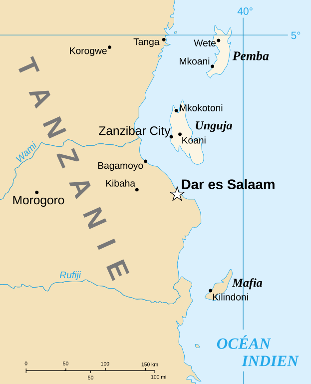
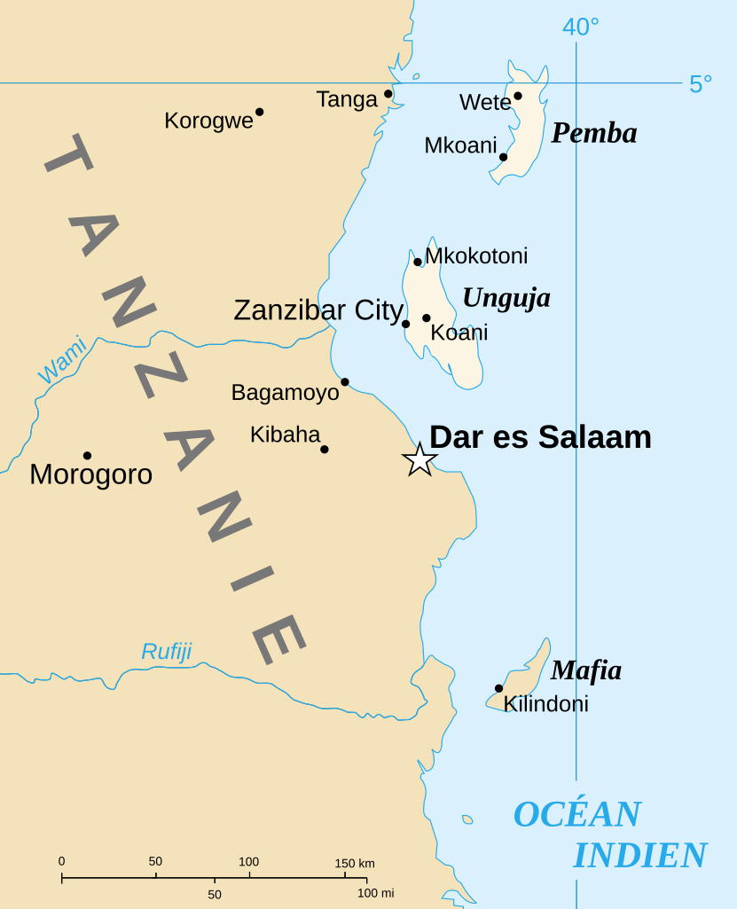
English: Part of the map of Tanzania in French, showing the Spice Islands. Français : Détail de la carte de Tanzanie en français montrant l'archipel de Zanzibar. |
| Date | of the translation : July 2007 |
| Source | Image:Spice Islands (Zanzibar highlighted).svg created by Mysid |
| Author | of the translation : Sting |
| Permission (Reusing this file) |
PD |
| Other versions |
Image:Spice_Islands_Tanzania-fr.svg in English : Image:Spice Islands (Tanzania).svg in English : Image:Spice Islands (Zanzibar highlighted).svg |
.svg)
.svg)

|
This SVG file contains embedded text that can be translated into your language, using any capable SVG editor, text editor or the SVG Translate tool. For more information see: About translating SVG files. |
Licensing[edit]
| I, the copyright holder of this work, release this work into the public domain. This applies worldwide. In some countries this may not be legally possible; if so: I grant anyone the right to use this work for any purpose, without any conditions, unless such conditions are required by law. |
| This work was previously under Public Domain, or a Free License. It has been digitally enhanced and/or modified. This derivative work has been (or is hereby) released into the public domain by its author, Sting at the French Wikipedia project. This applies worldwide. In some countries this is not legally possible; if so:
|
File history
Click on a date/time to view the file as it appeared at that time.
| Date/Time | Thumbnail | Dimensions | User | Comment | |
|---|---|---|---|---|---|
| current | 13:31, 6 July 2007 | | 713 × 879 (24 KB) | Sting (talk | contribs) | {{Information |Description={{en|Part of the map of Tanzania in French, showing the Spice Islands.}}{{fr|Détail de la carte de Tanzanie en français montrant l'archipel de Zanzibar.}} |Source=[[:Image:Spice |
You cannot overwrite this file.
File usage on Commons
The following page uses this file:
File usage on other wikis
The following other wikis use this file:
- Usage on el.wikipedia.org
- Usage on en.wikipedia.org
- Usage on es.wikipedia.org
- Usage on fr.wikipedia.org
- Usage on uk.wikipedia.org
- Usage on zh.wikipedia.org