File:Table of Distances NYPL1602855.tiff
Jump to navigation
Jump to search
Size of this JPG preview of this TIF file: 470 × 600 pixels. Other resolutions: 188 × 240 pixels | 376 × 480 pixels | 602 × 768 pixels | 802 × 1,024 pixels | 1,605 × 2,048 pixels | 5,404 × 6,896 pixels.
Original file (5,404 × 6,896 pixels, file size: 106.62 MB, MIME type: image/tiff)
Captions
Captions
Add a one-line explanation of what this file represents
Summary[edit]
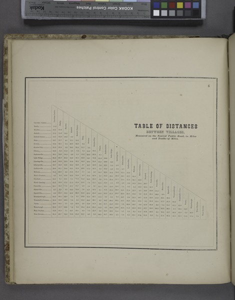
| Description | Table of Distances; Atlases of the United States / New York / New topographical atlas of Tompkins County, New York. From actual surveys especially for this atlas. | |||||||||||||||||||||||
| Catalogue call number | Map Div. 76-797 | |||||||||||||||||||||||
| Date | ||||||||||||||||||||||||
| Source |
http://digitalgallery.nypl.org/nypldigital/dgkeysearchdetail.cfm?imageID=1602855
|
|||||||||||||||||||||||
| Author | Stone and Stewart -- Author | |||||||||||||||||||||||
| Permission (Reusing this file) |
From The Lionel Pincus and Princess Firyal Map Division. http://maps.nypl.org
|
|||||||||||||||||||||||
| Source description | 57 p. illus., col. maps. 41 cm. | |||||||||||||||||||||||
| Location | Stephen A. Schwarzman Building / The Lionel Pincus and Princess Firyal Map Division | |||||||||||||||||||||||
| Digital item published | 11-9-2007; updated 3-25-2011 | |||||||||||||||||||||||
| Digital ID | 1602855 | |||||||||||||||||||||||

The making of this file was supported by Wikimedia UK.
To see other files made with the support of Wikimedia UK, please see the category Supported by Wikimedia UK.
|
File history
Click on a date/time to view the file as it appeared at that time.
| Date/Time | Thumbnail | Dimensions | User | Comment | |
|---|---|---|---|---|---|
| current | 22:19, 7 May 2014 |  | 5,404 × 6,896 (106.62 MB) | Fæ (talk | contribs) | GWToolset: Creating mediafile for Fæ. Tranche 4 -4989 restart @08:55 BST, 7 May 2014 |
You cannot overwrite this file.
File usage on Commons
There are no pages that use this file.