File:The Strand - geograph.org.uk - 360893.jpg
Jump to navigation
Jump to search
No higher resolution available.
The_Strand_-_geograph.org.uk_-_360893.jpg (640 × 479 pixels, file size: 150 KB, MIME type: image/jpeg)
Captions
Captions
Add a one-line explanation of what this file represents
Summary[edit]
| Description |
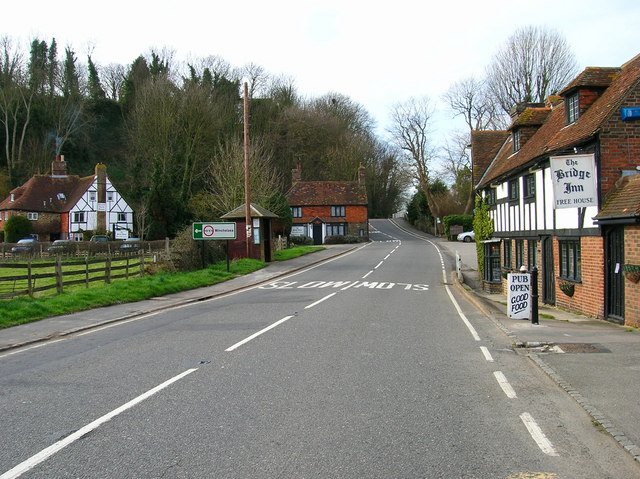
English: The Strand Now the A259 but once the site of the town's harbour before it silted up in the 15th century. The Bridge Inn on the right roughly stands on the site of the Town Quay whilst the road would formerly have been the site of warehouses and the fish market. The former cliffs can be seen behind Strand Guest House on the left. |
| Date | |
| Source | From geograph.org.uk |
| Author | Simon Carey |
| Attribution (required by the license) | Simon Carey / The Strand / |
| Camera location | | View this and other nearby images on: OpenStreetMap |
|---|
_heading:292.00&language=en)
| Object location | | View this and other nearby images on: OpenStreetMap |
|---|
_heading:292.00&language=en)
Licensing[edit]

|
This image was taken from the Geograph project collection. See this photograph's page on the Geograph website for the photographer's contact details. The copyright on this image is owned by Simon Carey and is licensed for reuse under the Creative Commons Attribution-ShareAlike 2.0 license.
|
This file is licensed under the Creative Commons Attribution-Share Alike 2.0 Generic license.
Attribution: Simon Carey
- You are free:
- to share – to copy, distribute and transmit the work
- to remix – to adapt the work
- Under the following conditions:
- attribution – You must give appropriate credit, provide a link to the license, and indicate if changes were made. You may do so in any reasonable manner, but not in any way that suggests the licensor endorses you or your use.
- share alike – If you remix, transform, or build upon the material, you must distribute your contributions under the same or compatible license as the original.
File history
Click on a date/time to view the file as it appeared at that time.
| Date/Time | Thumbnail | Dimensions | User | Comment | |
|---|---|---|---|---|---|
| current | 18:10, 4 January 2011 | | 640 × 479 (150 KB) | GeographBot (talk | contribs) | == {{int:filedesc}} == {{Information |description={{en|1=The Strand Now the A259 but once the site of the town's harbour before it silted up in the 15th century. The Bridge Inn on the right roughly stands on the site of the Town Quay whilst the road would |
You cannot overwrite this file.
File usage on Commons
There are no pages that use this file.