File:Tinum infraestructura.svg
Jump to navigation
Jump to search

Size of this PNG preview of this SVG file: 800 × 554 pixels. Other resolutions: 320 × 221 pixels | 640 × 443 pixels | 1,024 × 709 pixels | 1,280 × 886 pixels | 2,560 × 1,771 pixels | 1,198 × 829 pixels.
Original file (SVG file, nominally 1,198 × 829 pixels, file size: 620 KB)
Captions
Captions
Add a one-line explanation of what this file represents
Summary[edit]
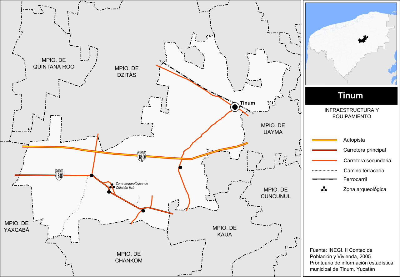
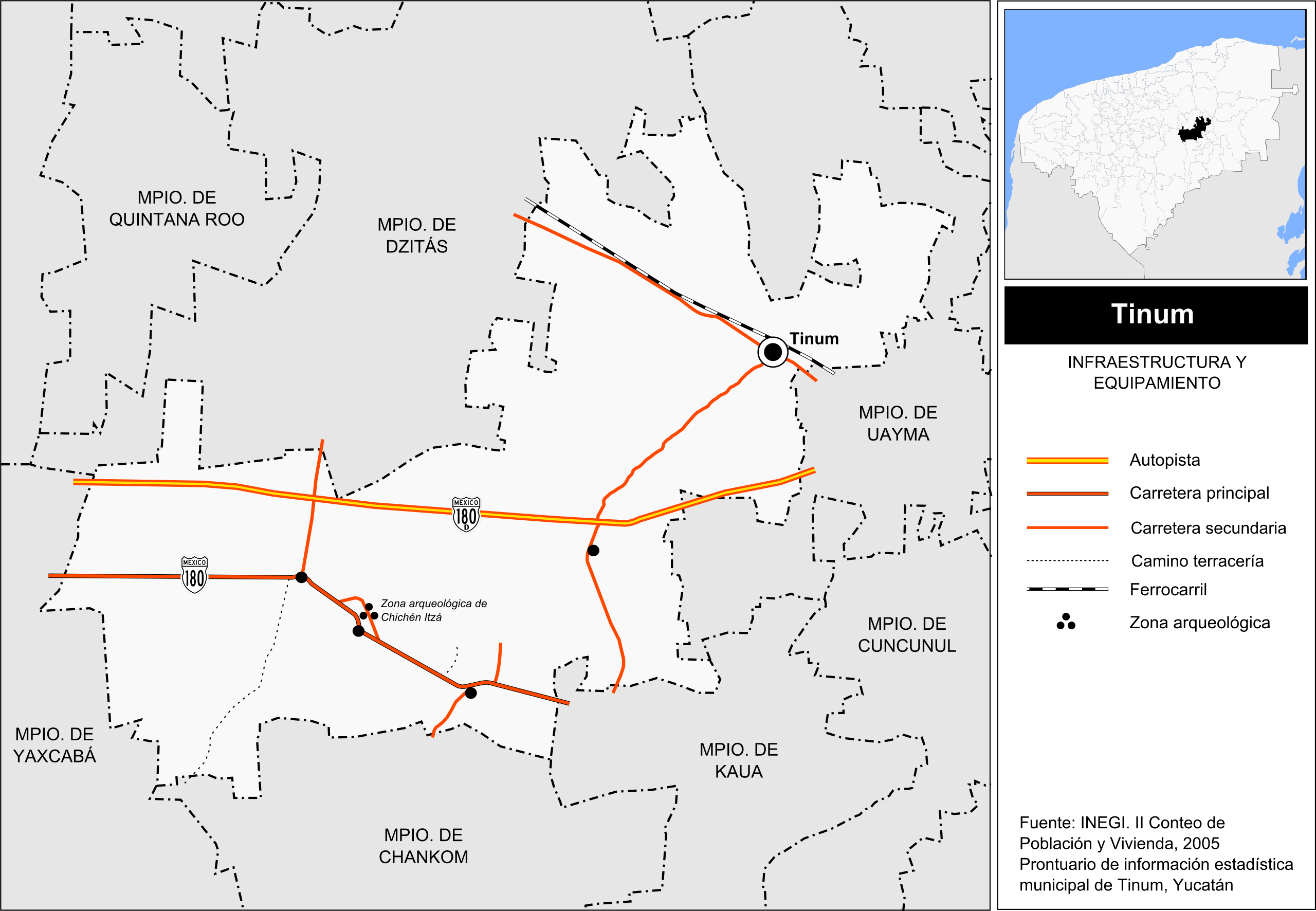
| Description | Mapa de infraestrctura y equipamiento del municipio de Tinum en el estado mexicano de Yucatán. | ||
| Date | |||
| Source |
Own work This W3C-unspecified vector image was created with Inkscape . |
||
| Author | Battroid | ||
| Permission (Reusing this file) |
|
File history
Click on a date/time to view the file as it appeared at that time.
| Date/Time | Thumbnail | Dimensions | User | Comment | |
|---|---|---|---|---|---|
| current | 02:13, 20 September 2010 | | 1,198 × 829 (620 KB) | Battroid (talk | contribs) | == Summary == {{Information |Description=Mapa de infraestrctura y equipamiento del municipio de Tinum en el estado mexicano de Yucatán. |Source={{own}} {{Inkscape}} |Date=2010-09-19 |Author=Battroid |Permission={{PD-self}} |other_versio |
You cannot overwrite this file.
File usage on Commons
There are no pages that use this file.
File usage on other wikis
The following other wikis use this file:
- Usage on es.wikipedia.org