File:Toul 1866 assemblage.png

Original file (1,571 × 1,493 pixels, file size: 5.76 MB, MIME type: image/png)
Captions
Captions
Summary[edit]
| Description |
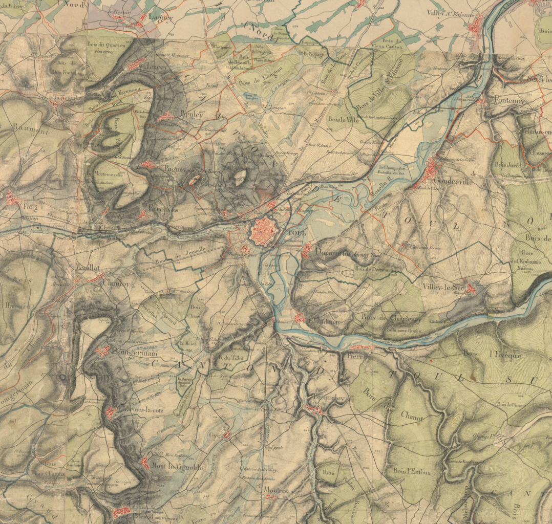
English: Map of Toul, France Français : Carte de Toul, extrait de la carte d'état-major (feuilles « Nancy » et « Commercy » ; 1:40000) |
| Date | |
| Source |
This file was derived from: |
| Author |
|
| This is a retouched picture, which means that it has been digitally altered from its original version. Modifications: Assemblage de deux images. The original can be viewed here: Toul-Sud 1866.png:
|
Licensing[edit]
This image is in the public domain because it is a mere mechanical scan or photocopy of a public domain original, or – from the available evidence – is so similar to such a scan or photocopy that no copyright protection can be expected to arise. The original itself is in the public domain for the following reason:
This tag is designed for use where there may be a need to assert that any enhancements (eg brightness, contrast, colour-matching, sharpening) are in themselves insufficiently creative to generate a new copyright. It can be used where it is unknown whether any enhancements have been made, as well as when the enhancements are clear but insufficient. For known raw unenhanced scans you can use an appropriate {{PD-old}} tag instead. For usage, see Commons:When to use the PD-scan tag.  | ||||
Original upload log[edit]
This image is a derivative work of the following images:
- File:Toul-Nord_1866.png licensed with PD-scan
- File:Toul-Sud_1866.png licensed with PD-scan
Uploaded with derivativeFX
File history
Click on a date/time to view the file as it appeared at that time.
| Date/Time | Thumbnail | Dimensions | User | Comment | |
|---|---|---|---|---|---|
| current | 16:59, 12 January 2013 | | 1,571 × 1,493 (5.76 MB) | Flappiefh (talk | contribs) | == {{int:filedesc}} == {{Information |Description={{en|1=Map of Toul, France}}{{fr|1=Carte de Toul, extrait de la carte d'état-major (feuilles « Nancy » et « Commercy » ; 1:40000)}} |date=1866 |Source={{Derived from|Toul-Nord_1866.png|Toul-Sud_186... |
You cannot overwrite this file.
File usage on Commons
There are no pages that use this file.
File usage on other wikis
The following other wikis use this file:
- Usage on fr.wikipedia.org