File:TransCanadaHWY.png
Jump to navigation
Jump to search
Size of this preview: 746 × 599 pixels. Other resolutions: 299 × 240 pixels | 598 × 480 pixels | 860 × 691 pixels.
Original file (860 × 691 pixels, file size: 156 KB, MIME type: image/png)
Captions
Captions
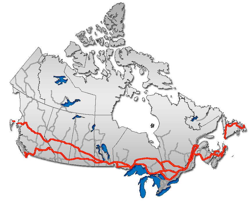
Trans Canada Highway, as overlaid on Canada map
Summary[edit]
| Description |
English: Trans Canada Highway, as overlaid on Canada map
Français : Route transcanadienne sur la carte du Canada
Esperanto: Trans-Kanada Ŝoseo sur mapo de Kanado
日本語: トランスカナダハイウェイ地図。
Nederlands: Routemap van de Trans-Canada Highway |
| Date | |
| Source | GIS data |
| Author | Qyd (talk · contribs) |
| Permission (Reusing this file) |
All |
| Other versions |
|


Licensing[edit]
| I, the copyright holder of this work, release this work into the public domain. This applies worldwide. In some countries this may not be legally possible; if so: I grant anyone the right to use this work for any purpose, without any conditions, unless such conditions are required by law. |

|
This road map image could be re-created using vector graphics as an SVG file. This has several advantages; see Commons:Media for cleanup for more information. If an SVG form of this image is available, please upload it and afterwards replace this template with
{{vector version available|new image name}}.
It is recommended to name the SVG file “TransCanadaHWY.svg”—then the template Vector version available (or Vva) does not need the new image name parameter. |
| Annotations | This image is annotated: View the annotations at Commons |
File history
Click on a date/time to view the file as it appeared at that time.
| Date/Time | Thumbnail | Dimensions | User | Comment | |
|---|---|---|---|---|---|
| current | 00:39, 24 January 2007 | | 860 × 691 (156 KB) | Qyd (talk | contribs) | reload |
| 11:45, 13 December 2006 |  | 860 × 691 (156 KB) | Qyd (talk | contribs) | add On hwy 11 and 71 | |
| 02:06, 13 December 2006 |  | 860 × 691 (156 KB) | Qyd (talk | contribs) | oops again, forgot about yellowhead | |
| 01:48, 13 December 2006 |  | 860 × 691 (155 KB) | Qyd (talk | contribs) | oops, another correction | |
| 01:41, 13 December 2006 |  | 860 × 691 (155 KB) | Qyd (talk | contribs) | corrected route, thanks Bearcat | |
| 13:23, 8 December 2006 |  | 860 × 691 (157 KB) | Qyd (talk | contribs) | add major road network shadow | |
| 21:19, 21 November 2006 |  | 860 × 691 (142 KB) | Qyd (talk | contribs) | complete canada contour, UTM projection | |
| 09:53, 30 October 2006 |  | 677 × 300 (17 KB) | Matt314 (talk | contribs) | corrections by User:Bearcat: minor inaccuracy in Ontario (Highway 11 is not TCH south of North Bay; Hwy 400 is not TCH south of Coldwater.) | |
| 23:07, 21 February 2006 |  | 677 × 300 (18 KB) | Qyd (talk | contribs) | ||
| 23:47, 16 February 2006 |  | 693 × 312 (22 KB) | Qyd (talk | contribs) | Trans Canada Highway. Category:Maps_of_CanadaCategory:Highways_in_Canada |
You cannot overwrite this file.
File usage on Commons
The following 4 pages use this file:
File usage on other wikis
The following other wikis use this file:
- Usage on ar.wikipedia.org
- Usage on ca.wikipedia.org
- Usage on de.wikipedia.org
- Usage on en.wikipedia.org
- Trans-Canada Highway
- Confederation Bridge
- Numbered highways in Canada
- Yellowhead Highway
- British Columbia Highway 16
- British Columbia Highway 1
- Ontario Highway 17
- Ontario Highway 11
- Ontario Highway 7
- New Brunswick Route 2
- Ontario Highway 417
- Ontario Highway 400
- CFB Shilo
- Ontario Highway 69
- Quebec Autoroute 20
- Quebec Autoroute 40
- Quebec Autoroute 15
- Quebec Autoroute 25
- Quebec Route 185
- Alberta Highway 16
- New Brunswick Route 16
- Alberta Highway 1
- Nova Scotia Highway 104
- Nova Scotia Highway 105
- Nova Scotia Highway 106
- Perimeter Highway (Winnipeg)
- Manitoba Highway 1
- Newfoundland and Labrador Route 1
- Manitoba Highway 16
- Template:Trans-Canada
- Talk:Trans-Canada Highway
- User talk:Qyd
- Prince Edward Island Route 1
- Saskatchewan Highway 1
- Saskatchewan Highway 16
- Quebec Route 117
- Ontario Highway 12
- Ontario Highway 66
- Ontario Highway 71
- Quebec Autoroute 85
- Portal:Roads/Did you know
- Ontario Highway 17A
- Ministry of Highways and Infrastructure (Saskatchewan)
- Regina Bypass
- Wikipedia:Graphics Lab/Map workshop/Archive/Apr 2019
- Usage on eo.wikipedia.org
View more global usage of this file.