File:USA Minnesota location map.svg
Jump to navigation
Jump to search

Size of this PNG preview of this SVG file: 514 × 599 pixels. Other resolutions: 206 × 240 pixels | 412 × 480 pixels | 658 × 768 pixels | 878 × 1,024 pixels | 1,756 × 2,048 pixels | 1,029 × 1,200 pixels.
Original file (SVG file, nominally 1,029 × 1,200 pixels, file size: 697 KB)
Captions
Captions
Add a one-line explanation of what this file represents
Summary[edit]
| Description |
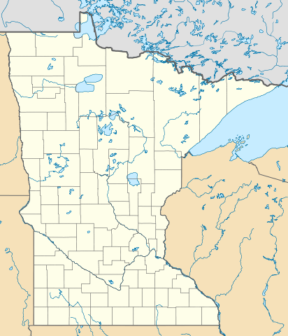
Deutsch: Positionskarte von Minnesota, USA
Quadratische Plattkarte, N-S-Streckung 150.0 %. Geographische Begrenzung der Karte:
|
| Date | |
| Source | Own work |
| Author | Alexrk2 |
| Other versions |
Derivative works of this file: BMO Harris Bank 2012-06.png Derivative works of this file: |

|
This map has been made or improved in the German Kartenwerkstatt (Map Lab). You can propose maps to improve as well.
|
Licensing[edit]
I, the copyright holder of this work, hereby publish it under the following licenses:

|
Permission is granted to copy, distribute and/or modify this document under the terms of the GNU Free Documentation License, Version 1.2 or any later version published by the Free Software Foundation; with no Invariant Sections, no Front-Cover Texts, and no Back-Cover Texts. A copy of the license is included in the section entitled GNU Free Documentation License. |
This file is licensed under the Creative Commons Attribution 3.0 Unported license.
- You are free:
- to share – to copy, distribute and transmit the work
- to remix – to adapt the work
- Under the following conditions:
- attribution – You must give appropriate credit, provide a link to the license, and indicate if changes were made. You may do so in any reasonable manner, but not in any way that suggests the licensor endorses you or your use.
You may select the license of your choice.
| Annotations | This image is annotated: View the annotations at Commons |
File history
Click on a date/time to view the file as it appeared at that time.
| Date/Time | Thumbnail | Dimensions | User | Comment | |
|---|---|---|---|---|---|
| current | 12:06, 21 June 2009 | | 1,029 × 1,200 (697 KB) | Alexrk2 (talk | contribs) | simp water |
| 11:53, 21 June 2009 |  | 1,029 × 1,200 (700 KB) | Alexrk2 (talk | contribs) | == Beschreibung == {{Information |Description= {{de|Positionskarte von Minnesota, USA}} Quadratische Plattkarte, N-S-Streckung 150.0 %. Geographische Begrenzung der Karte: * N: 49.6° N * S: 43.3° N * W: 97.4° W * O: 89.3° |
You cannot overwrite this file.
File usage on Commons
The following 17 pages use this file:
- File:BMO Harris Bank 2012-06.png
- File:Checkers and Rally's footprint.png
- File:Citgo locations 2020 September.png
- File:Costco footprint map USA 2021-01.png
- File:Dollar Tree footprint map 2020-12.png
- File:Family Dollar footprint map 2020-12.png
- File:Kum&GoFootprint July2020.png
- File:Kwik Trip, Inc. brands Footprint map 2020-12.png
- File:Moto Mart footprint map.png
- File:Save-A-Lot footprint map.png
- File:Speedway Footprint 2020 August.png
- File:Speedway Jun2018 to Aug2020 comparison.png
- File:Target stores footprint 2020-12.png
- File:USA Minnesota relief location map.svg
- File:Valero brands branded gas stations 2020-12.png
- File:Walmart branded fuel stations map 2020-12.png
- File:Walmart locations with on-site fuel stations map 2020-20.png
File usage on other wikis
The following other wikis use this file:
- Usage on an.wikipedia.org
- Usage on ar.wikipedia.org
- Usage on arz.wikipedia.org
- Usage on ast.wikipedia.org
- Usage on azb.wikipedia.org
- فرونتنک، مینهسوتا
- رایس لیک، مینهسوتا
- الکور، مینهسوتا
- فیش لیک، مینهسوتا
- ساوت تروی، مینهسوتا
- برنتساید، مینهسوتا
- بوسترینق، مینهسوتا
- سنترال لیکس، مینهسوتا
- اماویل، مینهسوتا
- جنوا، مینهسوتا
- نیو سوئیدن، مینهسوتا
- سیجینا، مینهسوتا
- میکینن، مینهسوتا
- الدز کورنر، مینهسوتا
- چستر، مینهسوتا
- کورینق، مینهسوتا
- کاشینق، مینهسوتا
- قادال، مینهسوتا
- بتانی، مینهسوتا
- اه-قواه-چینق، مینهسوتا
- فیلمور، مینهسوتا
- کلمنتسون، مینهسوتا
- قریستون، مینهسوتا
- اسنلمن، مینهسوتا
- کرافتویل، مینهسوتا
- دانویلا، مینهسوتا
- بیرچدیل، مینهسوتا
- هاینز، مینهسوتا
- داونر، مینهسوتا
- داقدیل، مینهسوتا
- سیسکو، مینهسوتا
- بیولیو، مینهسوتا
- سودان، مینهسوتا
- کاسن، مینهسوتا
- کانیون، مینهسوتا
- آنقورا، مینهسوتا
- بریمسون، مینهسوتا
- فریزلند، مینهسوتا
- بیور بی شرقی، مینهسوتا
- فرهیون، مینهسوتا
- بال کلاب، مینهسوتا
- اوساقا، مینهسوتا
View more global usage of this file.