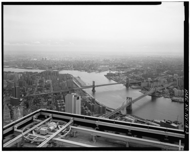
File:View looking E from top of World Trade Tower with World Trade Tower parapet in foreground. Jet Lowe, photographer, 1982. - Brooklyn Bridge, Spanning East River between Park Row, HAER NY,31-NEYO,90-3.tif
Jump to navigation
Jump to search

Size of this JPG preview of this TIF file: 751 × 600 pixels. Other resolutions: 301 × 240 pixels | 601 × 480 pixels | 962 × 768 pixels | 1,280 × 1,022 pixels | 2,560 × 2,045 pixels | 5,000 × 3,994 pixels.
Original file (5,000 × 3,994 pixels, file size: 19.05 MB, MIME type: image/tiff)
Captions
Captions
Add a one-line explanation of what this file represents
Summary[edit]
| View looking E from top of World Trade Tower with World Trade Tower parapet in foreground. Jet Lowe, photographer, 1982. - Brooklyn Bridge, Spanning East River between Park Row, Manhattan and Sands Street, Brooklyn, New York, New York County, NY
( |
||||||||||||||||||||||||
|---|---|---|---|---|---|---|---|---|---|---|---|---|---|---|---|---|---|---|---|---|---|---|---|---|
| Photographer |
|
|||||||||||||||||||||||
| Title |
View looking E from top of World Trade Tower with World Trade Tower parapet in foreground. Jet Lowe, photographer, 1982. - Brooklyn Bridge, Spanning East River between Park Row, Manhattan and Sands Street, Brooklyn, New York, New York County, NY |
|||||||||||||||||||||||
| Depicted place | New York; New York County; New York | |||||||||||||||||||||||
| Date | 1982 | |||||||||||||||||||||||
| Dimensions | height: 4 in (10.1 cm); width: 5 in (12.7 cm) | |||||||||||||||||||||||
| Current location |
Library of Congress Prints and Photographs Division Washington, D.C. 20540 USA http://hdl.loc.gov/loc.pnp/pp.print |
|||||||||||||||||||||||
| Accession number |
HAER NY,31-NEYO,90-3 |
|||||||||||||||||||||||
| Credit line |
|
|||||||||||||||||||||||
| Source | https://www.loc.gov/pictures/item/ny1234.photos.120493p | |||||||||||||||||||||||
| Permission (Reusing this file) |
|
|||||||||||||||||||||||
.jpg)

File history
Click on a date/time to view the file as it appeared at that time.
| Date/Time | Thumbnail | Dimensions | User | Comment | |
|---|---|---|---|---|---|
| current | 15:12, 29 July 2014 |  | 5,000 × 3,994 (19.05 MB) | Fæ (talk | contribs) | GWToolset: Creating mediafile for Fæ. HABS 24 July 2014 (2301:2600) |
You cannot overwrite this file.
File usage on Commons
The following page uses this file: