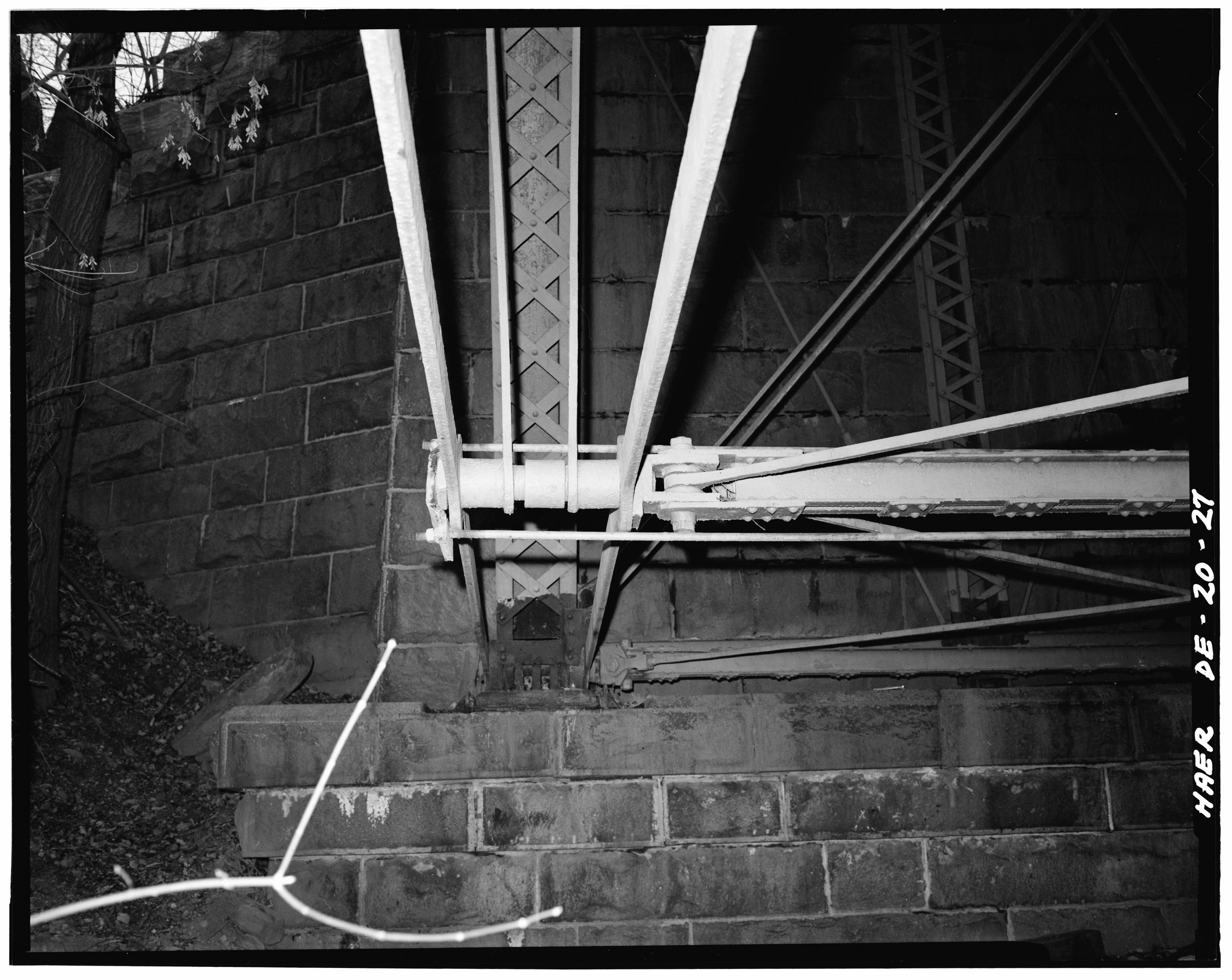
File:View southeast from beneath structure noting detail of Pin connection near east abutment. - Augustine Bridge, Brandywine River,Augustine Cutoff, Wilmington, New Castle County, DE HAER DEL,2-WILM,39-27.tif
Jump to navigation
Jump to search

Size of this JPG preview of this TIF file: 754 × 600 pixels. Other resolutions: 302 × 240 pixels | 603 × 480 pixels | 965 × 768 pixels | 1,280 × 1,019 pixels | 2,560 × 2,037 pixels | 4,930 × 3,923 pixels.
Original file (4,930 × 3,923 pixels, file size: 18.45 MB, MIME type: image/tiff)
Captions
Captions
Add a one-line explanation of what this file represents
Summary[edit]
| View southeast from beneath structure noting detail of Pin connection near east abutment. - Augustine Bridge, Brandywine River,Augustine Cutoff, Wilmington, New Castle County, DE
( |
||||||||||||||||||||||||
|---|---|---|---|---|---|---|---|---|---|---|---|---|---|---|---|---|---|---|---|---|---|---|---|---|
| Photographer |
Tim O'Brien |
|||||||||||||||||||||||
| Title |
View southeast from beneath structure noting detail of Pin connection near east abutment. - Augustine Bridge, Brandywine River,Augustine Cutoff, Wilmington, New Castle County, DE |
|||||||||||||||||||||||
| Depicted place | Delaware; New Castle County; Wilmington | |||||||||||||||||||||||
| Date | April 1979 | |||||||||||||||||||||||
| Dimensions | height: 4 in (10.1 cm); width: 5 in (12.7 cm) | |||||||||||||||||||||||
| Collection |
|
|||||||||||||||||||||||
| Current location |
Prints and Photographs Division Washington, D.C. 20540 USA http://hdl.loc.gov/loc.pnp/pp.print |
|||||||||||||||||||||||
| Accession number |
HAER DEL,2-WILM,39-27 |
|||||||||||||||||||||||
| Credit line |
|
|||||||||||||||||||||||
| Source | https://www.loc.gov/pictures/item/de0145.photos.032192p | |||||||||||||||||||||||
| Permission (Reusing this file) |
|
|||||||||||||||||||||||


| Camera location | | View this and other nearby images on: OpenStreetMap |
|---|
File history
Click on a date/time to view the file as it appeared at that time.
| Date/Time | Thumbnail | Dimensions | User | Comment | |
|---|---|---|---|---|---|
| current | 10:47, 10 July 2014 |  | 4,930 × 3,923 (18.45 MB) | Fæ (talk | contribs) | GWToolset: Creating mediafile for Fæ. HABS 09 July 2014 (801:1000) |
You cannot overwrite this file.
File usage on Commons
The following page uses this file: