File:Wallowa-Whitman National Forest map.gif
Jump to navigation
Jump to search

Size of this preview: 583 × 600 pixels. Other resolutions: 233 × 240 pixels | 600 × 617 pixels.
Original file (600 × 617 pixels, file size: 38 KB, MIME type: image/gif)
Captions
Captions
Add a one-line explanation of what this file represents
Summary[edit]
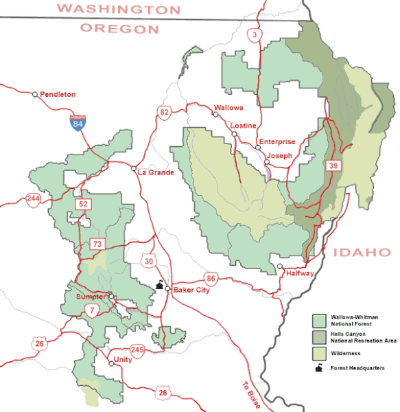
| Description | Map of the Wallowa-Whitman National Forest in northeastern Oregon. |
| Source | U.S. Forest Service |
| Author | U.S. Forest Service |
| Permission (Reusing this file) |
Public domain, created by federal government |
Licensing[edit]
This image is a work of the Forest Service of the United States Department of Agriculture. As a work of the U.S. federal government, the image is in the public domain.
|
File history
Click on a date/time to view the file as it appeared at that time.
| Date/Time | Thumbnail | Dimensions | User | Comment | |
|---|---|---|---|---|---|
| current | 09:36, 14 May 2008 | | 600 × 617 (38 KB) | Northwest-historian (talk | contribs) | {{Information |Description=Map of the Wallowa-Whitman National Forest in northeastern Oregon. |Source=[http://www.fs.fed.us/r6/w-w/recreation/recreation-map.shtml U.S. Forest Service] |Author=U.S. Forest Service |Permission=Public domain, created by feder |
You cannot overwrite this file.
File usage on Commons
The following page uses this file:
File usage on other wikis
The following other wikis use this file:
- Usage on ca.wikipedia.org
- Usage on en.wikipedia.org
- Usage on es.wikipedia.org
- Usage on fa.wikipedia.org
- Usage on ja.wikipedia.org
- Usage on ro.wikipedia.org
- Usage on sh.wikipedia.org
- Usage on ur.wikipedia.org
- Usage on zh.wikipedia.org