File:Welborne Map Colour A4 (4).jpg
Jump to navigation
Jump to search
Size of this preview: 800 × 552 pixels. Other resolutions: 320 × 221 pixels | 640 × 441 pixels | 1,024 × 706 pixels | 1,280 × 882 pixels | 2,560 × 1,765 pixels | 3,023 × 2,084 pixels.
Original file (3,023 × 2,084 pixels, file size: 532 KB, MIME type: image/jpeg)
Captions
Captions
Add a one-line explanation of what this file represents
Summary[edit]
.jpg&action=edit§ion=1)
| Description |
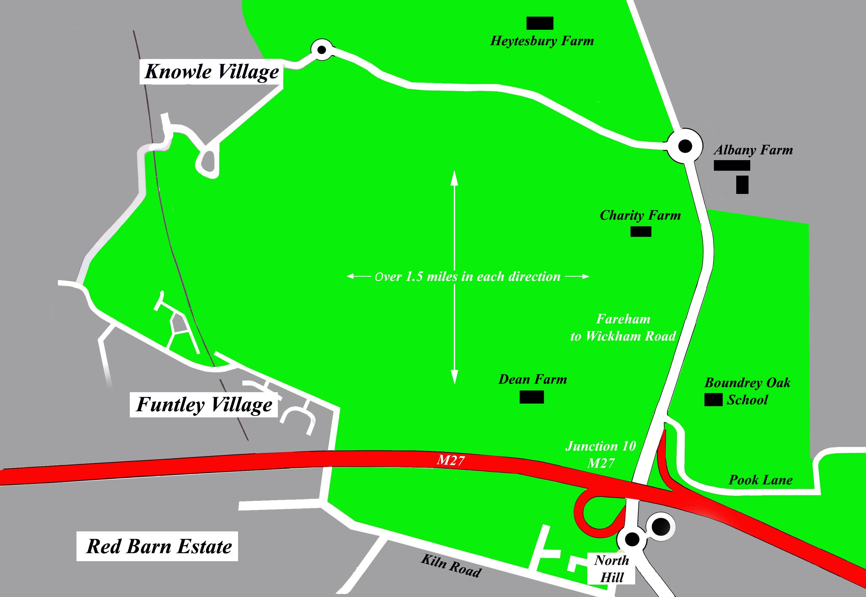
English: Map of proposed Welborne development - boundaries as per latest council draft plan. The area in green is the land that Fareham Borough Council intend to turn into housing and industry. |
| Date | |
| Source | Own work |
| Author | JasonRMudge |
Licensing[edit]
.jpg&action=edit§ion=2)
I, the copyright holder of this work, hereby publish it under the following license:
This file is licensed under the Creative Commons Attribution-Share Alike 3.0 Unported license.
- You are free:
- to share – to copy, distribute and transmit the work
- to remix – to adapt the work
- Under the following conditions:
- attribution – You must give appropriate credit, provide a link to the license, and indicate if changes were made. You may do so in any reasonable manner, but not in any way that suggests the licensor endorses you or your use.
- share alike – If you remix, transform, or build upon the material, you must distribute your contributions under the same or compatible license as the original.
File history
Click on a date/time to view the file as it appeared at that time.
| Date/Time | Thumbnail | Dimensions | User | Comment | |
|---|---|---|---|---|---|
| current | 09:30, 30 September 2019 | | 3,023 × 2,084 (532 KB) | Belbury (talk | contribs) | Cropped 4 % horizontally, 8 % vertically using CropTool with lossless mode. |
| 10:50, 7 March 2014 |  | 3,149 × 2,269 (640 KB) | JasonRMudge (talk | contribs) | User created page with UploadWizard |
You cannot overwrite this file.
File usage on Commons
There are no pages that use this file.
File usage on other wikis
The following other wikis use this file:
- Usage on en.wikipedia.org
.jpg&oldid=670598079)