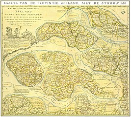
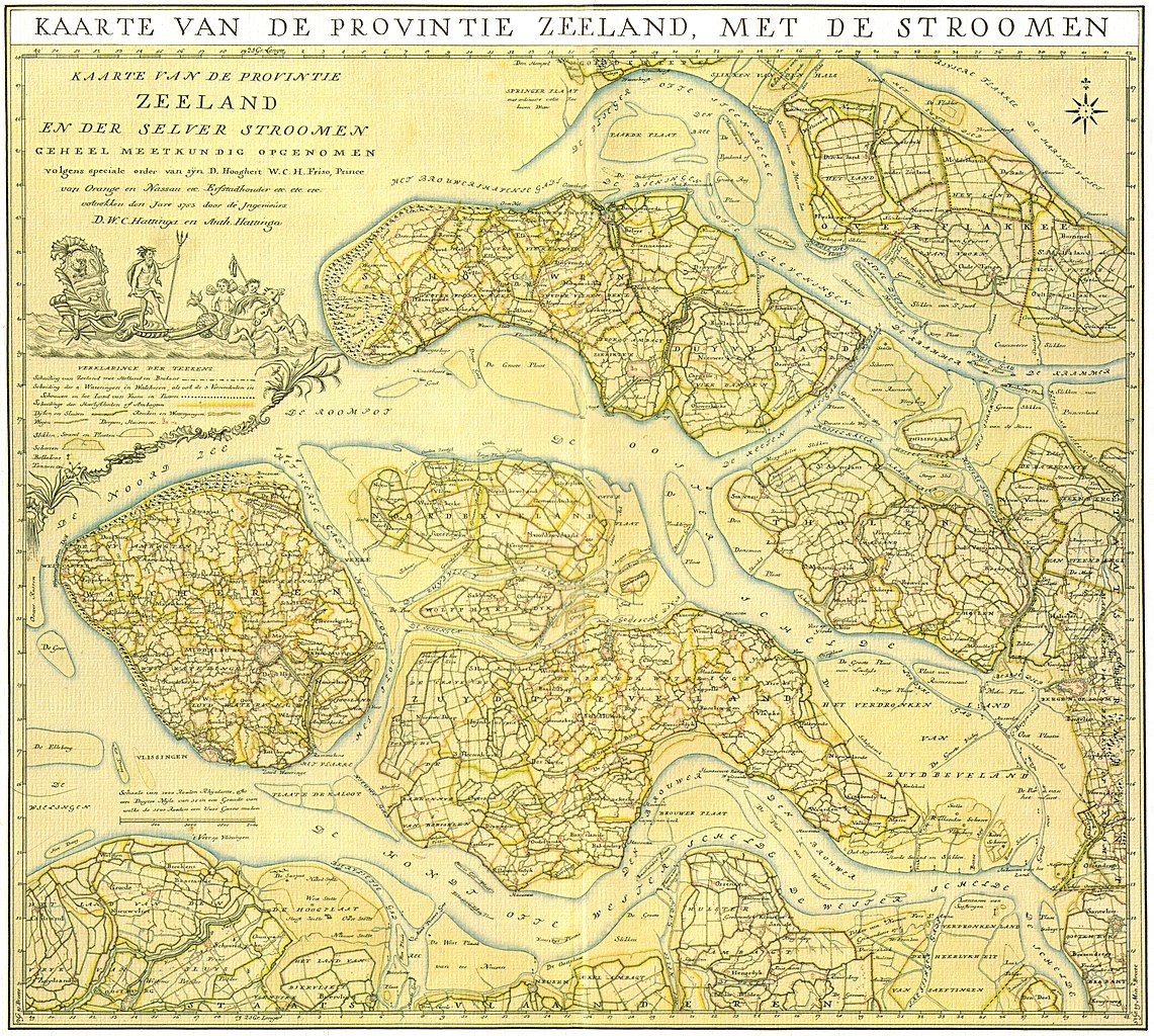
File:Zeeland 1753 Hattinga.jpg
Jump to navigation
Jump to search

Size of this preview: 668 × 600 pixels. Other resolutions: 267 × 240 pixels | 535 × 480 pixels | 856 × 768 pixels | 1,141 × 1,024 pixels | 2,282 × 2,048 pixels | 4,841 × 4,345 pixels.
Original file (4,841 × 4,345 pixels, file size: 27.06 MB, MIME type: image/jpeg)
Captions
Captions
Add a one-line explanation of what this file represents
Summary[edit]
| Description |
Dutch:
Kaarte van de provintie Zeeland en der Selver stroomen geheel meetkundig opgenomen volgens speciale order van sÿn D. Hoogheit W. C. H. Friso, Prince von Orange en Nassau etc. Erfstadhouder etc. etc. etc. vottrokken den Jare 1753 door de Ingenieurs D. W. C. Hattinga en Anth. Hattinga. Nederlands: Kaart van Zeeland, noordelijk deel |
| Date | |
| Source | In 4 delen ingescande kaart uit eigen bezit |
| Author | Hattinga, DWC & A |
| Other versions | TU Delft Uitgave van Covens & Zn, 1787 |
Licensing[edit]
|
This is a faithful photographic reproduction of a two-dimensional, public domain work of art. The work of art itself is in the public domain for the following reason:
The official position taken by the Wikimedia Foundation is that "faithful reproductions of two-dimensional public domain works of art are public domain".
This photographic reproduction is therefore also considered to be in the public domain in the United States. In other jurisdictions, re-use of this content may be restricted; see Reuse of PD-Art photographs for details. | ||||
File history
Click on a date/time to view the file as it appeared at that time.
| Date/Time | Thumbnail | Dimensions | User | Comment | |
|---|---|---|---|---|---|
| current | 14:26, 9 July 2010 | | 4,841 × 4,345 (27.06 MB) | Joop Rotte (talk | contribs) | {{Information |Description={{nl|1=Kaart van Zeeland}} |Source=In 4 delen ingesccande kaart uit eigen bezit |Author=Hattinga, DWC & A |Date=1753 |Permission= |other_versions= }} Zeeland, noordelijdeel Category:Zeeland Category:Cartography |
You cannot overwrite this file.
File usage on Commons
There are no pages that use this file.
File usage on other wikis
The following other wikis use this file:
- Usage on nl.wikipedia.org