File:Map of Lycoming County Pennsylvania With Municipal and Township Labels.png
Jump to navigation
Jump to search

Size of this preview: 800 × 495 pixels. Other resolutions: 320 × 198 pixels | 640 × 396 pixels | 882 × 546 pixels.
Original file (882 × 546 pixels, file size: 62 KB, MIME type: image/png)
Captions
Captions
Add a one-line explanation of what this file represents
| Description |
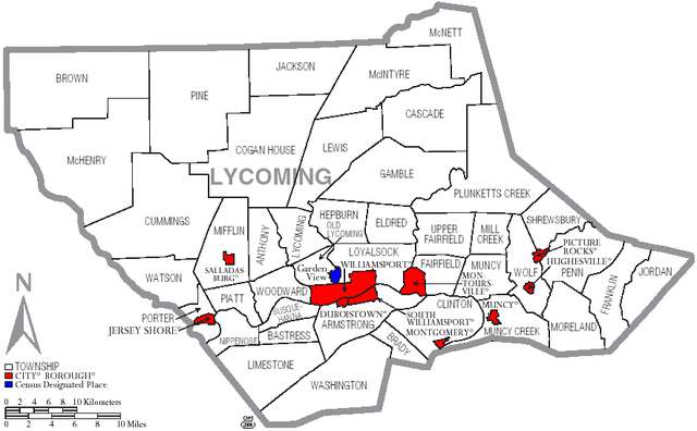
English: Map of Lycoming County with township and municipal bondaries is taken from US Census website [1] and modified by User:Ruhrfisch in August 2005. My modifications licensed under the GNU Free Documentation License. |
| Date | |
| Source | US Census website [2] |
| Author | Ruhrfisch |

|
Permission is granted to copy, distribute and/or modify this document under the terms of the GNU Free Documentation License, Version 1.2 or any later version published by the Free Software Foundation; with no Invariant Sections, no Front-Cover Texts, and no Back-Cover Texts. A copy of the license is included in the section entitled GNU Free Documentation License. |
| This file is licensed under the Creative Commons Attribution-Share Alike 3.0 Unported license. | ||
| ||
| This licensing tag was added to this file as part of the GFDL licensing update. |
File history
Click on a date/time to view the file as it appeared at that time.
| Date/Time | Thumbnail | Dimensions | User | Comment | |
|---|---|---|---|---|---|
| current | 18:03, 16 June 2006 | | 882 × 546 (62 KB) | Ruhrfisch (talk | contribs) | {{Information |Description=Map of Lycoming County with township and municipal bondaries |Source=taken from US Census website [http://factfinder.census.gov/] and modified by User:Ruhrfisch |Date=June 2006 |Author= US Census / Government and Ruhrfisch |
| 18:41, 3 April 2006 |  | 882 × 546 (62 KB) | Ruhrfisch (talk | contribs) | Map of Lycoming County with township and municipal boundaries is taken from US Census website [http://www2.census.gov/geo/maps/general_ref/cousub_outline/cen2k_pgsz/pa_cosub.pdf] and modified by User:Ruhrfisch in April 2006. My modifications licensed | |
| 19:21, 2 September 2005 |  | 981 × 599 (25 KB) | Ruhrfisch (talk | contribs) | Map of Lycoming County with township and municipal bondaries is taken from US Census website [http://factfinder.census.gov/] and modified by User:Ruhrfisch in August 2005. My modifications licensed under the GNU Free Documentation License. Sourc |
You cannot overwrite this file.
File usage on Commons
The following page uses this file:
File usage on other wikis
The following other wikis use this file:
- Usage on de.wikipedia.org
- Usage on en.wikipedia.org
- Lycoming County, Pennsylvania
- User talk:Cedrus-Libani
- User:Ruhrfisch/Frog
- User:Ruhrfisch/Maps
- History of Lycoming County, Pennsylvania
- List of municipalities in Lycoming County, Pennsylvania
- User talk:SatyrTN/Archive 8
- List of villages in Lycoming County, Pennsylvania
- User talk:Circeus/november2007
- User talk:Cirt/Archive 1
- User talk:Golbez/Archive 3
- Usage on ja.wikipedia.org
- Usage on nl.wikipedia.org
- Usage on pt.wikipedia.org