File:Pyrenees Mountains view from satellite.jpg
Jump to navigation
Jump to search

Size of this preview: 780 × 600 pixels. Other resolutions: 312 × 240 pixels | 624 × 480 pixels | 999 × 768 pixels | 1,280 × 985 pixels | 2,600 × 2,000 pixels.
Original file (2,600 × 2,000 pixels, file size: 877 KB, MIME type: image/jpeg)
Captions
Captions
Add a one-line explanation of what this file represents
Summary[edit]
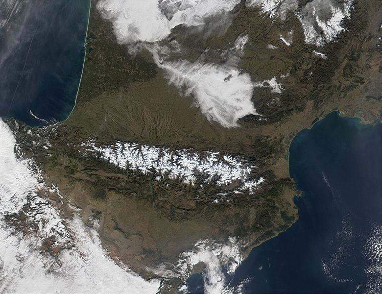
| Description | The Pyrenees Mountains (center) act as a natural border between France to the north and Spain to the south. In this MODIS image from January 18, 2002, they are covered in snow (bright red in the false-color image.) At upper left, contrails are visible over the Bay of Biscay, which, along the French shores, sport miles and miles of white sandy beaches. |
| Date | |
| Source | http://visibleearth.nasa.gov/view_rec.php?id=2690 |
| Author | Jacques Descloitres, MODIS Land Rapid Response Team, NASA/GSFC |
Licensing[edit]
| This file is in the public domain in the United States because it was solely created by NASA. NASA copyright policy states that "NASA material is not protected by copyright unless noted". (See Template:PD-USGov, NASA copyright policy page or JPL Image Use Policy.) | ||
 |
Warnings:
|
File history
Click on a date/time to view the file as it appeared at that time.
| Date/Time | Thumbnail | Dimensions | User | Comment | |
|---|---|---|---|---|---|
| current | 20:30, 3 December 2004 | | 2,600 × 2,000 (877 KB) | Alfio (talk | contribs) | pyrenees mountains seen from satellite |
You cannot overwrite this file.
File usage on Commons
The following 2 pages use this file:
File usage on other wikis
The following other wikis use this file:
- Usage on an.wikipedia.org
- Usage on ast.wikipedia.org
- Usage on ca.wikipedia.org
- Usage on cs.wikipedia.org
- Usage on es.wikipedia.org
- Usage on eu.wikipedia.org
- Usage on ext.wikipedia.org
- Usage on fi.wikipedia.org
- Usage on gl.wikipedia.org
- Usage on he.wikipedia.org
- Usage on it.wikipedia.org
- Usage on ja.wikipedia.org
- Usage on kk.wikipedia.org
- Usage on la.wiktionary.org
- Usage on lfn.wikipedia.org
- Usage on nl.wikipedia.org
- Usage on oc.wikipedia.org
- Usage on oc.wiktionary.org
- Usage on pl.wiktionary.org
- Usage on pms.wikipedia.org
- Usage on pt.wikipedia.org
- Usage on qu.wikipedia.org
- Usage on war.wikipedia.org
View more global usage of this file.