Mount Rainier National Park
ナビゲーションに移動
検索に移動
English: Mount Rainier National Park contains Mount Rainier and numerous lesser mountains
Maps[編集]
-
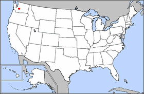 Park location

Landscapes[編集]
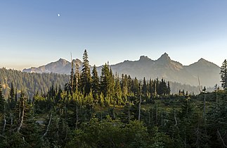
Cowlitz Chimneys[編集]
See also: Cowlitz Chimneys


Little Tahoma[編集]
See also: Little Tahoma
-
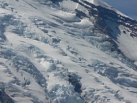
 from Ingraham Glacier
 -
 from the northeast
 -
 from the east-northeast
 -
 from the south
 -
 from the west


Mount Rainier[編集]
See also: Mount Rainier

.jpg)


Mowich Lake and Mist Park area[編集]


Paradise area[編集]
-
 from Skyline trail, looking south
 -
 Tatoosh Range
 -
 Paradise River
 -
 Reflection lake and Mount Rainier
 -
 Wildflower Meadow near Paradise
 -
 Views of Mount Rainier from Paradise area
 -

-


.jpg)


Sunrise area[編集]
-

-

-

-

-

-
 Mount Rainier NE face
 -
 at Sunrise visitor center
 -
 Goat Island Mountain and the White River
 -
 Subalpine meadows at Sunrise


Grove of the Patriarchs[編集]
-

-
 Nature Trail
 -
 Ohanapecosh River
 -
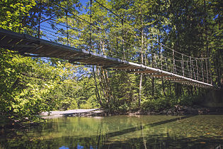 Footbridge across river


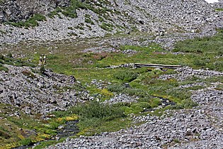
Summerland and Panhandle Gap area[編集]
-

-
-

-

-

-

-

-

-

-

-

-
 Summerland subalpine meadow
 -

-

-


Tatoosh Range[編集]
メインカテゴリー: Tatoosh Range
-
 Tatoosh Range
 -
 Stevens Peak
 -
 Pinnacle Peak
 -
 Lane Peak
 -
 Unicorn Peak
 -
 Plummer Peak
 -
 Denman Peak
 -
 Wahpenayo Peak and Chutla Peak
 -
 The Castle
.jpg)


Other[編集]
-
 old Kautz Creek river bed
 -
 Nisqually River
 -
 Ohanapecosh River


