Category:Portsmouth
Przejdź do nawigacji
Przejdź do wyszukiwania
city in Hampshire, England    | |||||
| Prześlij plik multimedialny | |||||
| Jest to | |||||
|---|---|---|---|---|---|
| Patron | |||||
| Miejsce | City of Portsmouth, Hampshire, Południowo-wschodnia Anglia, Anglia | ||||
| Ważne zdarzenie |
| ||||
| Liczba ludności |
| ||||
| Powierzchnia |
| ||||
| oficjalna strona internetowa | |||||
 | |||||

Podkategorie
Poniżej wyświetlono 29 spośród wszystkich 29 podkategorii tej kategorii.
*
- Quality images of Portsmouth (67 plików)
A
- Aerial photographs of Portsmouth (39 plików)
- Allotments in Portsmouth (10 plików)
C
E
F
G
H
M
N
P
- Panoramics of Portsmouth (14 plików)
- Playgrounds in Portsmouth (17 plików)
S
- Skylines of Portsmouth (36 plików)
- Sunsets of Portsmouth (30 plików)
T
V
Pliki w kategorii „Portsmouth”
Poniżej wyświetlono 200 spośród wszystkich 326 plików w tej kategorii.
(poprzednia strona) (następna strona)-
 Andrew Bell St - geograph.org.uk - 6047314.jpg 1024 × 681; 182 KB
-
 Balcony view overlooking Watts Road - geograph.org.uk - 5165906.jpg 640 × 427; 63 KB
-
 Bishop Chrispian Way, Portsmouth - geograph.org.uk - 6121515.jpg 2560 × 1920; 2,03 MB
-

-
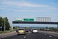
 City of Portsmouth , The A27 - geograph.org.uk - 5738952.jpg 6000 × 4000; 7,15 MB
-
 Claremont Rd - geograph.org.uk - 6047342.jpg 1024 × 681; 130 KB
-
 Clarence St - geograph.org.uk - 6047311.jpg 1024 × 681; 182 KB
-
 Coach waiting by York Place - geograph.org.uk - 897343.jpg 640 × 480; 109 KB
-
 Consort House in Princes Street - geograph.org.uk - 2278267.jpg 480 × 640; 70 KB
-
 Corner of Kingston Road and New Road - geograph.org.uk - 5165874.jpg 640 × 427; 63 KB
-

-
 Corpus Christi Presbytery - geograph.org.uk - 723136.jpg 640 × 480; 54 KB
-
 Crane in Exchange Street - geograph.org.uk - 3821361.jpg 480 × 640; 54 KB
-
-
 Cue Ball Snooker Club, Portsmouth - geograph.org.uk - 5304802.jpg 800 × 589; 108 KB
-
 Curious structure at St Mary's - geograph.org.uk - 692860.jpg 480 × 640; 130 KB
-

-
-
 Dead end at Veolia - geograph.org.uk - 858449.jpg 640 × 480; 58 KB
-
 Dead end in Shore Avenue - geograph.org.uk - 1071599.jpg 640 × 480; 63 KB
-
 Derelict office block with reflections - geograph.org.uk - 4512686.jpg 1280 × 960; 152 KB
-
 Discarded nitrous oxide canisters.jpg 3456 × 4608; 7,34 MB
-
 Dombey Court in Victoria Street - geograph.org.uk - 2278244.jpg 640 × 480; 69 KB
-
 Empty washing lines in Yorke Street - geograph.org.uk - 1940355.jpg 640 × 480; 97 KB
-
En-uk-Portsmouth.ogg 2,0 s; 13 KB
-
 Flats in Broom Square - geograph.org.uk - 1071464.jpg 640 × 480; 62 KB
-
 Flats in St Paul's Square - geograph.org.uk - 1940389.jpg 640 × 480; 77 KB
-
 Flats in Victoria Street - geograph.org.uk - 2278233.jpg 640 × 480; 60 KB
-
 Flats, Buckingham Green - geograph.org.uk - 5057137.jpg 640 × 480; 94 KB
-
 Former car park - geograph.org.uk - 3610281.jpg 640 × 480; 108 KB
-
 Former chapel in Rosebery Avenue - geograph.org.uk - 714980.jpg 640 × 480; 54 KB
-

-
 Furze Lane - geograph.org.uk - 4432531.jpg 640 × 426; 51 KB
-
 Gantry over the A27 - geograph.org.uk - 3673911.jpg 640 × 430; 52 KB
-
 Garage in Queens Road - geograph.org.uk - 1996323.jpg 640 × 480; 60 KB
-
 Garage in St Paul's Square - geograph.org.uk - 1940408.jpg 640 × 480; 57 KB
-
 Garfield Road in mid February - geograph.org.uk - 2280395.jpg 640 × 427; 59 KB
-

-
 Godwit Rd - geograph.org.uk - 4432209.jpg 640 × 426; 59 KB
-

-
 Hanway Medical Centre - geograph.org.uk - 5165879.jpg 640 × 427; 65 KB
-

-
 Heidelberg Road, Portsmouth - geograph.org.uk - 5304889.jpg 800 × 633; 123 KB
-
 HMS M33 at Portsmouth Historic Dockyard - geograph.org.uk - 6338377.jpg 4225 × 3399; 2,44 MB
-
 Hope Street beside HMS Nelson - geograph.org.uk - 3696949.jpg 2973 × 2118; 1,1 MB
-
 Houses in Agincourt Road - geograph.org.uk - 2654874.jpg 640 × 480; 68 KB
-
 Houses in Malins Road - geograph.org.uk - 2278285.jpg 480 × 640; 68 KB
-
 Houses in Mayhall Road - geograph.org.uk - 1992077.jpg 640 × 480; 70 KB
-
 Houses in Portchester Road - geograph.org.uk - 1996294.jpg 640 × 480; 58 KB
-
 Houses in Queens Road - geograph.org.uk - 1996327.jpg 640 × 480; 73 KB
-
 Houses in Telephone Road - geograph.org.uk - 2395421.jpg 640 × 480; 66 KB
-
 Housing estate south of Sultan Road - geograph.org.uk - 5165915.jpg 640 × 427; 74 KB
-

-
 Isambard Brunel Rd - geograph.org.uk - 4750546.jpg 640 × 426; 53 KB
-

-

-
 Lake Rd, A2030 - geograph.org.uk - 6047320.jpg 1024 × 681; 200 KB
-
 Lamppost in Woodville Drive - geograph.org.uk - 1995040.jpg 640 × 480; 69 KB
-
 Landrover in Victoria Street - geograph.org.uk - 2278239.jpg 640 × 480; 72 KB
-
 Lok'n'Store in Rudmore Road - geograph.org.uk - 2284015.jpg 640 × 480; 51 KB
-

-
 Looking west from Southwick Road - geograph.org.uk - 6175620.jpg 7199 × 4584; 4,5 MB
-
 Lorries in Flathouse Road - geograph.org.uk - 2275895.jpg 640 × 480; 92 KB
-
 Manners Rd - geograph.org.uk - 6054989.jpg 1024 × 681; 124 KB
-
 Marker stone - geograph.org.uk - 3789527.jpg 1224 × 1632; 559 KB
-
 Mile End Road Automatic Monitoring Site, Portsmouth.jpg 3936 × 5248; 7,28 MB
-
 Mine all mine^ - geograph.org.uk - 2395093.jpg 640 × 480; 68 KB
-
 MOT Centre in Waterworks Road - geograph.org.uk - 639412.jpg 640 × 480; 46 KB
-
 Multistorey flats, Fratton, Portsmouth - geograph.org.uk - 5305582.jpg 800 × 596; 102 KB
-
 Nancy Road, Fratton, Portsmouth - geograph.org.uk - 5305654.jpg 800 × 493; 64 KB
-
 Nursery next to Ken's hairdressers - geograph.org.uk - 639442.jpg 640 × 480; 54 KB
-
 Old boat in the dockyard with rope (Unsplash).jpg 4000 × 6000; 14,25 MB
-
 Old tram tracks, Portsmouth - geograph.org.uk - 6323285.jpg 1024 × 768; 270 KB
-
 Old tram tracks, Portsmouth - geograph.org.uk - 6323293.jpg 1024 × 768; 344 KB
-
 Old tram tracks, Portsmouth - geograph.org.uk - 6323311.jpg 1024 × 684; 272 KB
-
-

-
 Orchard Road, Portsmouth - geograph.org.uk - 5304887.jpg 800 × 666; 112 KB
-
 Orchard Road, Portsmouth - geograph.org.uk - 5304896.jpg 800 × 778; 109 KB
-
 Ordnance Row - geograph.org.uk - 3024074.jpg 640 × 480; 100 KB
-
 Ornate gates at Rydal Close - geograph.org.uk - 703938.jpg 640 × 480; 69 KB
-
 Park Rd - geograph.org.uk - 4411946.jpg 640 × 426; 87 KB
-
 Park Road, Portsmouth - geograph.org.uk - 3754358.jpg 800 × 589; 171 KB
-
 Path ahead for Plumpton Gardens - geograph.org.uk - 855073.jpg 640 × 480; 61 KB
-
 Paulsgrove Interchange (M275-M27) - geograph.org.uk - 3735230.jpg 640 × 480; 266 KB
-
 Pavement in Wallington Road - geograph.org.uk - 1992127.jpg 640 × 480; 70 KB
-
 Pavement in Wimborne Road - geograph.org.uk - 1419806.jpg 640 × 480; 101 KB
-
 Peacock Lane - geograph.org.uk - 1994824.jpg 640 × 480; 72 KB
-
 Percy Rd - geograph.org.uk - 6054995.jpg 1024 × 681; 140 KB
-
 Peronne Close - geograph.org.uk - 776741.jpg 640 × 480; 55 KB
-
 Pet hospital in Middle Street - geograph.org.uk - 1940339.jpg 640 × 480; 113 KB
-
-

-
 Playzone in Northarbour Road - geograph.org.uk - 1492302.jpg 640 × 480; 55 KB
-
 Plug Cryostat Cosplay.jpg 344 × 611; 73 KB
-

-
 Portsdown Hill Road - Portsmouth - geograph.org.uk - 784488.jpg 640 × 480; 87 KB
-

-
 Portsea, Privett House - geograph.org.uk - 5439962.jpg 1024 × 768; 190 KB
-
 Portsmouth , Alfred Road ^ Traffic Lights - geograph.org.uk - 2879818.jpg 2560 × 1920; 2,37 MB
-
 Portsmouth , Anglesea Road A3 - geograph.org.uk - 1990008.jpg 4218 × 2740; 4,7 MB
-
 Portsmouth , Commercial Road - geograph.org.uk - 1990001.jpg 4214 × 2730; 4,47 MB
-
 Portsmouth , Cornmill Street - geograph.org.uk - 1989189.jpg 4218 × 2740; 4,86 MB
-

-
 Portsmouth Carers Centre, Portsmouth - geograph.org.uk - 5304916.jpg 800 × 724; 85 KB
-
 Portsmouth collage.jpg 700 × 1100; 393 KB
-
 Portsmouth Dockyard (1) - geograph.org.uk - 2962801.jpg 1798 × 1163; 1,6 MB
-

-
 Portsmouth Job Centre - geograph.org.uk - 657943.jpg 640 × 480; 67 KB
-
 Portsmouth montage.png 600 × 1200; 1,23 MB
-

-
 Portsmouth UK ward map 2023.svg 1055 × 1226; 271 KB
-
 Portsmouth, Hope Street - geograph.org.uk - 3621927.jpg 640 × 480; 309 KB
-

-

-
 Precision House in Northarbour Road - geograph.org.uk - 1492312.jpg 640 × 480; 56 KB
-

-
 Protype in York Terrace - geograph.org.uk - 777060.jpg 640 × 480; 49 KB
-
 Queens Road in early July - geograph.org.uk - 1996346.jpg 640 × 480; 66 KB
-
 Racing starts near Farmlea Road - geograph.org.uk - 706533.jpg 640 × 480; 56 KB
-

-

-
 Rear of Baptist Church Hall - geograph.org.uk - 703857.jpg 640 × 480; 74 KB
-
 Rear of Community Offices - geograph.org.uk - 703806.jpg 640 × 480; 62 KB
-

-
 Rear of houses off Clydebank Road - geograph.org.uk - 770344.jpg 640 × 480; 44 KB
-
 Rear of Maydman Square - geograph.org.uk - 854209.jpg 640 × 480; 66 KB
-
 Rear of Portsmouth Enterprise Centre - geograph.org.uk - 858461.jpg 640 × 480; 49 KB
-
 Rear of units on Limberline Road - geograph.org.uk - 776878.jpg 640 × 480; 46 KB
-

-
 Rear of York Place - geograph.org.uk - 897356.jpg 640 × 480; 110 KB
-
 Road junction by Victoria Park - geograph.org.uk - 698531.jpg 640 × 480; 62 KB
-
 Road markings on Market Way - geograph.org.uk - 2275904.jpg 640 × 480; 58 KB
-
-
-
 Roadworks in Northarbour Road - geograph.org.uk - 1492321.jpg 640 × 480; 66 KB
-
 Roadworks outside JAG - geograph.org.uk - 784116.jpg 480 × 640; 76 KB
-
 ROKO opposite Amberley Road - geograph.org.uk - 854423.jpg 640 × 480; 78 KB
-
 Rolls Royce in Northarbour Road - geograph.org.uk - 1492281.jpg 640 × 480; 51 KB
-

-
 Rowthorn Signs by Copnor Bridge - geograph.org.uk - 859769.jpg 640 × 480; 65 KB
-
 Royal Court Apartments in London Road - geograph.org.uk - 770791.jpg 640 × 480; 98 KB
-
 Rudmore in 2011.JPG 4000 × 3000; 4,7 MB
-
 Rydal Close - geograph.org.uk - 1177335.jpg 480 × 640; 51 KB
-
 Salterns Avenue - geograph.org.uk - 1071606.jpg 640 × 480; 63 KB
-

-

-

-
-
 Scooter in Harbourgate - geograph.org.uk - 1177385.jpg 480 × 640; 49 KB
-
 Seagull Close, Milton - geograph.org.uk - 3090476.jpg 640 × 480; 88 KB
-
 Second entrance at Alchorne Place - geograph.org.uk - 858465.jpg 640 × 480; 61 KB
-
 Selbourne Terrace - geograph.org.uk - 6047341.jpg 1024 × 681; 139 KB
-
-
 Self-storage and engineering firm - geograph.org.uk - 1514865.jpg 640 × 480; 147 KB
-

-

-
 Severely pruned trees in Kirby Road - geograph.org.uk - 2356923.jpg 480 × 640; 56 KB
-
 Severn Close - geograph.org.uk - 1373681.jpg 640 × 480; 80 KB
-
 Shackleton House in St Chad's Avenue - geograph.org.uk - 770749.jpg 640 × 480; 61 KB
-
 Shipwrights' Way 212 - geograph.org.uk - 5443443.jpg 800 × 600; 140 KB
-

-

-
 Site of the former Jessie Road Halt - geograph.org.uk - 673841.jpg 640 × 480; 48 KB
-
 Small builders in Northover Road - geograph.org.uk - 856438.jpg 480 × 640; 55 KB
-
 Small bungalow in Dysart Avenue - geograph.org.uk - 715104.jpg 640 × 480; 63 KB
-
 Small business in Tredegar Road - geograph.org.uk - 718755.jpg 640 × 480; 41 KB
-
 Solicitors in Kings Road - geograph.org.uk - 1940635.jpg 480 × 640; 83 KB
-
 Solid balconies in Magdalen Road - geograph.org.uk - 770796.jpg 640 × 480; 69 KB
-
 Somerfield at North End - geograph.org.uk - 770467.jpg 640 × 480; 71 KB
-
 South Road, Buckland - geograph.org.uk - 769516.jpg 640 × 480; 56 KB
-
 Southampton Road - geograph.org.uk - 1177401.jpg 640 × 480; 45 KB
-

-
 Southern end of Old Wymering Lane - geograph.org.uk - 675758.jpg 640 × 480; 78 KB
-

-
 Speed limit sign in Laburnum Grove - geograph.org.uk - 1992092.jpg 640 × 480; 67 KB
-
 Spring blossom in Mayfield Road - geograph.org.uk - 2356937.jpg 480 × 640; 88 KB
-
 St Barbara Way, Gatcombe Park - geograph.org.uk - 777025.jpg 640 × 480; 81 KB
-
 St Colman's Presbytery - geograph.org.uk - 613273.jpg 640 × 480; 55 KB
-
 St Luke's Vicarage in Brunel Road - geograph.org.uk - 1484874.jpg 480 × 640; 77 KB
-
 St. James's Street, Portsmouth - geograph.org.uk - 3303814.jpg 1600 × 1151; 259 KB
-
 STICKEE (4531255891).jpg 2832 × 4256; 4,19 MB
-
 Storage depot in Milton Road - geograph.org.uk - 1070730.jpg 640 × 480; 42 KB
-
 Summer in St Paul's Road - geograph.org.uk - 1940463.jpg 640 × 480; 79 KB
-
 Sunrise Stained Glass, Portsmouth - geograph.org.uk - 3754242.jpg 769 × 800; 167 KB
-
 Surrey Street - geograph.org.uk - 2309626.jpg 640 × 480; 82 KB
-
 Surrey Street in early March - geograph.org.uk - 2309647.jpg 640 × 480; 80 KB
-
 Talbot Rd - geograph.org.uk - 4408603.jpg 640 × 426; 72 KB
-

-

-

-
-

-

-

-

-
-

-

-


.jpg)


_-_geograph.org.uk_-_3735230.jpg)


_-_geograph.org.uk_-_2962801.jpg)


.jpg)


.jpg)
.jpg)
.jpg)
.jpg)
.jpg)
.jpg)
.jpg)
.jpg)
.jpg)
.jpg)
.jpg)
.jpg)