File:Nanaimo aerial 1.jpg
Jump to navigation
Jump to search

Size of this preview: 800 × 534 pixels. Other resolutions: 320 × 213 pixels | 640 × 427 pixels | 1,024 × 683 pixels | 1,280 × 854 pixels | 1,597 × 1,065 pixels.
Original file (1,597 × 1,065 pixels, file size: 1.5 MB, MIME type: image/jpeg)
Captions
Captions
Add a one-line explanation of what this file represents
Summary[edit]
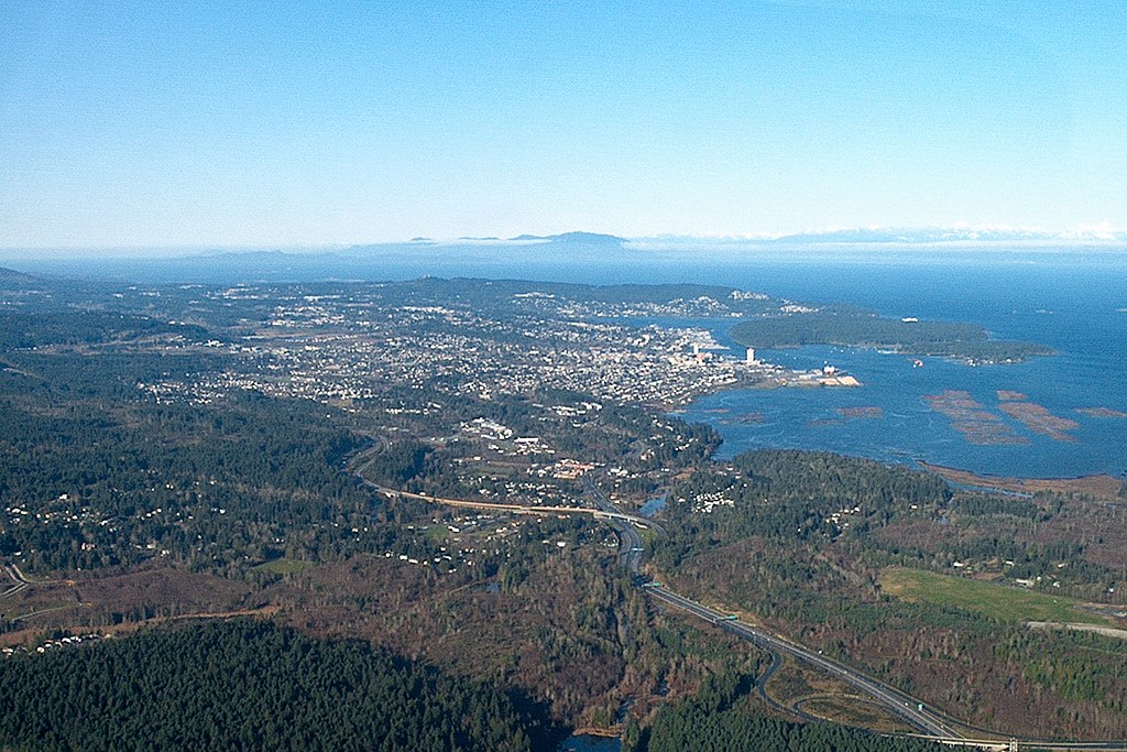
| Description | Aerial photograph I took myself of the City of Nanaimo BC on December 27, 2004 showing the city as well as Newcastle Island (just below a BC Ferry headed for Vancouver) and Protection Island looking approximately North across the Strait of Georgia. 1 of 2. |
| Date | |
| Source | Own Work. I took this photo myself |
| Author | Ken Walker |
| Permission (Reusing this file) |
GFDL |
Licensing[edit]
I, the copyright holder of this work, hereby publish it under the following licenses:

|
Permission is granted to copy, distribute and/or modify this document under the terms of the GNU Free Documentation License, Version 1.2 or any later version published by the Free Software Foundation; with no Invariant Sections, no Front-Cover Texts, and no Back-Cover Texts. A copy of the license is included in the section entitled GNU Free Documentation License. |
| This file is licensed under the Creative Commons Attribution-Share Alike 3.0 Unported license. | ||
| ||
| This licensing tag was added to this file as part of the GFDL licensing update. |
You may select the license of your choice.
| Camera location | | View this and other nearby images on: OpenStreetMap |
|---|
File history
Click on a date/time to view the file as it appeared at that time.
| Date/Time | Thumbnail | Dimensions | User | Comment | |
|---|---|---|---|---|---|
| current | 04:47, 26 September 2020 | | 1,597 × 1,065 (1.5 MB) | Ponderosapine210 (talk | contribs) | Cropped and straightened. Adjusted colours. |
| 06:30, 25 July 2006 |  | 1,600 × 1,200 (1.13 MB) | KenWalker (talk | contribs) | {{Information |Description=Aerial photograph I took myself of the City of Nanaimo BC on December 27, 2004 showing the city as well as Newcastle Island (just below a BC Ferry headed for Vancouver) and Protection Island looking approximately North across th |
You cannot overwrite this file.
File usage on Commons
There are no pages that use this file.
File usage on other wikis
The following other wikis use this file:
- Usage on pl.wikipedia.org