User:Sémhur
Jump to navigation
Jump to search
| ||||||||
| ||||||||
| ||||||||
| ||||||||
| ||||||||
| ||||||||
| ||||||||
| ||||||||
English:
This user is a wikigraphist, working for the Atelier Graphique – the French Graphic Lab.
He makes or modifies maps, diagrams and photographs, to improve illustrations of Wikipedias.
This user is a wikigraphist, working for the Atelier Graphique – the French Graphic Lab.
He makes or modifies maps, diagrams and photographs, to improve illustrations of Wikipedias.
Español:
Este usuario es un wikigrafista, que trabaja para el Atelier Graphique – el Taller Gráfico francés.
Crea o modifica mapas, esquemas y fotografías, para mejorar las ilustraciones de las Wikipedias.
Este usuario es un wikigrafista, que trabaja para el Atelier Graphique – el Taller Gráfico francés.
Crea o modifica mapas, esquemas y fotografías, para mejorar las ilustraciones de las Wikipedias.
Français :
Cet utilisateur est un wikigraphiste, travaillant pour l'Atelier Graphique.
Il crée ou modifie des cartes, schémas et photographies, pour améliorer les illustrations des Wikipédias.
Cet utilisateur est un wikigraphiste, travaillant pour l'Atelier Graphique.
Il crée ou modifie des cartes, schémas et photographies, pour améliorer les illustrations des Wikipédias.
-
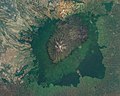 Mount Kenya
Modified photograph -

 Workmen in Rangiroa
Own work -
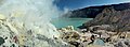
 Mining in Kawah Ijen
Panorama


-
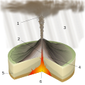 Diagram of volcano
 -
 Diagram of cigarette
 -
 Simple chart
 -
 Administrative map


-
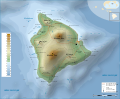 Topographic map
 -
 Historical map
 -
 General map
 -
 Animated map


== {{int:filedesc}} ==
{{Information
|Description=
{{en|1= {{w|||en}}.}}
{{fr|1= {{w|||fr}}.}}
|Source=
* {{f|}} by {{u|}} under licence GFDL or CC-BY-SA 3.0
{{en|1=
* Shorelines, lakes, rivers, borders : NGDC [http://www.ngdc.noaa.gov/mgg/shorelines/gshhs.html GSHHS]
* Relief : [http://www.ngdc.noaa.gov/mgg/global/global.html National Geophysical Data Center (NGDC) ETOPO1]
* Shorelines and lakes: NASA Shuttle Radar Topography Mission (SWBD) (public domain)
* Topography and relief: NASA Shuttle Radar Topography Mission (SRTM3 v.2) (public domain) ;
* Communes and rivers: [www.openstreetmap.fr OpenStreetMap] (CC-BY-SA-2.0)}}
{{fr|1=
* Côtes, lacs, rivières, frontières : NGDC [http://www.ngdc.noaa.gov/mgg/shorelines/gshhs.html GSHHS]
* Relief : [http://www.ngdc.noaa.gov/mgg/global/global.html Centre de données géophysiques nationales (NGDC) ETOPO1]
* Tracé des côtes et lacs : NASA Shuttle Radar Topography Mission (SWBD) (domaine public)
* Topographie et relief : NASA Shuttle Radar Topography Mission (SRTM3 v.2) (domaine public) ;
* communes et rivières : [www.openstreetmap.fr OpenStreetMap] (CC-BY-SA-2.0)}}
|Date=~~~~~
|Author=
* {{U|Sémhur}}
* OpenStreetMap contributors
|other_versions={{Columns|2|
* {{f|-en.svg}} : {{#language:en}}
* {{f|-fr.svg}} : {{#language:fr}}
* {{f|-blank.svg}} : ''Blank map''}}
{{User:Sémhur/Credit}}{{Igen|Im|+|%=p|!|gf|s=mbs|subcat=:Maps}}
}}
{{location dec|90|-180|type:landmark_region:FR_heading:0}}

== {{int:license-header}} ==
{{self|FAL|cc-by-sa-all}}

{{Atelier graphique}}
{{RetouchedPicture}}
{{Mérimée|type=classé inscrit|IA49003251}}

[[Category:SVG maps in French]] [[Category:SVG maps showing history in French]] [[Category:SVG language-neutral maps]]
[[Category:Diagrams in French]] [[Category:Schemes in French]]
[[Category:Files created by User:Sémhur]] [[Category:Files modified by User:Sémhur]]
[[Category:Maps by User:Sémhur]] [[Category:Diagrams by User:Sémhur]] [[Category:Photos by User:Sémhur]]
[[Category:Monuments historiques in Maine-et-Loire]] [[Category:OpenStreetMap maps of France]] [[Category:Location not applicable]]
| Templates or category | Description |
|---|---|
| {{Igen|Im|+|%=p|!|gf|s=mbs|subcat=:Maps}} | Im : ajoute le petit bandeau "Cette carte a été créée avec Inkscape–important" + : ajoute le petit bandeau "Le code de ce fichier SVG est valide." |
| {{fr}} {{Atelier graphique carte}} |
To categorise my work from the fr:Wikipédia:Atelier graphique. |
| {{Published}} | Indicate that a Commons file has been used in non-Wikipedia projects. |
| {{RetouchedPicture}} | For photo, if my work alter the original. |
| [[Category:SVG maps in French]] [[Category:SVG maps showing history in French]] |
To categorise a map with French labels |
| [[Category:Diagrams in French]] [[Category:Schemes in French]] |
To categorise a diagram with French labels |
| {{location dec|45|45|type:landmark_region:FR-PF_scale:2000_heading:1}} | For pictures with location. See :
|
| [[Category:Location not applicable]] | For pictures without possible location. |
| http://validator.w3.org/#validate_by_upload | For testing valid SVG. To do before uploading. |
| {{Igen}} | Indicates informations about the SVG : made by which software, valid or not, translation possible, etc. |
| {{Bitmap from Inkscape}} | Indicates that the bitmap file was made with Inkscape (and would be better in SVG}}. |
| {{Legend}} | Tools for legend. |