File:Alland - Kirche (2).JPG
Jump to navigation
Jump to search
Size of this preview: 766 × 600 pixels. Other resolutions: 307 × 240 pixels | 613 × 480 pixels | 981 × 768 pixels | 1,280 × 1,002 pixels | 2,560 × 2,004 pixels | 4,134 × 3,236 pixels.
Original file (4,134 × 3,236 pixels, file size: 10.63 MB, MIME type: image/jpeg)
Captions
Captions
Add a one-line explanation of what this file represents
Summary[edit]
| Description |
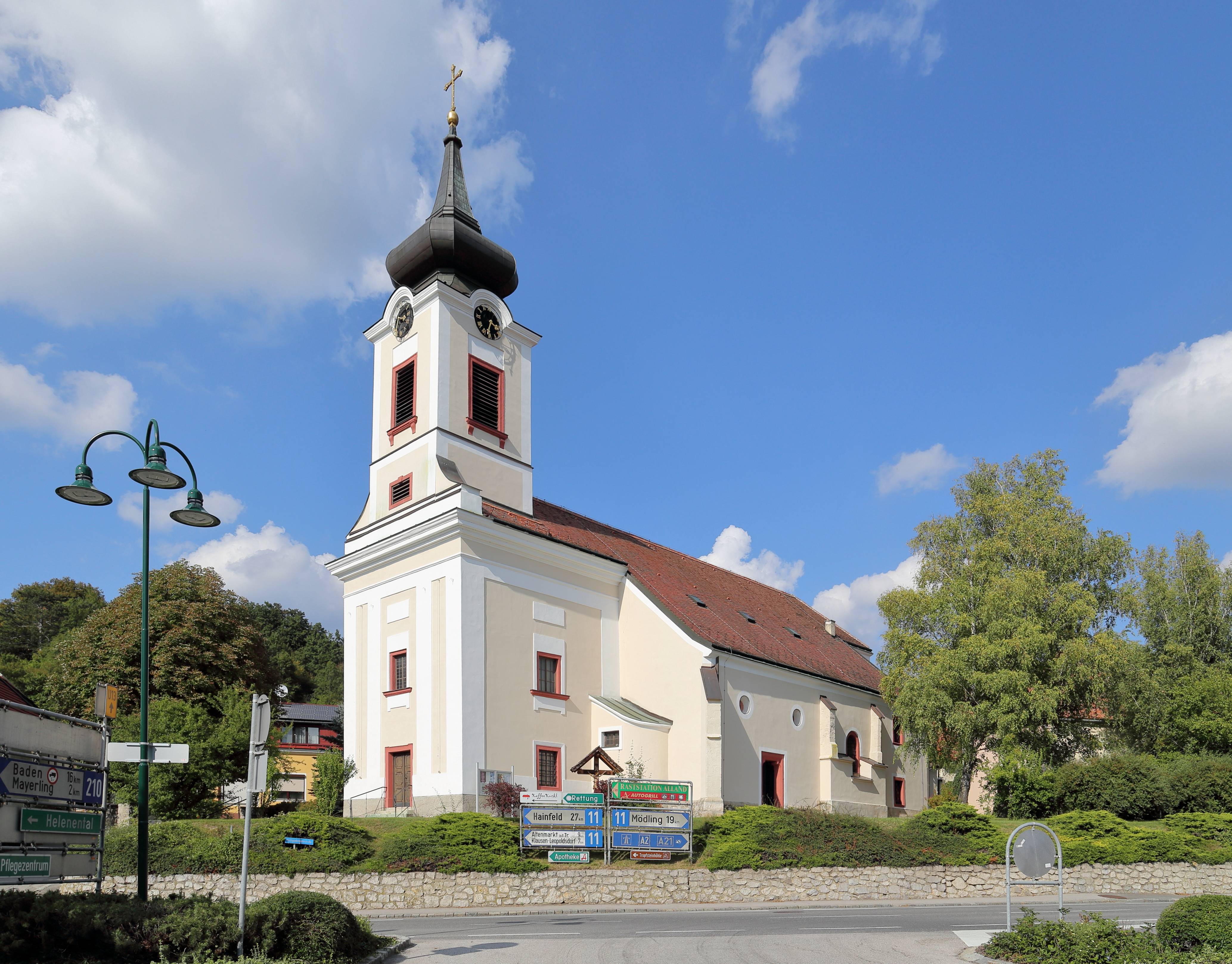
Deutsch: Südansicht der röm.-kath. Pfarrkirche hll. Georg und Margarethe der niederösterreichischen Gemeinde Alland.
Ursprünglich eine romanische Saalkirche. Im 12. Jahrhundert wurde diese um ein Nordschiff und einen Westturm erweitert. Im 14. Jahrhundert erfolgte der Anbau der Südostkapelle, die Einwölbung des Nordschiffes sowie der Neubau des Chores. Um 1500 Zubau eines 2. südlichen Seitenschiffjoches und des Südportales. Um 1800 Neubau der oberen Geschosse des Turmes und Barockisierung der Fassade. Im Zuge der Kriegshandlungen 1945 stürzte das zweijochige Mittelschiff und das Südschiff ein und wurde bis 1954 wiederaufgebaut. Bei den zwei Türkenbelagerungen (1529 und 1683) wurde die Kirche ebenfalls schwer beschädigt und jeweils wiederinstandgesetzt. |
| Date | |
| Source | Own work |
| Author | C.Stadler/Bwag |
| Permission (Reusing this file) |
Deutsch: Hallo, du darfst mein Foto kostenlos nutzen, aber nenne mich bitte als Fotograf, beispielsweise „Foto: C.Stadler/Bwag“ oder © C.Stadler/Bwag; CC-BY-SA-4.0. Auf mehr Angaben bestehe ich nicht - im Gegensatz zu manch anderen, die die Vorgaben der unten angeführten Lizenzierung auf Punkt und Beistrich einfordern. English: Feel free to use my photos, but please mention me as the author like © C.Stadler/Bwag or © C.Stadler/Bwag; CC-BY-SA-4.0 (that's good enough) and if you want send me a message: bwag@gmx.net. |
| Other versions |
|
.JPG)
.JPG&action=edit§ion=1)
| Camera location | | View this and other nearby images on: OpenStreetMap |
|---|
.JPG¶ms=048.058100_N_0016.080577_E_globe:Earth_type:camera_alt:345.1_source:exif_&language=en)
| Object location | | View this and other nearby images on: OpenStreetMap |
|---|
.JPG¶ms=048.058550_N_0016.080820_E_globe:Earth_class:object_type:object_region:AT-3_&language=en)
Licensing[edit]
.JPG&action=edit§ion=2)
I, the copyright holder of this work, hereby publish it under the following license:
This file is licensed under the Creative Commons Attribution-Share Alike 4.0 International license.
- You are free:
- to share – to copy, distribute and transmit the work
- to remix – to adapt the work
- Under the following conditions:
- attribution – You must give appropriate credit, provide a link to the license, and indicate if changes were made. You may do so in any reasonable manner, but not in any way that suggests the licensor endorses you or your use.
- share alike – If you remix, transform, or build upon the material, you must distribute your contributions under the same or compatible license as the original.
File history
Click on a date/time to view the file as it appeared at that time.
| Date/Time | Thumbnail | Dimensions | User | Comment | |
|---|---|---|---|---|---|
| current | 19:48, 9 September 2016 | | 4,134 × 3,236 (10.63 MB) | Bwag (talk | contribs) | {{Information |Description= {{de|1= Südansicht der röm.-kath. Pfarrkirche hll. Georg und Margarethe der niederösterreichischen Gemeinde Alland.<br/>Ursprünglich eine romanische Saalkirche. Im 12. Jahrhunde... |
You cannot overwrite this file.
File usage on Commons
The following 2 pages use this file:
File usage on other wikis
The following other wikis use this file:
- Usage on de.wikipedia.org
- Usage on de.wikivoyage.org
- Usage on en.wikipedia.org
- Usage on fr.wikipedia.org
- Usage on pl.wikipedia.org
- Usage on www.wikidata.org
.JPG&oldid=789254299)