Category:1470s maps of the world
Jump to navigation
Jump to search
| 15th-century maps of the world: 1400s 1410s 1420s 1430s 1440s 1450s 1460s 1470s 1480s 1490s → |
English: This category is supposed to hold world maps created in the 1470s.
Media in category "1470s maps of the world"
The following 11 files are in this category, out of 11 total.
-
 1475 Rudimentum Novitorum Lucas brandis.jpg 2,500 × 2,221; 3.45 MB
-

-
 Bodleian Libraries, The World in late Antiquity.jpg 1,000 × 675; 107 KB
-
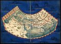
 Crivelli World Map.png 4,000 × 3,055; 33.61 MB
-
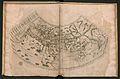
 First Map of the Bologna Ptolemy.png 4,000 × 2,317; 7.08 MB
-
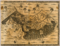
 Gulf4..JPG 3,072 × 2,304; 2.79 MB
-
 Habitabilis Nostre Tabula.jpg 3,231 × 2,133; 1.3 MB
-
 Habitabilis Nostre Tabula II.jpeg 2,500 × 1,827; 986 KB
-
 Habitabilis Nostre Tabula III.jpg 760 × 553; 162 KB
-
 Habitabilis Nostre Tabula IV.jpg 1,000 × 637; 133 KB
-
 Tabula Prima.jpg 800 × 581; 132 KB


