Category:14th-century church towers in Herefordshire
Jump to navigation
Jump to search
Ceremonial counties of England: Bedfordshire · Berkshire · Buckinghamshire · Cambridgeshire · Cheshire · Cornwall · Cumbria · Derbyshire · Devon · Dorset · East Sussex · Essex · Gloucestershire · Greater London · Hampshire · Herefordshire · Hertfordshire · Kent · Lancashire · Leicestershire · Lincolnshire · Merseyside · Norfolk · North Yorkshire · Northamptonshire · Nottinghamshire · Oxfordshire · Rutland · Shropshire · Somerset · South Yorkshire · Staffordshire · Suffolk · Surrey · Tyne and Wear · Warwickshire · West Midlands · West Yorkshire · Wiltshire · Worcestershire
City-counties:
Former historic counties:
Other former counties:
City-counties:
Former historic counties:
Other former counties:
Media in category "14th-century church towers in Herefordshire"
The following 58 files are in this category, out of 58 total.
-

-

-
 Riverside path, Bodenham - geograph.org.uk - 1247501.jpg 640 × 480; 140 KB
-
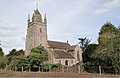 St Michael and All Angels, Bodenham - geograph.org.uk - 1764597.jpg 3,439 × 2,227; 4.68 MB
-
 St Michael and All Angels, Bodenham - geograph.org.uk - 1764603.jpg 3,300 × 2,233; 5.08 MB
-
 St Michael's Church - geograph.org.uk - 147139.jpg 480 × 640; 86 KB
-
 St Michael's Church at Bodenham - geograph.org.uk - 457393.jpg 640 × 480; 142 KB
-
 St Michael's Church at Bodenham - geograph.org.uk - 457403.jpg 640 × 480; 142 KB
-
-
 St. Michael and All Angels, Bodenham - geograph.org.uk - 1248928.jpg 479 × 640; 138 KB
-
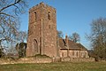
 Bodenham Church Tower - geograph.org.uk - 1365636.jpg 480 × 640; 155 KB
-
 St Bridget's Church, Bridstow - geograph.org.uk - 808856.jpg 640 × 426; 92 KB
-
 St Bridgets - geograph.org.uk - 79286.jpg 640 × 480; 73 KB
-
 St. Bridget's church, Bridstow - geograph.org.uk - 1145529.jpg 640 × 480; 200 KB
-
 St. Bridget's church, Bridstow - geograph.org.uk - 1145531.jpg 640 × 480; 211 KB
-
 St. Bridget's Church, south facade - geograph.org.uk - 520214.jpg 640 × 480; 424 KB
-
 St. Bridgets Church, Bridstow - geograph.org.uk - 150790.jpg 640 × 426; 140 KB
-
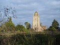
 Credenhill Church (geograph 2226578).jpg 681 × 1,024; 169 KB
-
 St Giles' Church Goodrich - geograph.org.uk - 870478.jpg 480 × 640; 126 KB
-
 Goodrich Church (6062321782).jpg 1,940 × 1,539; 401 KB
-
 St Dubricius church, Hentland - geograph.org.uk - 115437.jpg 640 × 426; 137 KB
-
 St Mary, Humber (geograph 3225428).jpg 3,456 × 2,592; 3.77 MB
-
 Humber Church - geograph.org.uk - 146700.jpg 640 × 480; 91 KB
-
 Kingsland church - geograph.org.uk - 363616.jpg 426 × 640; 144 KB
-
 Kingsland church - geograph.org.uk - 363627.jpg 640 × 426; 103 KB
-
 Belfry at St Mary's Church, Linton - geograph.org.uk - 1487674.jpg 640 × 426; 71 KB
-
 Belfry at St Marys, Linton (geograph 1487684).jpg 426 × 640; 72 KB
-
 St Mary's Church - 1 - geograph.org.uk - 1530463.jpg 640 × 471; 58 KB
-
 St Mary's Church - 2 - geograph.org.uk - 1530469.jpg 480 × 640; 94 KB
-
-
 Linton Church Spire - geograph.org.uk - 742940.jpg 426 × 640; 58 KB
-
 Lugwardine Church - geograph.org.uk - 1596726.jpg 640 × 426; 77 KB
-
 Rhystone Lane, Lugwardine - geograph.org.uk - 723457.jpg 640 × 480; 121 KB
-
 St Peter's Church, Lugwardine - geograph.org.uk - 143473.jpg 426 × 640; 90 KB
-
 St Peter's Church, Lugwardine - geograph.org.uk - 143474.jpg 640 × 426; 91 KB
-
 St Peter's Church, Lugwardine - geograph.org.uk - 626610.jpg 640 × 480; 74 KB
-
 Lugwardine - Church From Lumber Lane - geograph.org.uk - 1355879.jpg 640 × 480; 163 KB
-

-
 Marden Church - geograph.org.uk - 146999.jpg 426 × 640; 66 KB
-
 St Laurence church, Preston-on-Wye-geograph.org.uk-1996515.jpg 640 × 480; 98 KB
-
 St Lawrence Church, Preston on Wye - geograph.org.uk - 148864.jpg 640 × 480; 304 KB
-
 Richards Castle - The Old Church - geograph.org.uk - 1759103.jpg 640 × 480; 192 KB
-
 St. Mary's Church, Ross-on-Wye - geograph.org.uk - 1056743.jpg 640 × 427; 45 KB
-
 Church at Weobley - panoramio.jpg 3,072 × 2,304; 1.34 MB
-

-
 Spire of Weobleychurch.JPG 1,536 × 2,048; 645 KB
-
 St Peter and St Paul's, Weobley- tower and porch.JPG 1,536 × 2,048; 701 KB
-
 St Peter and St Paul, Weobley - geograph.org.uk - 779897.jpg 640 × 358; 67 KB
-
 The tallest spire in Herefordshire - geograph.org.uk - 872967.jpg 480 × 640; 67 KB
-
 The War Memorial, Weobley - geograph.org.uk - 319729.jpg 426 × 640; 96 KB
-
 Weobley church - geograph.org.uk - 319726.jpg 426 × 640; 102 KB
-
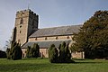
 Parish Church of St. Lawrence - geograph.org.uk - 479473.jpg 480 × 640; 385 KB
-

-
 St. Lawrence's church - geograph.org.uk - 1351779.jpg 640 × 426; 84 KB
-

-
 Tower of St. Lawrence's church - geograph.org.uk - 1328955.jpg 480 × 640; 237 KB
-
 Weston-under-Penyard - geograph.org.uk - 1328948.jpg 640 × 480; 275 KB
-
 Churchyard cross, St Peter's, Withington - geograph.org.uk - 1029317.jpg 640 × 480; 154 KB


.jpg)

.jpg)

.jpg)


.jpg)


