Category:1665
Saltar para a navegação
Saltar para a pesquisa
| ◀ 1660s ▶ (século XVII, II milénio) |
|---|
| ◀ 1660 · 1661 · 1662 · 1663 · 1664 · 1665 · 1666 · 1667 · 1668 · 1669 ▶ |

ano | |||||
| Carregar ficheiro | |||||
| Instância de | |||||
|---|---|---|---|---|---|
| Parte de | |||||
| Data de ocorrência |
| ||||
| Precedido por | |||||
| Sucedido por | |||||
| |||||
Subcategorias
Esta categoria contém as seguintes 11 subcategorias (de um total de 11).
*
+
E
O
Multimédia na categoria "1665"
Esta categoria contém os seguintes 129 ficheiros (de um total de 129).
-
 1665 journal des scavans p1.png 2 592 × 3 508; 126 kB
-
 1665 journal des scavans p2.png 2 592 × 3 508; 139 kB
-
 1665 journal des scavans title.jpg 1 110 × 1 827; 537 kB
-
 1665 phil trans vol i title.png 1 512 × 2 272; 517 kB
-
 22 High Street, Hale date.jpg 4 168 × 3 384; 6,26 MB
-
 A mapp of New England (2675735796).jpg 2 000 × 1 665; 2,83 MB
-
 AMH-2550-NA Ground plan of the Fort of Good Hope with the start of a new pentagon.jpg 1 792 × 2 400; 598 kB
-
 AMH-5623-NA Map of the Malabar coast.jpg 2 400 × 1 662; 762 kB
-
 AMH-5625-NA Map of Saldanha Bay, Table Bay, Hout Bay and False Bay.jpg 2 400 × 1 645; 775 kB
-
 AMH-5626-NA Bird's eye view of the city of Judja.jpg 2 400 × 1 591; 796 kB
-
 AMH-5649-KB Map depicting the journey by Joan Nieuhoff from Canton to Peking.jpg 2 400 × 2 024; 682 kB
-
 AMH-6030-NA Bird's eye view of the city of Macao.jpg 6 985 × 5 005; 6,66 MB
-
 AMH-6130-NA View of Ambon.jpg 2 400 × 1 579; 457 kB
-
 AMH-6132-NA Bird's eye view of the city of Atjeh.jpg 2 400 × 1 677; 564 kB
-
 AMH-6133-NA View of Batticaloa.jpg 2 400 × 2 020; 604 kB
-
 AMH-6134-NA Bird's eye view of the fort of Batticaloa.jpg 2 400 × 1 938; 895 kB
-
 AMH-6135-NA View of Batavia.jpg 2 400 × 1 883; 787 kB
-
 AMH-6143-NA Map of Table Bay.jpg 2 400 × 1 810; 727 kB
-
 AMH-6145-NA View of Canton.jpg 2 400 × 1 636; 518 kB
-
 AMH-6146-NA Bird's eye view of Eauweck, Cambodia.jpg 2 400 × 1 785; 591 kB
-
 AMH-6148-NA Bird's eye view of the city of Cochin, India.jpg 2 400 × 1 682; 602 kB
-
 AMH-6150-NA View of Dabul.jpg 2 400 × 1 724; 455 kB
-
 AMH-6151-NA View of the city of Dabul.jpg 2 400 × 1 848; 510 kB
-
 AMH-6153-NA Bird's eye view of Negombo.jpg 2 400 × 1 892; 909 kB
-
 AMH-6154-NA View of the city of Jaffna.jpg 2 400 × 1 649; 606 kB
-
 AMH-6155-NA Map of the city of Macao.jpg 2 400 × 1 701; 585 kB
-
 AMH-6156-NA Map of the city of Malakka.jpg 2 400 × 1 113; 368 kB
-
 AMH-6158-NA Picture of the Osacca castle.jpg 2 400 × 1 696; 849 kB
-
 AMH-6159-NA View of Galle.jpg 2 400 × 1 740; 408 kB
-
 AMH-6160-NA View of the city of Raiebaagh.jpg 2 400 × 1 652; 477 kB
-
 AMH-6161-NA Bird's eye view of the city of Samboppe, Macassar.jpg 2 400 × 1 715; 636 kB
-
 AMH-6162-NA Bird's eye view of the city of Samboppe, Macassar.jpg 2 400 × 1 750; 524 kB
-
 AMH-6163-NA View of the castle of Visiapour.jpg 2 400 × 1 626; 520 kB
-
 AMH-6164-NA View of Visiapour (according to the title), depicted is Suratte.jpg 2 400 × 1 802; 474 kB
-
 AMH-6166-NA Bird's eye view of Colombo and environs.jpg 2 400 × 1 718; 620 kB
-

-
 AMH-6732-NA Map of East Africa.jpg 2 400 × 1 657; 865 kB
-
 AMH-6733-NA Map of the Indian Ocean.jpg 2 400 × 1 656; 708 kB
-
 AMH-6734-NA Map of the coast of Venezuela.jpg 2 400 × 1 662; 679 kB
-
 AMH-6735-NA Map of the Philippines.jpg 2 400 × 1 668; 634 kB
-
 AMH-6736-NA Map of the Arabian peninsula.jpg 2 400 × 1 637; 983 kB
-
 AMH-6737-NA Map of the Suratte river.jpg 2 400 × 1 657; 735 kB
-
 AMH-6738-NA Map of the northern part of the Greek archipelago.jpg 2 400 × 1 686; 497 kB
-
 AMH-6741-NA Map of Anjouan.jpg 2 400 × 1 560; 729 kB
-
 AMH-6742-NA View of the bay at Acapulco.jpg 2 400 × 1 865; 831 kB
-
 AMH-6743-NA View of Arguin castle.jpg 2 400 × 1 820; 404 kB
-
 AMH-6746-NA Bird's eye view of the Baya Hondo, Venezuela.jpg 2 400 × 1 760; 517 kB
-
 AMH-6747-NA Bird's eye view of St. Jago bay in Cuba.jpg 2 400 × 1 709; 657 kB
-
 AMH-6750-NA Bird's eye view of the bay near Cabo de Tiburon on Hispaniola, Haïti.jpg 2 400 × 1 768; 530 kB
-
 AMH-6751-NA View of the castle of Cabita.jpg 2 400 × 1 709; 398 kB
-
 AMH-6752-NA Bird's eye view of Groot Caymit, St. Domingo, Haïti.jpg 2 400 × 1 772; 637 kB
-
 AMH-6753-NA Map of Cabo Verde and environs.jpg 2 400 × 1 649; 513 kB
-
 AMH-6754-NA Bird's eye view of the city of Santo Domingo.jpg 2 400 × 1 771; 508 kB
-
 AMH-6755-NA Map of the island of Goeree.jpg 2 400 × 1 711; 499 kB
-
 AMH-6756-NA View of the island of Gouree on Cape Verde.jpg 2 400 × 1 784; 450 kB
-
 AMH-6758-NA Map of the island of Hispaniola (Haïti and Dominican Republic).jpg 2 400 × 1 297; 520 kB
-
 AMH-6759-NA Map of Hispaniola and Puerto Rico.jpg 2 400 × 1 680; 812 kB
-
 AMH-6761-NA Bird's eye view of the city of Loanda.jpg 2 400 × 1 702; 532 kB
-
 AMH-6762-NA View of Loanda.jpg 2 400 × 1 602; 331 kB
-
 AMH-6763-NA Bird's eye view of Manila.jpg 2 400 × 1 720; 476 kB
-
 AMH-6764-NA Map of the bay of Manila.jpg 2 400 × 1 719; 400 kB
-
 AMH-6765-NA View of Sao Luis de Maranhao.jpg 2 400 × 1 606; 408 kB
-
 AMH-6766-NA Map of Sao Luis de Marranhao.jpg 2 400 × 1 631; 573 kB
-
 AMH-6767-NA Fort Mauritius at the river of St. Francisco.jpg 2 400 × 1 677; 364 kB
-
 AMH-6777-NA Map of the harbour at Pernambuco.jpg 2 400 × 1 718; 656 kB
-
 AMH-6778-NA View of El Mina Fort.jpg 2 400 × 1 917; 435 kB
-
 AMH-6780-NA Map of El Mina Fort.jpg 2 400 × 1 730; 663 kB
-
 AMH-6781-NA Map of the city of Mexico.jpg 2 400 × 1 873; 766 kB
-
 AMH-6782-NA Floor plan of the fort of Mauritius on Rio San Francisco.jpg 2 400 × 1 677; 547 kB
-
 AMH-6785-NA View of Paraiba.jpg 2 400 × 1 633; 406 kB
-
 AMH-6786-NA Map of the mouth of the Paraiba River.jpg 2 400 × 1 613; 682 kB
-
 AMH-6787-NA View of Porto Calvo.jpg 2 400 × 1 640; 448 kB
-
 AMH-6788-NA Map of San Francisco on Santa Domingo.jpg 2 400 × 1 773; 535 kB
-
 AMH-6789-NA Map of Puerto Rico.jpg 2 400 × 1 795; 558 kB
-
 AMH-6790-NA View of Puerto Rico.jpg 2 400 × 1 818; 361 kB
-
 AMH-6791-NA Map of the Powathan River.jpg 2 400 × 1 662; 722 kB
-
 AMH-6792-NA Map of the mouth of the Rio Grande and Fort Ceulen.jpg 2 400 × 1 598; 558 kB
-
 AMH-6793-NA Map of the mouth of the Pousioucq River.jpg 2 400 × 1 624; 523 kB
-
 AMH-6794-NA View of Fort Ceulen on the Rio Grande.jpg 2 400 × 1 963; 635 kB
-
 AMH-6795-NA View of Keulen Fort.jpg 2 400 × 1 625; 334 kB
-
 AMH-6796-NA Bird's eye view of the mouth of the Senegal, Saint Louis.jpg 2 400 × 1 446; 451 kB
-
 AMH-6797-NA Bird's eye view of Spirito Sancto bay.jpg 2 400 × 1 706; 588 kB
-
 AMH-6798-NA Bird's eye view of the bay and the fort of Nieuw Vlissingen on Tobago.jpg 2 400 × 1 786; 508 kB
-
 AMH-6799-NA Map of the island of Tamaraca.jpg 2 400 × 1 663; 780 kB
-
 AMH-6800-NA Map of the island of San Thomé.jpg 7 320 × 5 304; 6,24 MB
-
 AMH-6801-NA Chart of Isla da Vaca near Hispaniola, Haïti.jpg 2 400 × 1 772; 548 kB
-
 AMH-6802-NA View of Angra on Tercera.jpg 2 400 × 1 649; 600 kB
-
 AMH-6803-NA Bird's eye view of Mozambique island.jpg 2 400 × 1 689; 529 kB
-
 AMH-6804-NA Map of Olinda.jpg 2 400 × 1 697; 677 kB
-
 AMH-6806-NA View of Bahia de todos os santos, All Saints bay.jpg 2 400 × 1 687; 331 kB
-
 AMH-6807-NA View of unidentified fort.jpg 2 400 × 1 644; 336 kB
-
 AMH-6808-NA View of Goa.jpg 2 400 × 1 722; 514 kB
-
 AMH-6809-NA View of Tamaraca.jpg 2 400 × 1 631; 317 kB
-
 AMH-6810-NA View of Calicut.jpg 2 400 × 1 727; 524 kB
-
 AMH-6811-NA View of Porto Rico.jpg 2 400 × 1 757; 565 kB
-
 AMH-6812-NA Map of countries around the North Sea.jpg 2 400 × 1 676; 867 kB
-
 AMH-6813-NA Map of England, the south of Ireland and part of the French coast.jpg 2 400 × 1 669; 896 kB
-
 AMH-6814-NA Map of Ireland.jpg 2 400 × 1 669; 843 kB
-
 AMH-7710-NA View of Fort Elmina.jpg 2 400 × 1 880; 491 kB
-
 Battle of Lowestoft Map1.png 647 × 418; 61 kB
-
 Bill of Mortality.jpg 500 × 839; 359 kB
-
 Blokland1665.JPG 716 × 553; 114 kB
-
 Charles II as a child.jpg 2 362 × 2 780; 6,48 MB
-
 Dutch and Portuguese in Asia c 1665.png 617 × 473; 30 kB
-
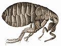
 Flea-Hooke.jpg 1 195 × 881; 302 kB
-
 Fondamente maison 1665.JPG 2 304 × 3 456; 3,75 MB
-
 Gotha kamienica Hauptmarkt 28 2.jpg 5 184 × 3 456; 5,29 MB
-
 Headless cross1.jpg 500 × 429; 21 kB
-
 Hilarri Bustince.jpg 2 124 × 1 719; 2,24 MB
-
 Hooke-bluefly.jpg 1 176 × 1 786; 1,96 MB
-
 HookeFlea01.jpg 1 992 × 1 494; 1,28 MB
-

-
 Johannes Vingboons - D Stadt Loandas Pauli (1665).jpg 1 280 × 907; 239 kB
-
 Johannes Vingboons - Oispito Santo (1665).jpg 1 280 × 910; 276 kB
-

-
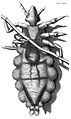 Louse diagram, Micrographia, Robert Hooke, 1667.jpg 1 105 × 1 853; 1,05 MB
-
 LowestoftMap1.png 647 × 418; 73 kB
-
 MaximesLaRouchefoucauld.jpg 530 × 931; 163 kB
-
 Micrographia title page.gif 1 098 × 1 737; 1 013 kB
-
 Middelpolder1665.JPG 621 × 431; 84 kB
-
 Monforte Malagon Madrid 1666.jpg 513 × 714; 205 kB
-
 MundusSubterraneus.jpg 2 104 × 2 240; 1,23 MB
-
 Münze Doppelte Dank-Portugalese.jpg 1 215 × 1 106; 231 kB
-
 RobertHookeMicrographia1665.jpg 1 200 × 1 600; 985 kB
-
 Siegel der CAU.png 200 × 235; 15 kB
-
 Siegel der CAU.svg 397 × 463; 158 kB
-
 St.Oswald - Opferstock.jpg 1 920 × 2 560; 2,13 MB
-
 Vermeer, Pracownia własna, 1665.jpg 2 434 × 2 967; 1,47 MB
-
 Zentralbibliothek Solothurn - Der Wyniger Vertrag von 1665 - aa0834.tif 2 416 × 2 868; 19,86 MB


.jpg)


,_depicted_is_Suratte.jpg)


.jpg)


.jpg)
.jpg)


